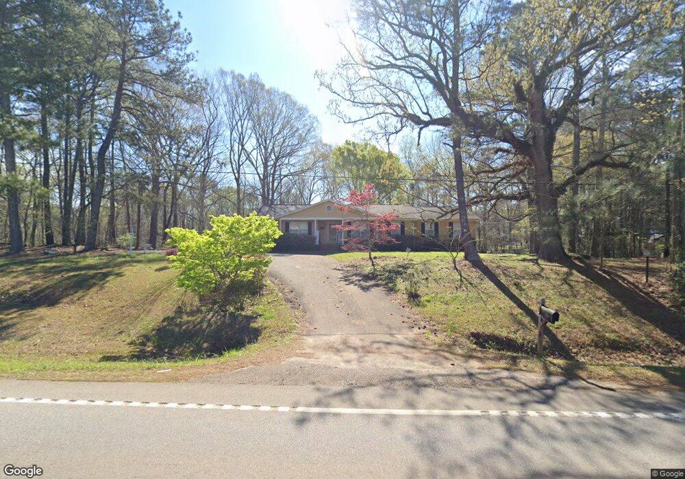
2981 West Point Rd Lagrange, GA 30240
Estimated Value: $213,000 - $247,000
3
Beds
2
Baths
2,270
Sq Ft
$103/Sq Ft
Est. Value
About This Home
This home is located at 2981 West Point Rd, Lagrange, GA 30240 and is currently estimated at $232,876, approximately $102 per square foot. 2981 West Point Rd is a home located in Troup County with nearby schools including Berta Weathersbee Elementary School, Long Cane Elementary School, and Whitesville Road Elementary School.
Ownership History
Date
Name
Owned For
Owner Type
Purchase Details
Closed on
Jun 17, 2025
Sold by
Echols Damin Keith
Bought by
Laue Shanna and Remaklus Steel
Current Estimated Value
Purchase Details
Closed on
Mar 2, 2018
Sold by
Loftin Robert Wayne
Bought by
Echols Damin Keith
Home Financials for this Owner
Home Financials are based on the most recent Mortgage that was taken out on this home.
Original Mortgage
$116,544
Interest Rate
4.37%
Mortgage Type
FHA
Purchase Details
Closed on
Jun 23, 1999
Sold by
Jennie Walker
Bought by
Loftin Robert and Vicki Cottle
Purchase Details
Closed on
Sep 8, 1997
Sold by
William Walker
Bought by
Jennie Walker
Purchase Details
Closed on
Jan 21, 1992
Sold by
Wagner Lillian C and Wagner Joseph E
Bought by
William Walker
Purchase Details
Closed on
Sep 15, 1987
Sold by
Johnson William W and Johnson Jane M
Bought by
Wagner Lillian C and Wagner Joseph E
Purchase Details
Closed on
Sep 1, 1987
Bought by
Johnson William W and Johnson Jane M
Purchase Details
Closed on
Jul 31, 1979
Sold by
Mallory Realty Companyinc
Purchase Details
Closed on
Apr 10, 1979
Sold by
Meadows Darden H and Meadows Jason
Bought by
Mallory Realty Companyinc
Purchase Details
Closed on
Nov 5, 1974
Bought by
Meadows Darden H and Meadows Jason
Create a Home Valuation Report for This Property
The Home Valuation Report is an in-depth analysis detailing your home's value as well as a comparison with similar homes in the area
Purchase History
| Date | Buyer | Sale Price | Title Company |
|---|---|---|---|
| Laue Shanna | $220,000 | -- | |
| Echols Damin Keith | $119,900 | -- | |
| Loftin Robert | -- | -- | |
| Jennie Walker | -- | -- | |
| William Walker | $78,000 | -- | |
| Wagner Lillian C | $70,000 | -- | |
| Johnson William W | -- | -- | |
| -- | $15,000 | -- | |
| Mallory Realty Companyinc | $75,500 | -- | |
| Meadows Darden H | -- | -- |
Source: Public Records
Mortgage History
| Date | Status | Borrower | Loan Amount |
|---|---|---|---|
| Previous Owner | Echols Damin Keith | $116,544 |
Source: Public Records
Tax History
| Year | Tax Paid | Tax Assessment Tax Assessment Total Assessment is a certain percentage of the fair market value that is determined by local assessors to be the total taxable value of land and additions on the property. | Land | Improvement |
|---|---|---|---|---|
| 2025 | $2,253 | $82,608 | $10,000 | $72,608 |
| 2024 | $1,889 | $69,260 | $10,000 | $59,260 |
| 2023 | $1,980 | $72,588 | $10,000 | $62,588 |
| 2022 | $1,879 | $67,308 | $8,000 | $59,308 |
| 2021 | $1,491 | $49,440 | $4,000 | $45,440 |
| 2020 | $1,459 | $48,360 | $5,480 | $42,880 |
| 2019 | $1,447 | $48,440 | $5,480 | $42,960 |
| 2018 | $1,289 | $42,748 | $5,908 | $36,840 |
| 2017 | $1,289 | $42,748 | $5,908 | $36,840 |
| 2016 | $1,278 | $42,372 | $5,908 | $36,464 |
| 2015 | $1,280 | $42,372 | $5,908 | $36,464 |
| 2014 | $1,200 | $39,662 | $5,908 | $33,754 |
| 2013 | -- | $42,052 | $5,908 | $36,144 |
Source: Public Records
Map
Nearby Homes
- 808 S Fling Rd
- 509 Connie Dr
- 427 Fling Rd
- 8 Horace Carter Rd
- 0 Bradfield Dr Unit 10568803
- 0 Glass Bridge Rd Unit 10679358
- 2239 Pegasus Pkwy
- 275 Hanson Dr
- 0 Hanson Dr Unit 10641272
- 124 Foxdale Dr
- 266 Glass Bridge Rd
- 22 Freeman Rd
- 104 Bridlewood Dr
- 105 Redwood Dr
- 640 Hudson Rd
- 135 Planters Ridge Dr
- 3 Reed Dr
- 336 Whitaker Rd
- 0 Unit 10514554
- 117 Brookwood Dr
- 110 West Gate Dr
- 112 W Gate Dr
- 3009 W Point Rd
- 112 West Gate Dr
- 112 Westgate Dr
- 114 W Gate Dr
- 114 West Gate Dr
- 2913 W Point Rd
- 107 West Gate Dr
- 107 W Gate Dr
- W Gate Dr
- 105 W Gate Dr
- 105 West Gate Dr
- 109 W Gate Dr
- 109 West Gate Dr
- 116 Westover Trail
- 3017 W Point Rd
- 118 Westover Trail
- 2922 West Point Rd
- 22 Teaver Rd
Your Personal Tour Guide
Ask me questions while you tour the home.