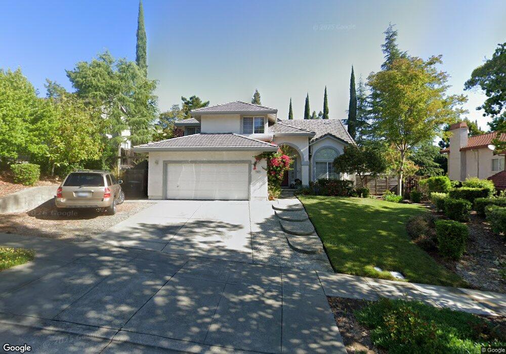
2982 Rustle Ct Fairfield, CA 94534
Estimated Value: $675,737 - $774,000
4
Beds
3
Baths
2,298
Sq Ft
$317/Sq Ft
Est. Value
About This Home
This home is located at 2982 Rustle Ct, Fairfield, CA 94534 and is currently estimated at $727,684, approximately $316 per square foot. 2982 Rustle Ct is a home located in Solano County with nearby schools including K. I. Jones Elementary School, Angelo Rodriguez High School, and We R Family Christian School.
Ownership History
Date
Name
Owned For
Owner Type
Purchase Details
Closed on
Apr 20, 2023
Sold by
Fernandez Roel B and Fernandez Angelita C
Bought by
Angelita And Roel Fernandez Living Trust
Current Estimated Value
Purchase Details
Closed on
Aug 20, 1994
Sold by
Kaufman & Broad Of Northern California
Bought by
Fernandez Roel B and Fernandez Angelita C
Home Financials for this Owner
Home Financials are based on the most recent Mortgage that was taken out on this home.
Original Mortgage
$192,600
Interest Rate
8.8%
Create a Home Valuation Report for This Property
The Home Valuation Report is an in-depth analysis detailing your home's value as well as a comparison with similar homes in the area
Purchase History
| Date | Buyer | Sale Price | Title Company |
|---|---|---|---|
| Angelita And Roel Fernandez Living Trust | -- | None Listed On Document | |
| Fernandez Roel B | $214,500 | First American Title Guarant |
Source: Public Records
Mortgage History
| Date | Status | Borrower | Loan Amount |
|---|---|---|---|
| Previous Owner | Fernandez Roel B | $192,600 |
Source: Public Records
Tax History
| Year | Tax Paid | Tax Assessment Tax Assessment Total Assessment is a certain percentage of the fair market value that is determined by local assessors to be the total taxable value of land and additions on the property. | Land | Improvement |
|---|---|---|---|---|
| 2025 | $4,571 | $379,933 | $117,570 | $262,363 |
| 2024 | $4,571 | $372,484 | $115,265 | $257,219 |
| 2023 | $4,442 | $365,181 | $113,005 | $252,176 |
| 2022 | $4,391 | $358,022 | $110,790 | $247,232 |
| 2021 | $4,350 | $351,003 | $108,618 | $242,385 |
| 2020 | $4,257 | $347,405 | $107,505 | $239,900 |
| 2019 | $4,161 | $340,595 | $105,398 | $235,197 |
| 2018 | $4,280 | $333,918 | $103,332 | $230,586 |
| 2017 | $4,100 | $327,371 | $101,306 | $226,065 |
| 2016 | $4,070 | $320,953 | $99,320 | $221,633 |
| 2015 | $3,825 | $316,133 | $97,829 | $218,304 |
| 2014 | $3,792 | $309,941 | $95,913 | $214,028 |
Source: Public Records
Map
Nearby Homes
- 2903 Burbank Dr
- 2848 Howe Ct
- 2810 Miller Ct
- 185 Canby Way
- 2222 Madrone Dr
- 3456 Norwalk Place
- 3114 Lomita Ct
- 2125 Mecca Ct
- 3451 Nantucket Dr
- 3511 Norwalk Place
- 2045 Dorland Dr
- 2051 Barbour Dr
- 1858 Barbour Dr
- 2837 Watson Ct
- 1437 Shelby Dr
- 1866 New Jersey St
- 1654 Minnesota St
- 2517 Kingsmill Ln
- 1949 New Jersey St
- 1318 Cleveland St
- 2988 Rustle Ct
- 2976 Rustle Ct
- 2970 Rustle Ct
- 1789 Gillespie Dr
- 2994 Rustle Ct
- 2971 Rustle Ct
- 2977 Rustle Ct
- 1795 Gillespie Dr
- 2965 Rustle Ct
- 2983 Rustle Ct
- 2989 Rustle Ct
- 1801 Gillespie Dr
- 1757 Gillespie Dr
- 1778 Gillespie Dr
- 1784 Gillespie Dr
- 1772 Gillespie Dr
- 1752 Kearny Ct
- 1766 Gillespie Dr
- 1758 Kearny Ct
- 2995 Rustle Ct
Your Personal Tour Guide
Ask me questions while you tour the home.