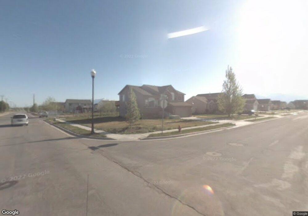
2982 W 2025 N Unit 20 Clinton, UT 84015
Estimated Value: $506,000 - $563,000
4
Beds
3
Baths
1,961
Sq Ft
$273/Sq Ft
Est. Value
About This Home
This home is located at 2982 W 2025 N Unit 20, Clinton, UT 84015 and is currently estimated at $534,851, approximately $272 per square foot. 2982 W 2025 N Unit 20 is a home located in Davis County with nearby schools including West Clinton Elementary School, West Point Junior High School, and Clearfield High School.
Ownership History
Date
Name
Owned For
Owner Type
Purchase Details
Closed on
Mar 16, 2022
Sold by
Kathryn Rampton
Bought by
Rampton Kathryn
Current Estimated Value
Home Financials for this Owner
Home Financials are based on the most recent Mortgage that was taken out on this home.
Original Mortgage
$318,500
Outstanding Balance
$297,346
Interest Rate
3.85%
Mortgage Type
New Conventional
Estimated Equity
$237,505
Purchase Details
Closed on
Jun 18, 2020
Sold by
Drossner Matthew and Drossner Jackie
Bought by
Rampton Kathryn and Rampton1 Sandee
Home Financials for this Owner
Home Financials are based on the most recent Mortgage that was taken out on this home.
Original Mortgage
$296,000
Interest Rate
3.2%
Mortgage Type
New Conventional
Purchase Details
Closed on
Jul 6, 2018
Sold by
Drossner Matthew
Bought by
Drossner Matthew and Drossner Jackie
Home Financials for this Owner
Home Financials are based on the most recent Mortgage that was taken out on this home.
Original Mortgage
$351,220
Interest Rate
4.5%
Mortgage Type
VA
Purchase Details
Closed on
Dec 16, 2011
Sold by
Smith Stuart A
Bought by
Newkirk Thomas E and Newkirk Beth A
Home Financials for this Owner
Home Financials are based on the most recent Mortgage that was taken out on this home.
Original Mortgage
$131,000
Interest Rate
3.93%
Mortgage Type
New Conventional
Purchase Details
Closed on
Oct 30, 2007
Sold by
Porter James J and Porter Ashlee D
Bought by
Smith Stuart A
Home Financials for this Owner
Home Financials are based on the most recent Mortgage that was taken out on this home.
Original Mortgage
$211,500
Interest Rate
6.29%
Mortgage Type
Purchase Money Mortgage
Purchase Details
Closed on
Aug 12, 2004
Sold by
Mainline Construction Inc
Bought by
Porter James J and Porter Ashlee D
Home Financials for this Owner
Home Financials are based on the most recent Mortgage that was taken out on this home.
Original Mortgage
$177,300
Interest Rate
6.17%
Mortgage Type
Purchase Money Mortgage
Create a Home Valuation Report for This Property
The Home Valuation Report is an in-depth analysis detailing your home's value as well as a comparison with similar homes in the area
Home Values in the Area
Average Home Value in this Area
Purchase History
| Date | Buyer | Sale Price | Title Company |
|---|---|---|---|
| Rampton Kathryn | -- | None Listed On Document | |
| Rampton Kathryn | -- | American Secure Title | |
| Drossner Matthew | -- | Cottonwood Title | |
| Drossner Matthew | -- | Security Title | |
| Newkirk Thomas E | -- | Bonneville Superior | |
| Smith Stuart A | -- | Bonneville Superior Title Co | |
| Porter James J | -- | Bonneville Title Company Inc |
Source: Public Records
Mortgage History
| Date | Status | Borrower | Loan Amount |
|---|---|---|---|
| Open | Rampton Kathryn | $318,500 | |
| Previous Owner | Rampton Kathryn | $296,000 | |
| Previous Owner | Drossner Matthew | $351,220 | |
| Previous Owner | Newkirk Thomas E | $131,000 | |
| Previous Owner | Smith Stuart A | $211,500 | |
| Previous Owner | Porter James J | $177,300 |
Source: Public Records
Tax History Compared to Growth
Tax History
| Year | Tax Paid | Tax Assessment Tax Assessment Total Assessment is a certain percentage of the fair market value that is determined by local assessors to be the total taxable value of land and additions on the property. | Land | Improvement |
|---|---|---|---|---|
| 2025 | $2,751 | $264,550 | $72,401 | $192,149 |
| 2024 | $2,652 | $256,300 | $79,572 | $176,728 |
| 2023 | $2,348 | $420,000 | $113,191 | $306,809 |
| 2022 | $2,496 | $246,950 | $69,209 | $177,741 |
| 2021 | $2,262 | $332,000 | $86,692 | $245,308 |
| 2020 | $1,914 | $278,000 | $73,690 | $204,310 |
| 2019 | $1,882 | $267,000 | $86,064 | $180,936 |
| 2018 | $1,722 | $240,000 | $72,686 | $167,314 |
| 2016 | $1,675 | $120,560 | $28,310 | $92,250 |
| 2015 | $1,609 | $110,110 | $28,310 | $81,800 |
| 2014 | $1,500 | $104,286 | $28,310 | $75,976 |
| 2013 | -- | $103,553 | $24,428 | $79,125 |
Source: Public Records
Map
Nearby Homes
- 3941 W 1800 N
- 1958 N 2750 W
- 339 N 3250 W Unit 12
- 3298 W 2300 N
- Harvard Plan at Summerfield - Enclave
- 2208 W 2615 N
- Linden Plan at Summerfield - Vista
- Yale Plan at Summerfield - Enclave
- Gambel Oak Plan at Summerfield - Vista
- Cedar Plan at Summerfield - Vista
- Elm Plan at Summerfield - Vista
- Princeton Plan at Summerfield - Enclave
- Cambridge Plan at Summerfield - Enclave
- Cornell Plan at Summerfield - Enclave
- Sycamore Plan at Summerfield - Vista
- Berkeley Plan at Summerfield - Enclave
- Birch Plan at Summerfield - Vista
- Stanford Plan at Summerfield - Enclave
- 3033 W 2600 N
- 2118 Snowy Crane Dr
- 2982 W 2025 N
- 2034 N 3000 W
- 2968 W 2025 N
- 2968 W 2025 N Unit 19
- 2037 N 3000 W
- 2983 W 2025 N
- 2954 W 2025 N
- 2954 W 2025 N Unit 18
- 2023 N 3000 W
- 2071 N 3000 W
- 2989 W 2100 N
- 2967 W 2100 N
- 2936 W 2025 N
- 2936 W 2025 N Unit 17
- 2959 W 2025 N
- 2959 W 2025 N
- 2959 W 2025 N Unit 22
- 2007 N 3000 W
- 1992 N 3000 W
- 1992 N 3000 W Unit 33