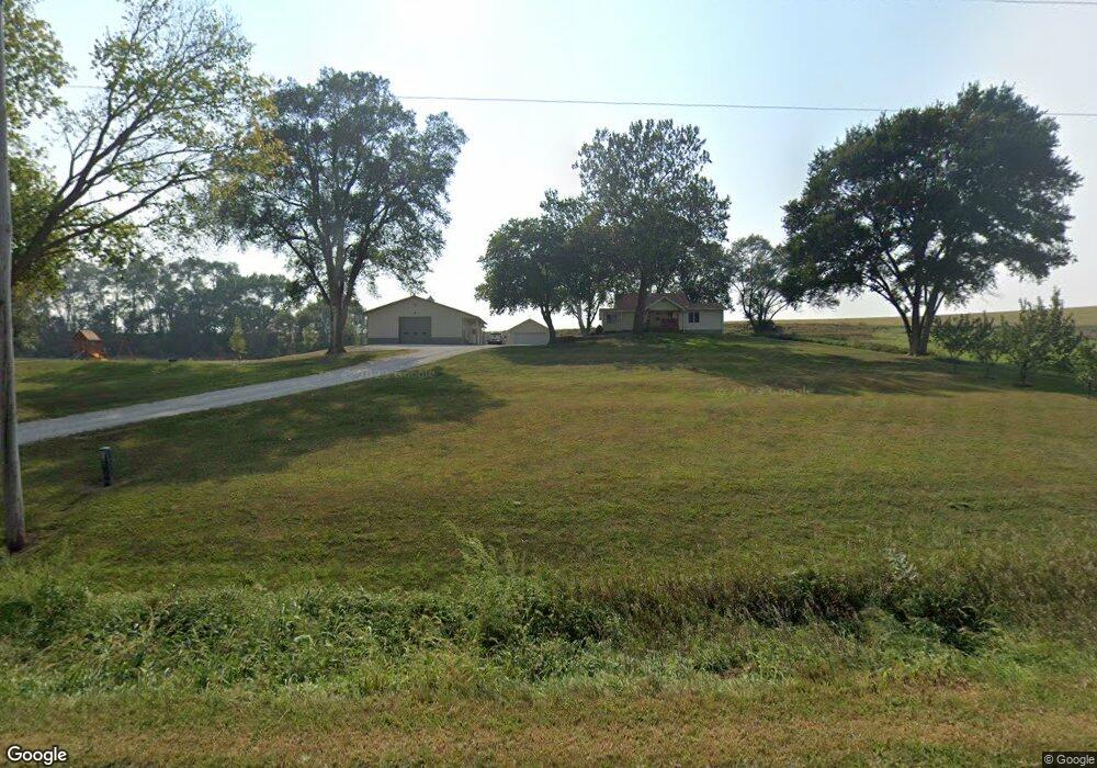
29870 210th St Honey Creek, IA 51542
Estimated Value: $279,000 - $321,076
3
Beds
1
Bath
1,240
Sq Ft
$248/Sq Ft
Est. Value
About This Home
This home is located at 29870 210th St, Honey Creek, IA 51542 and is currently estimated at $308,019, approximately $248 per square foot. 29870 210th St is a home located in Pottawattamie County with nearby schools including Tri-Center Elementary School, Tri-Center Middle School, and Tri-Center High School.
Ownership History
Date
Name
Owned For
Owner Type
Purchase Details
Closed on
Sep 14, 2023
Sold by
Driver Mark T and Driver Tina
Bought by
Driver Family Acres Llc
Current Estimated Value
Purchase Details
Closed on
Apr 28, 2008
Sold by
Driver Arlene D
Bought by
Robertson Eric A and Robertson Sherri A
Home Financials for this Owner
Home Financials are based on the most recent Mortgage that was taken out on this home.
Original Mortgage
$136,000
Interest Rate
5.88%
Mortgage Type
Unknown
Create a Home Valuation Report for This Property
The Home Valuation Report is an in-depth analysis detailing your home's value as well as a comparison with similar homes in the area
Home Values in the Area
Average Home Value in this Area
Purchase History
| Date | Buyer | Sale Price | Title Company |
|---|---|---|---|
| Driver Family Acres Llc | -- | None Listed On Document | |
| Robertson Eric A | -- | Multiple |
Source: Public Records
Mortgage History
| Date | Status | Borrower | Loan Amount |
|---|---|---|---|
| Previous Owner | Robertson Eric A | $136,000 |
Source: Public Records
Tax History Compared to Growth
Tax History
| Year | Tax Paid | Tax Assessment Tax Assessment Total Assessment is a certain percentage of the fair market value that is determined by local assessors to be the total taxable value of land and additions on the property. | Land | Improvement |
|---|---|---|---|---|
| 2025 | $2,592 | $269,300 | $69,100 | $200,200 |
| 2024 | $2,592 | $225,100 | $60,100 | $165,000 |
| 2023 | $2,580 | $225,100 | $60,100 | $165,000 |
| 2022 | $2,422 | $180,100 | $45,500 | $134,600 |
| 2021 | $3,597 | $180,100 | $45,500 | $134,600 |
| 2020 | $2,300 | $165,000 | $44,815 | $120,185 |
| 2019 | $2,385 | $165,000 | $44,815 | $120,185 |
| 2018 | $2,328 | $165,000 | $44,815 | $120,185 |
| 2017 | $2,328 | $165,000 | $44,815 | $120,185 |
| 2015 | $2,434 | $165,000 | $44,815 | $120,185 |
| 2014 | $2,498 | $165,000 | $44,815 | $120,185 |
Source: Public Records
Map
Nearby Homes
- 22154 Sumac Rd
- 75.05 AC Coldwater Ave
- 162.11 AC Cougar Ave
- 92.1 ACRES 185th St
- 29965 185th St
- 205.14 AC Pinoak Rd
- 27019 195th St
- 12A 215th St
- 339.16 AC 215th St
- 111.89 AC 208th St
- 28299 185th St
- 230.67 AC 208th St
- 26366 208th St
- 32927 185th St
- 25440 County Road L34
- 12C Road L34
- 12B Road L34
- 4 AC M/L 210th St
- 30238 Nixon Dr
- 143.23 AC 195th St