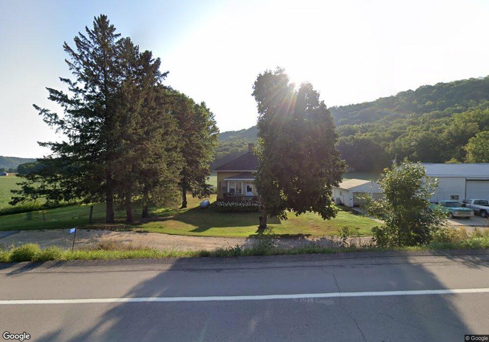
29878 State Highway 43 Rushford, MN 55971
Estimated Value: $179,000 - $209,000
--
Bed
1
Bath
1,200
Sq Ft
$159/Sq Ft
Est. Value
About This Home
This home is located at 29878 State Highway 43, Rushford, MN 55971 and is currently estimated at $190,947, approximately $159 per square foot. 29878 State Highway 43 is a home located in Fillmore County with nearby schools including Rushford-Peterson Elementary School, Rushford-Peterson Middle School, and Rushford-Peterson Senior High School.
Ownership History
Date
Name
Owned For
Owner Type
Purchase Details
Closed on
Apr 30, 2019
Sold by
Benson Alma A
Bought by
Hanson Richard A
Current Estimated Value
Home Financials for this Owner
Home Financials are based on the most recent Mortgage that was taken out on this home.
Original Mortgage
$60,000
Interest Rate
4%
Mortgage Type
New Conventional
Create a Home Valuation Report for This Property
The Home Valuation Report is an in-depth analysis detailing your home's value as well as a comparison with similar homes in the area
Home Values in the Area
Average Home Value in this Area
Purchase History
| Date | Buyer | Sale Price | Title Company |
|---|---|---|---|
| Hanson Richard A | $130,000 | -- |
Source: Public Records
Mortgage History
| Date | Status | Borrower | Loan Amount |
|---|---|---|---|
| Previous Owner | Hanson Richard A | $60,000 |
Source: Public Records
Tax History Compared to Growth
Tax History
| Year | Tax Paid | Tax Assessment Tax Assessment Total Assessment is a certain percentage of the fair market value that is determined by local assessors to be the total taxable value of land and additions on the property. | Land | Improvement |
|---|---|---|---|---|
| 2025 | $1,248 | $187,200 | $59,000 | $128,200 |
| 2024 | $1,248 | $144,700 | $41,300 | $103,400 |
| 2023 | $1,158 | $144,700 | $41,300 | $103,400 |
| 2022 | $1,158 | $121,100 | $44,300 | $76,800 |
| 2021 | $1,158 | $121,900 | $41,300 | $80,600 |
| 2020 | $1,240 | $121,900 | $41,300 | $80,600 |
| 2019 | $1,350 | $113,200 | $41,300 | $71,900 |
| 2018 | $1,324 | $113,200 | $41,300 | $71,900 |
| 2017 | -- | $106,200 | $38,800 | $67,400 |
| 2016 | $1,052 | $98,200 | $35,000 | $63,200 |
| 2015 | $922 | $87,500 | $29,600 | $57,900 |
| 2014 | $922 | $79,800 | $28,755 | $51,045 |
| 2013 | $922 | $79,700 | $28,745 | $50,955 |
Source: Public Records
Map
Nearby Homes
- 120 W Jessie St
- 203 S Maple St
- 111 N Elm St
- 203 E Grove St
- 503 E Rushford Ave
- 302 N Mill St
- 105 N Money Creek St
- 8 Lots - 1 Price Briella Ave
- Mn-16
- 0 Novlan Ave Unit NST6651709
- 3681 Berland Rd
- XXXX River Dr
- 2740 Christianson Hill Rd
- 22390 County 15
- 17360 Perkins Valley Dr
- 11512 County 4
- Tbd State Highway 16
- 41132 Chestnut Rd
- Dew Drop Rd
- 0 Tbd E Twin Ridge Rd Unit LotWP001
- 29957 State Highway 43
- 29705 State Highway 43
- 30047 State Highway 43
- 44191 Tower Ridge Rd
- 44578 Oakview Loop
- 44051 Tower Ridge Rd
- 44524 Oakview Loop
- 44536 Oakview Loop
- 44110 Tower Ridge Rd
- 44518 Oakview Loop
- 44567 Oakview Loop
- 44533 Oakview Loop
- 44587 Oakview Loop
- 44508 Oakview Loop
- 44429 Oakview Loop
- 44502 Oakview Loop
- 44493 Oakview Loop
- 30154 Sherwood St
- xxx Oakview Loop
- 44490 Oakview Loop