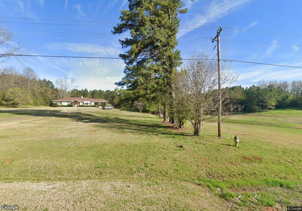
2988 Roanoke Rd Lagrange, GA 30240
Estimated Value: $407,000 - $715,893
4
Beds
3
Baths
2,629
Sq Ft
$205/Sq Ft
Est. Value
About This Home
This home is located at 2988 Roanoke Rd, Lagrange, GA 30240 and is currently estimated at $539,964, approximately $205 per square foot. 2988 Roanoke Rd is a home located in Troup County with nearby schools including Ethel W. Kight Elementary School, Hollis Hand Elementary School, and Franklin Forest Elementary School.
Ownership History
Date
Name
Owned For
Owner Type
Purchase Details
Closed on
Mar 24, 2014
Sold by
Overcash Raymond E
Bought by
Overcash Farm Llc
Current Estimated Value
Purchase Details
Closed on
Aug 20, 1981
Sold by
Whitehead C Mark
Bought by
Overcash Raymond E
Purchase Details
Closed on
Apr 1, 1954
Sold by
Statham Mrs J O
Bought by
Whitehead C Mark
Create a Home Valuation Report for This Property
The Home Valuation Report is an in-depth analysis detailing your home's value as well as a comparison with similar homes in the area
Purchase History
| Date | Buyer | Sale Price | Title Company |
|---|---|---|---|
| Overcash Farm Llc | -- | -- | |
| Overcash Raymond E | $10,000 | -- | |
| Whitehead C Mark | -- | -- |
Source: Public Records
Tax History
| Year | Tax Paid | Tax Assessment Tax Assessment Total Assessment is a certain percentage of the fair market value that is determined by local assessors to be the total taxable value of land and additions on the property. | Land | Improvement |
|---|---|---|---|---|
| 2025 | $3,420 | $260,772 | $136,640 | $124,132 |
| 2024 | $3,420 | $234,292 | $141,880 | $92,412 |
| 2023 | $3,078 | $222,612 | $141,880 | $80,732 |
| 2022 | $2,950 | $216,252 | $141,880 | $74,372 |
| 2021 | $2,983 | $186,128 | $116,760 | $69,368 |
| 2020 | $2,960 | $186,128 | $116,760 | $69,368 |
| 2019 | $2,805 | $181,728 | $116,760 | $64,968 |
| 2018 | $2,086 | $158,612 | $116,760 | $41,852 |
| 2017 | $2,065 | $158,612 | $116,760 | $41,852 |
| 2016 | $1,999 | $157,137 | $116,820 | $40,316 |
| 2015 | $1,983 | $157,137 | $116,820 | $40,316 |
| 2014 | $1,604 | $154,965 | $116,771 | $38,194 |
| 2013 | -- | $156,659 | $116,771 | $39,888 |
Source: Public Records
Map
Nearby Homes
- 336 Whitaker Rd
- 509 Connie Dr
- 117 Brookwood Dr
- 200 Cheyenne Dr
- 427 Fling Rd
- 104 Spring Valley Dr
- 223 Pinehaven Dr
- 203 Shawnee Dr
- 124 Foxdale Dr
- 104 Bridlewood Dr
- 229 W Lakeview Dr
- 641 Whitaker Rd
- 440 & 448 Kimbrough Rd
- 0 Deming St Unit 10550189
- 0 Salem Rd Tract 2 Unit 10675187
- 135 Planters Ridge Dr
- 114 Westgate Dr
- 217 Highland Trail
- 0 Bradfield Dr Unit 10568803
- 808 S Fling Rd
- 3019 Roanoke Rd
- 3044 Roanoke Rd
- 3047 Roanoke Rd
- 2987 Roanoke Rd
- 3068 Roanoke Rd
- 3059 Roanoke Rd
- 3075 Roanoke Rd
- 2907 Roanoke Rd
- 57 Tatum Heights Dr
- 3112 Roanoke Rd
- 3099 Roanoke Rd
- 2876 Roanoke Rd
- 3116 Roanoke Rd
- 75 Tatum Heights Dr
- 100 Tatum Heights Dr
- 2867 Roanoke Rd
- 52 Tatum Heights Dr
- 20 Tatum Heights Dr
- 32 Tatum Heights Dr
- 103 Tatum Heights Dr