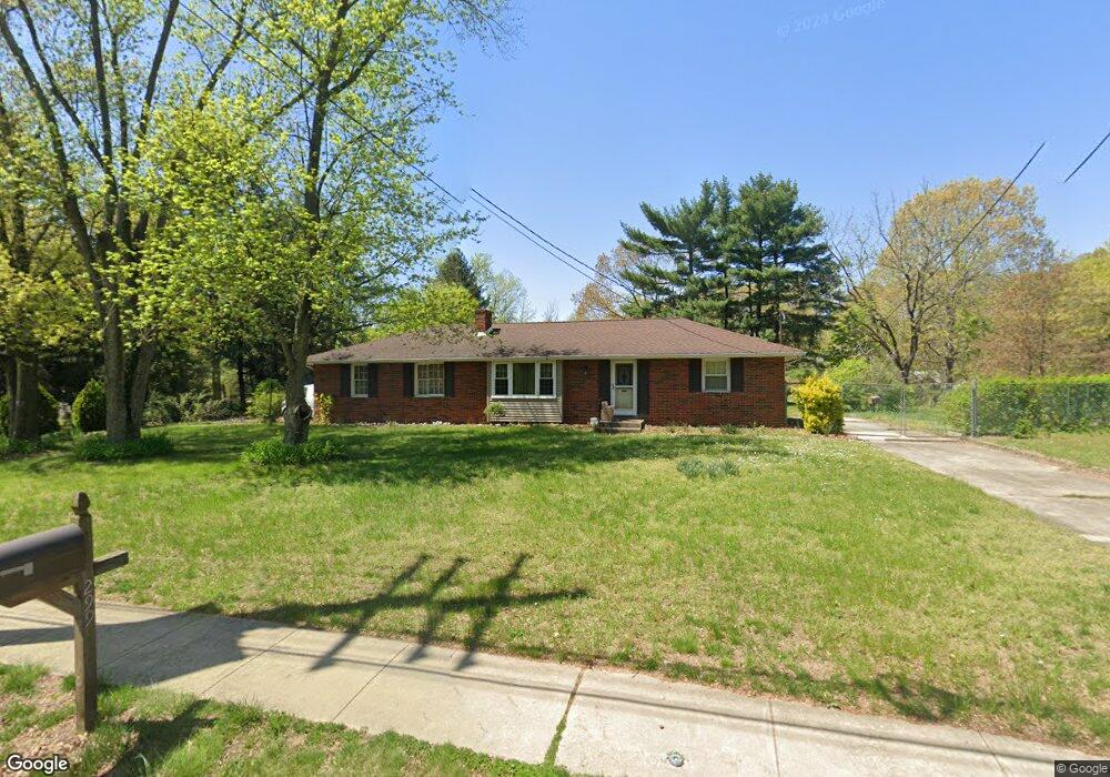
299 Conrow Rd Delran, NJ 08075
Estimated Value: $342,317 - $463,000
Studio
--
Bath
1,445
Sq Ft
$283/Sq Ft
Est. Value
About This Home
This home is located at 299 Conrow Rd, Delran, NJ 08075 and is currently estimated at $409,579, approximately $283 per square foot. 299 Conrow Rd is a home located in Burlington County with nearby schools including Millbridge Elementary School, Delran Intermediate School, and Delran Middle School.
Ownership History
Date
Name
Owned For
Owner Type
Purchase Details
Closed on
Feb 4, 2011
Sold by
Fortino Frank John and Fortino Francis Thomas
Bought by
Fortino Frank J and Fortino Jacqueline J
Current Estimated Value
Purchase Details
Closed on
Oct 31, 1997
Sold by
Holtz Richard E and Holtz Major G
Bought by
Fortino Francis T
Home Financials for this Owner
Home Financials are based on the most recent Mortgage that was taken out on this home.
Original Mortgage
$110,200
Outstanding Balance
$18,006
Interest Rate
7.23%
Estimated Equity
$391,573
Create a Home Valuation Report for This Property
The Home Valuation Report is an in-depth analysis detailing your home's value as well as a comparison with similar homes in the area
Home Values in the Area
Average Home Value in this Area
Purchase History
| Date | Buyer | Sale Price | Title Company |
|---|---|---|---|
| Fortino Frank J | -- | None Available | |
| Fortino Francis T | $116,000 | Surety Title Corporation | |
| Holtz Major G | -- | Surety Title Corporation |
Source: Public Records
Mortgage History
| Date | Status | Borrower | Loan Amount |
|---|---|---|---|
| Open | Holtz Major G | $110,200 |
Source: Public Records
Tax History
| Year | Tax Paid | Tax Assessment Tax Assessment Total Assessment is a certain percentage of the fair market value that is determined by local assessors to be the total taxable value of land and additions on the property. | Land | Improvement |
|---|---|---|---|---|
| 2025 | $8,000 | $201,200 | $72,200 | $129,000 |
| 2024 | $7,927 | $201,200 | $72,200 | $129,000 |
| 2023 | $7,927 | $201,200 | $72,200 | $129,000 |
| 2022 | $7,825 | $201,200 | $72,200 | $129,000 |
| 2021 | $6,782 | $183,100 | $72,200 | $110,900 |
| 2020 | $7,110 | $183,100 | $72,200 | $110,900 |
| 2019 | $7,044 | $183,100 | $72,200 | $110,900 |
| 2018 | $6,927 | $183,100 | $72,200 | $110,900 |
| 2017 | $6,817 | $183,100 | $72,200 | $110,900 |
| 2016 | $6,716 | $183,100 | $72,200 | $110,900 |
| 2015 | $6,604 | $183,100 | $72,200 | $110,900 |
| 2014 | $6,317 | $183,100 | $72,200 | $110,900 |
Source: Public Records
Map
Nearby Homes
- 1 Echo Ave
- 0 0 Swarthmore Dr
- 203 Congressional Ct
- 213 Swedes Run Dr
- 342 Huntington Dr Unit 342
- 23 Lehigh Dr
- 4304 Bridgeboro Rd
- 105 Hartford Rd
- 2 Bayberry Ln
- 144 Natalie Rd
- 148 Natalie Rd Unit 148
- 3 Dewberry Ln
- 123 Shelly Ln
- 108 Patricia Ave
- 328 Nicholas Dr Unit 328
- 4327 Bridgeboro Rd
- 4 Weatherly Rd
- 326 Nicholas Dr Unit 326
- 101 Congressional Ct
- 121 Congressional Ct
Your Personal Tour Guide
Ask me questions while you tour the home.