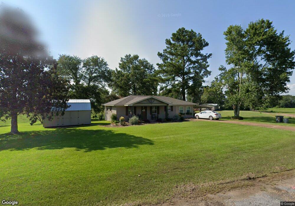
299 Tom Sistrunk Rd Jayess, MS 39641
Estimated Value: $113,413 - $139,000
Studio
2
Baths
936
Sq Ft
$135/Sq Ft
Est. Value
About This Home
This home is located at 299 Tom Sistrunk Rd, Jayess, MS 39641 and is currently estimated at $126,103, approximately $134 per square foot. 299 Tom Sistrunk Rd is a home located in Lawrence County with nearby schools including Topeka Tilton Attendance Center and Lawrence County High School.
Ownership History
Date
Name
Owned For
Owner Type
Purchase Details
Closed on
Mar 15, 2021
Bought by
Findley Melva R
Current Estimated Value
Purchase Details
Closed on
Jul 20, 2017
Sold by
Regions Bank
Bought by
Everett Alton
Purchase Details
Closed on
May 26, 2005
Sold by
Havard James M and Havard Amy M
Bought by
Bull Micah Lee
Home Financials for this Owner
Home Financials are based on the most recent Mortgage that was taken out on this home.
Original Mortgage
$60,000
Interest Rate
5.69%
Mortgage Type
Purchase Money Mortgage
Create a Home Valuation Report for This Property
The Home Valuation Report is an in-depth analysis detailing your home's value as well as a comparison with similar homes in the area
Purchase History
| Date | Buyer | Sale Price | Title Company |
|---|---|---|---|
| Findley Melva R | $60,000 | -- | |
| Everett Alton | $64,600 | -- | |
| Bull Micah Lee | -- | -- |
Source: Public Records
Mortgage History
| Date | Status | Borrower | Loan Amount |
|---|---|---|---|
| Previous Owner | Bull Micah Lee | $60,000 |
Source: Public Records
Tax History
| Year | Tax Paid | Tax Assessment Tax Assessment Total Assessment is a certain percentage of the fair market value that is determined by local assessors to be the total taxable value of land and additions on the property. | Land | Improvement |
|---|---|---|---|---|
| 2025 | -- | $6,052 | $0 | $0 |
| 2024 | -- | $5,684 | $0 | $0 |
| 2023 | -- | $5,684 | $0 | $0 |
| 2022 | $453 | $5,684 | $0 | $0 |
| 2021 | $453 | $5,685 | $0 | $0 |
| 2020 | $444 | $5,615 | $0 | $0 |
| 2019 | $430 | $5,615 | $0 | $0 |
| 2018 | $421 | $5,615 | $0 | $0 |
| 2017 | $421 | $5,615 | $0 | $0 |
| 2016 | $424 | $5,641 | $0 | $0 |
| 2015 | $403 | $5,641 | $0 | $0 |
| 2014 | $403 | $5,890 | $0 | $0 |
Source: Public Records
Map
Nearby Homes
- 163 Reid Givens Rd
- 92 Price Rd
- 1321 Mississippi 44
- 299 Robert Tynes Rd
- . Givens- Mullins Rd
- 358 Holmes Rd
- 182 Hwy 44
- 0 Tilton Rd
- 23 Topeka Jayess Rd
- Enon-Sartinville Rd
- 0 Enon Sartinville Rd
- 722 Holmesville Rd
- 7 Willie Roberts Rd
- 11 Carsey Ln
- 0 Highway 44 Unit LotWP001
- 182 Highway 44
- 0 Frog Ridge Rd
- 1636 Mississippi 583
- 1614 Mississippi 583
- 0 Hwy 583 N Unit LotWP001 19718421
- 295 Tom Sistrunk Rd
- 272 Tom Sistrunk Rd
- 469 Hulan Brister Rd
- 360 Reid Givens Rd
- 353 Reid Givens Rd
- 353 Reid Givens Rd
- 234 Tom Sistrunk Rd
- 234 Tom Sistrunk Rd
- 179 Tom Sistrunk Rd
- 180 Tom Sistrunk Rd
- 296 Reid Givens Rd
- 522 Hulan Brister Rd
- 522 Hulan Brister Rd
- 522 Hulan Brister Rd
- 170 Tom Sistrunk Rd
- 285 Reid Givens Rd
- 522 Hulon Brister Rd
- 506 Hulan Brister Rd
- 155 Tom Sistrunk Rd
- 284 Reid Givens Rd
Your Personal Tour Guide
Ask me questions while you tour the home.