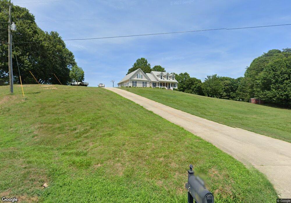
2991 Simpson Park Rd Gainesville, GA 30506
Estimated Value: $472,000 - $860,000
3
Beds
3
Baths
2,976
Sq Ft
$227/Sq Ft
Est. Value
About This Home
This home is located at 2991 Simpson Park Rd, Gainesville, GA 30506 and is currently estimated at $675,767, approximately $227 per square foot. 2991 Simpson Park Rd is a home located in Hall County with nearby schools including Sardis Elementary School, Cartersville Primary School, and Chestatee Middle School.
Ownership History
Date
Name
Owned For
Owner Type
Purchase Details
Closed on
Oct 16, 2006
Sold by
Gossett Ron
Bought by
Gossett Ron and Gossett Cindy
Current Estimated Value
Purchase Details
Closed on
May 21, 2004
Sold by
Elliott Edwin
Bought by
Gossett Ron and Gossett Cindy
Create a Home Valuation Report for This Property
The Home Valuation Report is an in-depth analysis detailing your home's value as well as a comparison with similar homes in the area
Home Values in the Area
Average Home Value in this Area
Purchase History
| Date | Buyer | Sale Price | Title Company |
|---|---|---|---|
| Gossett Ron | -- | -- | |
| Gossett Ron | $2,000 | -- |
Source: Public Records
Tax History Compared to Growth
Tax History
| Year | Tax Paid | Tax Assessment Tax Assessment Total Assessment is a certain percentage of the fair market value that is determined by local assessors to be the total taxable value of land and additions on the property. | Land | Improvement |
|---|---|---|---|---|
| 2024 | $5,258 | $212,000 | $44,360 | $167,640 |
| 2023 | $4,412 | $193,560 | $35,760 | $157,800 |
| 2022 | $4,371 | $168,960 | $31,480 | $137,480 |
| 2021 | $2,839 | $107,398 | $28,600 | $78,798 |
| 2020 | $2,920 | $107,398 | $28,600 | $78,798 |
| 2019 | $2,946 | $107,398 | $28,600 | $78,798 |
| 2018 | $3,042 | $107,398 | $28,600 | $78,798 |
| 2017 | $3,010 | $107,398 | $28,600 | $78,798 |
| 2016 | $2,938 | $107,398 | $28,600 | $78,798 |
| 2015 | $3,101 | $112,478 | $33,680 | $78,798 |
| 2014 | $3,101 | $112,478 | $33,680 | $78,798 |
Source: Public Records
Map
Nearby Homes
- 2496 Venture Dr
- 2527 Venture Cir
- 2903 Lynncliff Dr
- 2520 Dawsonville Hwy
- 2730 & 2726 Vaughandale Cir
- 2667 Tammi Ln
- 2650 Westview Cir
- 2624 Walnut Rd
- 2231 Lake Ranch Ct
- 3411 Lake Ridge Place
- 2245 Sidney Dr
- 3550 Dockside Shores Dr
- 2237 Lake Ranch Ct
- 2265 Sidney Dr
- 3514 Dockside Shores Dr
- 3164 Hidden Pass
- 3543 Dockside Shores Dr
- 3551 Dockside Shores Dr
- 3114 Lake Ranch Dr
- 2983 Simpson Park Rd
- 3003 Simpson Park Rd
- 2516 Venture Dr
- 2512 Venture Dr
- 2510 Venture Dr
- 2518 Venture Dr
- 2508 Venture Dr
- 2520 Venture Dr
- 2515 Venture Dr
- 2519 Venture Dr
- 2962 Simpson Park Rd
- 2505 Venture Dr
- 2959 Simpson Park Rd
- 2522 Venture Dr
- 2521 Venture Dr
- 3012 Simpson Park Rd
- 2506 Venture Cir
- 3030 Simpson Park Rd
- 2504 Venture Dr
- 2525 Venture Dr