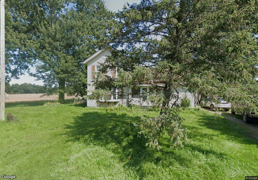
29911 M Dr N Unit Carver Rd Springport, MI 49284
Estimated Value: $187,000 - $303,000
3
Beds
1
Bath
1,616
Sq Ft
$136/Sq Ft
Est. Value
About This Home
This home is located at 29911 M Dr N Unit Carver Rd, Springport, MI 49284 and is currently estimated at $219,065, approximately $135 per square foot. 29911 M Dr N Unit Carver Rd is a home located in Calhoun County with nearby schools including Springport Elementary School, Springport Middle School, and Springport High School.
Ownership History
Date
Name
Owned For
Owner Type
Purchase Details
Closed on
Aug 16, 2018
Sold by
Kern Mark
Bought by
Wolcott Eglon Douglas
Current Estimated Value
Home Financials for this Owner
Home Financials are based on the most recent Mortgage that was taken out on this home.
Original Mortgage
$112,365
Outstanding Balance
$97,584
Interest Rate
4.5%
Mortgage Type
VA
Estimated Equity
$121,481
Purchase Details
Closed on
Oct 19, 2012
Sold by
Cypret Aaron J and Cypret Jason
Bought by
Kern Mark
Home Financials for this Owner
Home Financials are based on the most recent Mortgage that was taken out on this home.
Original Mortgage
$29,000
Interest Rate
3.38%
Mortgage Type
Purchase Money Mortgage
Create a Home Valuation Report for This Property
The Home Valuation Report is an in-depth analysis detailing your home's value as well as a comparison with similar homes in the area
Home Values in the Area
Average Home Value in this Area
Purchase History
| Date | Buyer | Sale Price | Title Company |
|---|---|---|---|
| Wolcott Eglon Douglas | $110,000 | American Title Co | |
| Kern Mark | $61,000 | Midstate Title |
Source: Public Records
Mortgage History
| Date | Status | Borrower | Loan Amount |
|---|---|---|---|
| Open | Wolcott Eglon Douglas | $112,365 | |
| Previous Owner | Kern Mark | $29,000 |
Source: Public Records
Tax History Compared to Growth
Tax History
| Year | Tax Paid | Tax Assessment Tax Assessment Total Assessment is a certain percentage of the fair market value that is determined by local assessors to be the total taxable value of land and additions on the property. | Land | Improvement |
|---|---|---|---|---|
| 2025 | $1,620 | $85,200 | $0 | $0 |
| 2024 | $577 | $83,200 | $0 | $0 |
| 2023 | $1,398 | $74,500 | $0 | $0 |
| 2022 | $1,398 | $64,700 | $0 | $0 |
| 2021 | $1,338 | $51,700 | $0 | $0 |
| 2020 | $1,338 | $51,000 | $0 | $0 |
| 2019 | $0 | $44,800 | $0 | $0 |
| 2018 | $0 | $40,000 | $4,800 | $35,200 |
| 2017 | $0 | $36,400 | $0 | $0 |
| 2016 | $0 | $33,600 | $0 | $0 |
| 2015 | -- | $34,500 | $8,351 | $26,149 |
| 2014 | -- | $29,200 | $8,351 | $20,849 |
Source: Public Records
Map
Nearby Homes
- 16711 Stark Rd
- 16594 Stark Rd
- 6600 Calhoun Rd
- 7295 N Gibbs Rd
- 19822 27 1 2 Mile Rd
- 0 R-Drive N
- 403 Green St
- 17208 28 Mile Rd
- 16445 29 Mile Rd
- 29510 S Dr N
- 0 Green St
- 261 Mechanic St
- 231 Bay Port Cir Unit 68
- 252 Bay Port Cir Unit 19
- 598 E Main St
- 26838 Q-Drive N
- 15900 28 Mile Rd
- 16400 Zuehlke Rd
- 2321 Country Club Way
- 4643 Anderson Rd
- 29911 M Dr N
- 29911 M Dr N Unit Craver Rd
- 29752 M Dr N
- 29750 M Dr N
- 18440 29 1/2 Mile Rd
- 16591 Craver Rd
- 29420 M-Drive N
- 16584 Craver Rd
- 16584 Craver Rd
- 29370 M Dr N
- 29370 M Dr N Unit M DR
- 0 M-Drive N
- 19002 29 1 2 Mile Rd
- 19002 29 1/2 Mile Rd
- 0 Elmer Unit 20010554
- 0 Elmer Unit 21044187
- 16791 Stark Rd
- 29705 O Dr N
- 29705 O Dr N
- 29705 O Dr N