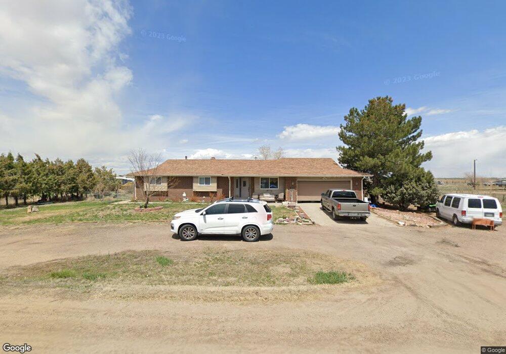
29947 E 131st Ave Commerce City, CO 80022
Estimated Value: $610,840 - $755,000
3
Beds
3
Baths
1,889
Sq Ft
$367/Sq Ft
Est. Value
About This Home
This home is located at 29947 E 131st Ave, Commerce City, CO 80022 and is currently estimated at $693,460, approximately $367 per square foot. 29947 E 131st Ave is a home located in Adams County with nearby schools including Henderson Elementary School, Otho E Stuart Middle School, and Prairie View High School.
Ownership History
Date
Name
Owned For
Owner Type
Purchase Details
Closed on
Feb 23, 2024
Sold by
Claassen Family Trust
Bought by
Claassen Zachary C
Current Estimated Value
Home Financials for this Owner
Home Financials are based on the most recent Mortgage that was taken out on this home.
Original Mortgage
$160,000
Outstanding Balance
$157,199
Interest Rate
6.66%
Mortgage Type
New Conventional
Estimated Equity
$536,261
Purchase Details
Closed on
Apr 2, 2013
Sold by
Claasen Carl Leo and Claasen Delela Susan
Bought by
Claasen Family Trust
Create a Home Valuation Report for This Property
The Home Valuation Report is an in-depth analysis detailing your home's value as well as a comparison with similar homes in the area
Home Values in the Area
Average Home Value in this Area
Purchase History
| Date | Buyer | Sale Price | Title Company |
|---|---|---|---|
| Claassen Zachary C | $427,500 | Land Title Guarantee | |
| Claasen Family Trust | -- | None Available |
Source: Public Records
Mortgage History
| Date | Status | Borrower | Loan Amount |
|---|---|---|---|
| Open | Claassen Zachary C | $160,000 |
Source: Public Records
Tax History Compared to Growth
Tax History
| Year | Tax Paid | Tax Assessment Tax Assessment Total Assessment is a certain percentage of the fair market value that is determined by local assessors to be the total taxable value of land and additions on the property. | Land | Improvement |
|---|---|---|---|---|
| 2024 | $4,775 | $45,210 | $6,040 | $39,170 |
| 2023 | $4,752 | $49,620 | $5,820 | $43,800 |
| 2022 | $3,027 | $36,280 | $5,610 | $30,670 |
| 2021 | $2,818 | $36,280 | $5,610 | $30,670 |
| 2020 | $2,338 | $32,530 | $5,770 | $26,760 |
| 2019 | $2,340 | $32,530 | $5,770 | $26,760 |
| 2018 | $1,738 | $26,040 | $3,940 | $22,100 |
| 2017 | $1,735 | $26,040 | $3,940 | $22,100 |
| 2016 | $1,113 | $20,010 | $4,090 | $15,920 |
| 2015 | $1,112 | $12,050 | $2,460 | $9,590 |
| 2014 | -- | $9,620 | $2,120 | $7,500 |
Source: Public Records
Map
Nearby Homes
- 32350 E 137th Way
- 31200 E 145th Ave
- 32501 E 137th Way
- 14651 Hayesmount Rd
- 16590 Watkins Rd
- 30522 E 148th Ct
- 14955 Lanewood St
- 32650 E 143rd Ave
- 6816 E 149th Ave
- 34308 E 139th Ct
- 15415 Gadsden Dr
- 13400 Harvest Rd
- 2 Imboden Rd
- 13350 Imboden Rd
- 0 Harvest Rd Unit REC9194952
- 0 E 152nd Ave
- 28550 E 159th Ave
- 30350 E 161st Ave Unit 25
- 30460 E 161st Ave
- 28700 E 160th Place
- 29967 E 131st Ave
- 29987 E 131st Ave
- 29966 E 131st Ave
- 29966 E 131st Ave
- 13160 Hayesmount Rd
- 29846 E 131st Ave
- 30067 E 131st Ave
- 13080 Hayesmount Rd
- 30086 E 131st Ave
- 30147 E 131st Ave
- 12980 Hayesmount Rd
- 30188 E 131st Ave
- 30187 E 131st Ave
- 30068 E 131st Ave
- 30267 E 131st Ave
- 12960 Hayesmount Rd
- 30266 E 131st Ave
- 30337 E 131st Ave
- 12920 Hayesmount Rd
- 30366 E 131st Ave