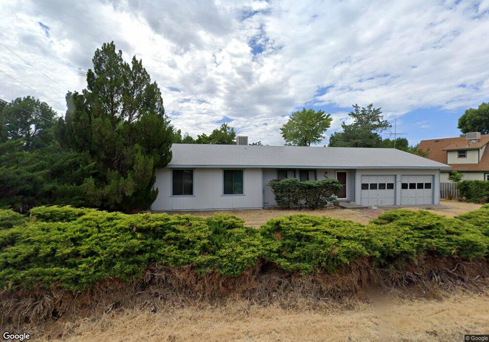
2997 F 3/10 Rd Grand Junction, CO 81504
Northeast Grand Junction NeighborhoodEstimated Value: $346,000 - $365,000
3
Beds
2
Baths
1,276
Sq Ft
$277/Sq Ft
Est. Value
About This Home
This home is located at 2997 F 3/10 Rd, Grand Junction, CO 81504 and is currently estimated at $353,095, approximately $276 per square foot. 2997 F 3/10 Rd is a home located in Mesa County with nearby schools including Thunder Mountain Elementary School, Bookcliff Middle School, and Central High School.
Ownership History
Date
Name
Owned For
Owner Type
Purchase Details
Closed on
Jan 23, 2018
Sold by
White Barbara and Estate Of C Dressler Jr
Bought by
White Barbara
Current Estimated Value
Home Financials for this Owner
Home Financials are based on the most recent Mortgage that was taken out on this home.
Original Mortgage
$10,000
Interest Rate
3.93%
Mortgage Type
Future Advance Clause Open End Mortgage
Purchase Details
Closed on
Oct 23, 1998
Sold by
Fawcett Bill B Bailey Liv
Bought by
Dressler Robert C
Home Financials for this Owner
Home Financials are based on the most recent Mortgage that was taken out on this home.
Original Mortgage
$80,600
Outstanding Balance
$17,388
Interest Rate
6.73%
Estimated Equity
$335,707
Purchase Details
Closed on
Apr 5, 1993
Sold by
Ball Marty
Bought by
White Barbara
Create a Home Valuation Report for This Property
The Home Valuation Report is an in-depth analysis detailing your home's value as well as a comparison with similar homes in the area
Home Values in the Area
Average Home Value in this Area
Purchase History
| Date | Buyer | Sale Price | Title Company |
|---|---|---|---|
| White Barbara | -- | None Available | |
| Dressler Robert C | $101,000 | First American Title Co | |
| White Barbara | $70,000 | -- |
Source: Public Records
Mortgage History
| Date | Status | Borrower | Loan Amount |
|---|---|---|---|
| Closed | White Barbara | $10,000 | |
| Open | Dressler Robert C | $80,600 |
Source: Public Records
Tax History Compared to Growth
Tax History
| Year | Tax Paid | Tax Assessment Tax Assessment Total Assessment is a certain percentage of the fair market value that is determined by local assessors to be the total taxable value of land and additions on the property. | Land | Improvement |
|---|---|---|---|---|
| 2024 | $1,250 | $16,240 | $4,640 | $11,600 |
| 2023 | $1,250 | $16,240 | $4,640 | $11,600 |
| 2022 | $1,219 | $15,510 | $4,170 | $11,340 |
| 2021 | $1,191 | $15,960 | $4,290 | $11,670 |
| 2020 | $967 | $13,060 | $3,580 | $9,480 |
| 2019 | $887 | $13,060 | $3,580 | $9,480 |
| 2018 | $968 | $12,550 | $3,240 | $9,310 |
| 2017 | $841 | $12,550 | $3,240 | $9,310 |
| 2016 | $841 | $12,930 | $3,180 | $9,750 |
| 2015 | $847 | $12,930 | $3,180 | $9,750 |
| 2014 | $702 | $10,610 | $2,790 | $7,820 |
Source: Public Records
Map
Nearby Homes
- 622 Hudson Bay Dr
- 631 Hudson Bay Dr
- 648 Hudson Bay Ct
- 3022 Country Rd
- 657 Starlight Dr
- 2990 Summerbrook Dr
- 608 1/2 Broken Spoke Rd
- 592 Ronlin St
- 2997 Brookwood Ct
- 2990 1/2 Brookwood Dr
- 3027 Patterson Rd
- 616 N Sunset Ct
- 3040 1/2 Regal Ct
- 590 Darby Dr
- 2984 1/2 Kia Dr
- 587 Mcmullin Dr
- 2951 Bret Dr
- 618 Stonegate Dr
- 2990 1/2 Redbud Ct
- 631 29 1 2 Rd
- 630 Fort Uncompahgre Dr
- 628 Fort Uncompahgre Dr
- 631 30 Rd
- 629 30 Rd
- 2996 F 3/10 Rd
- 2996 F 3 10 Rd
- 626 Fort Uncompahgre Dr
- 632 Fort Uncompahgre Dr
- 629 Fort Uncompahgre Dr
- 635 30 Rd
- 2998 F 1/4 Rd
- 627 Fort Uncompahgre Dr
- 629 Sovereign Ln
- 629 1/2 Fort Uncompahgre Dr
- 627 Sovereign Ln
- 634 Fort Uncompahgre Dr
- 631 Fort Uncompahgre Dr
- 625 Sovereign Ln
- 626 Hudson Bay Dr
- 628 Hudson Bay Dr