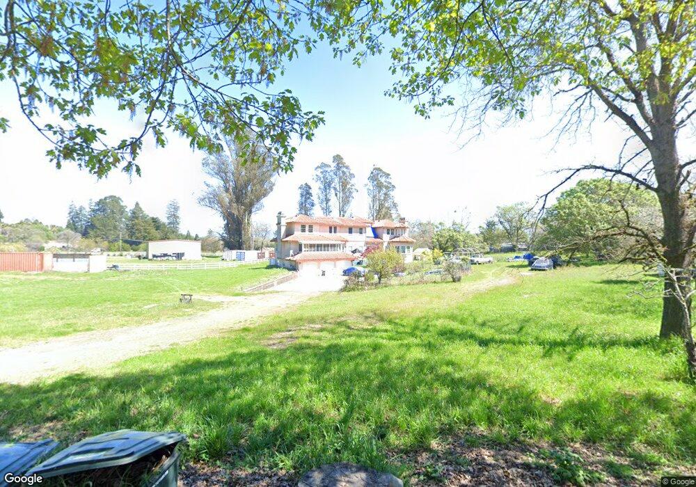
2999 Stone Station Rd Sebastopol, CA 95472
Estimated Value: $1,662,507 - $2,404,000
4
Beds
4
Baths
4,230
Sq Ft
$457/Sq Ft
Est. Value
About This Home
This home is located at 2999 Stone Station Rd, Sebastopol, CA 95472 and is currently estimated at $1,931,377, approximately $456 per square foot. 2999 Stone Station Rd is a home located in Sonoma County with nearby schools including Analy High School, Gravenstein Elementary School, and Sunridge Charter School.
Ownership History
Date
Name
Owned For
Owner Type
Purchase Details
Closed on
Sep 15, 2016
Sold by
Lum Shew King
Bought by
Lum Shew King
Current Estimated Value
Purchase Details
Closed on
Jun 27, 2005
Sold by
Lum Shew King
Bought by
Lum Shew King
Home Financials for this Owner
Home Financials are based on the most recent Mortgage that was taken out on this home.
Original Mortgage
$150,000
Interest Rate
5.55%
Mortgage Type
Credit Line Revolving
Create a Home Valuation Report for This Property
The Home Valuation Report is an in-depth analysis detailing your home's value as well as a comparison with similar homes in the area
Home Values in the Area
Average Home Value in this Area
Purchase History
| Date | Buyer | Sale Price | Title Company |
|---|---|---|---|
| Lum Shew King | -- | None Available | |
| Lum Shew King | -- | Fidelity Natl Title Co |
Source: Public Records
Mortgage History
| Date | Status | Borrower | Loan Amount |
|---|---|---|---|
| Previous Owner | Lum Shew King | $150,000 |
Source: Public Records
Tax History Compared to Growth
Tax History
| Year | Tax Paid | Tax Assessment Tax Assessment Total Assessment is a certain percentage of the fair market value that is determined by local assessors to be the total taxable value of land and additions on the property. | Land | Improvement |
|---|---|---|---|---|
| 2025 | $7,414 | $648,074 | $64,012 | $584,062 |
| 2024 | $7,414 | $635,367 | $62,757 | $572,610 |
| 2023 | $7,414 | $622,910 | $61,527 | $561,383 |
| 2022 | $7,162 | $610,697 | $60,321 | $550,376 |
| 2021 | $7,112 | $598,724 | $59,139 | $539,585 |
| 2020 | $7,130 | $592,586 | $58,533 | $534,053 |
| 2019 | $6,775 | $580,968 | $57,386 | $523,582 |
| 2018 | $6,676 | $569,577 | $56,261 | $513,316 |
| 2017 | $6,389 | $558,409 | $55,158 | $503,251 |
| 2016 | $6,286 | $547,461 | $54,077 | $493,384 |
| 2015 | -- | $539,238 | $53,265 | $485,973 |
| 2014 | -- | $528,676 | $52,222 | $476,454 |
Source: Public Records
Map
Nearby Homes
- 2550 Hwy 116 S
- 5111 Todd Rd
- 3765 Twig Ave
- 3790 Gravenstein Hwy S
- 3920 Gravenstein Hwy S
- 447 Sparkes Rd
- 5301 Hutchinson Rd
- 1415 Schaeffer Rd
- 3960 Llano Rd
- 4001 Walker Ave
- 1466 Cooper Rd
- 1171 Gravenstein Hwy S
- 8061 Elphick Rd
- 6720 Evergreen Ave
- 6917 Redwood Ave
- 5227 Wendell Ln
- 7086 Fircrest Ave
- 7251 Fircrest Ave
- 5611 Blank Rd
- 5300 Gravenstein Hwy S
- 3066 Stone Station Rd
- 2979 Stone Station Rd
- 3000 Gravenstein Hwy S
- 3089 Stone Station Rd
- 3022 Gravenstein Hwy S
- 3110 Stone Station Rd
- 2981 Stone Station Rd
- 3120 Stone Station Rd
- 3044 Gravenstein Hwy S
- 2990 Stone Station Rd
- 3165 Stone Station Rd
- 3193 Stone Station Rd
- 2980 Old Gravenstein Hwy
- 3046 Stone Station Rd
- 3020 Old Gravenstein Hwy
- 3200 Stone Station Rd
- 3215 Stone Station Rd
- 3205 Stone Station Rd
- 3175 Stone Station Rd
- 2880 Old Gravenstein Hwy