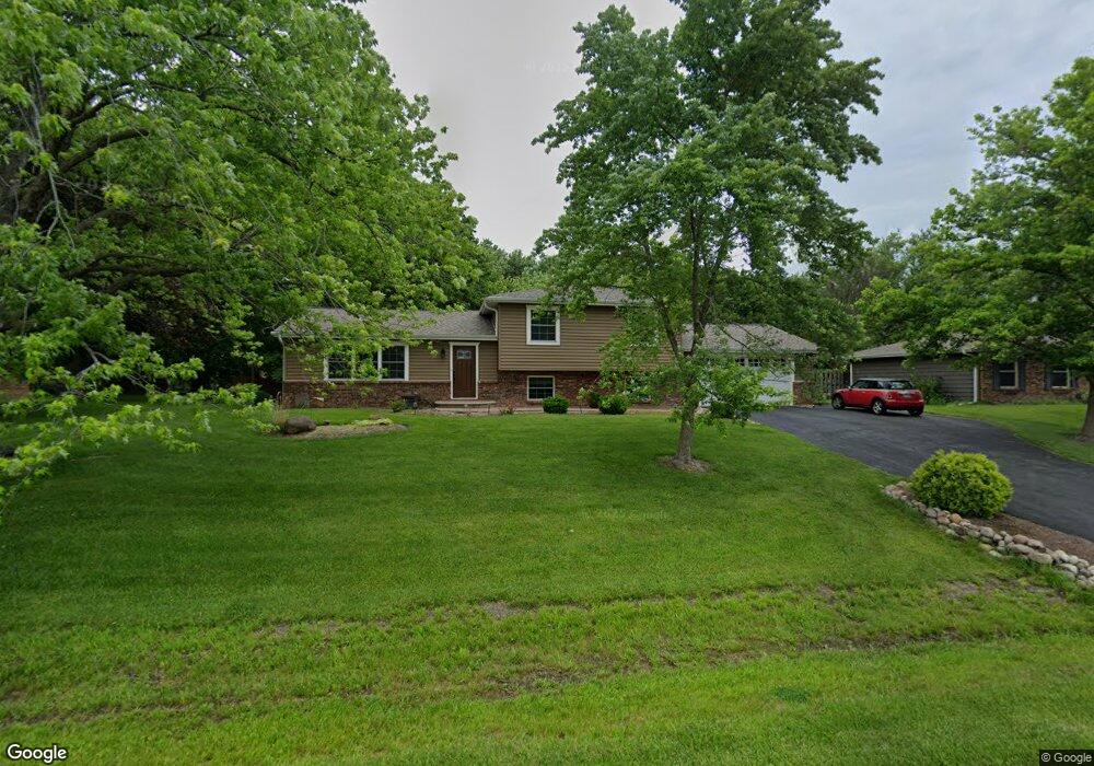
29W280 Mark Dr Naperville, IL 60564
Wheatland South NeighborhoodEstimated Value: $478,754 - $536,000
3
Beds
3
Baths
1,435
Sq Ft
$351/Sq Ft
Est. Value
About This Home
This home is located at 29W280 Mark Dr, Naperville, IL 60564 and is currently estimated at $503,439, approximately $350 per square foot. 29W280 Mark Dr is a home with nearby schools including Clifford Crone Middle School, Neuqua Valley High School, and Covenant Classical School.
Ownership History
Date
Name
Owned For
Owner Type
Purchase Details
Closed on
Jul 31, 2003
Sold by
Irmick Stephen A and Irmick Michele
Bought by
Golebiewski Krzysztof and Golebiewski Melissa
Current Estimated Value
Home Financials for this Owner
Home Financials are based on the most recent Mortgage that was taken out on this home.
Original Mortgage
$152,000
Outstanding Balance
$66,934
Interest Rate
5.62%
Mortgage Type
Purchase Money Mortgage
Estimated Equity
$436,505
Create a Home Valuation Report for This Property
The Home Valuation Report is an in-depth analysis detailing your home's value as well as a comparison with similar homes in the area
Home Values in the Area
Average Home Value in this Area
Purchase History
| Date | Buyer | Sale Price | Title Company |
|---|---|---|---|
| Golebiewski Krzysztof | $257,000 | Chicago Title Insurance Comp |
Source: Public Records
Mortgage History
| Date | Status | Borrower | Loan Amount |
|---|---|---|---|
| Open | Golebiewski Krzysztof | $152,000 |
Source: Public Records
Tax History Compared to Growth
Tax History
| Year | Tax Paid | Tax Assessment Tax Assessment Total Assessment is a certain percentage of the fair market value that is determined by local assessors to be the total taxable value of land and additions on the property. | Land | Improvement |
|---|---|---|---|---|
| 2024 | $7,727 | $137,238 | $25,941 | $111,297 |
| 2023 | $7,727 | $121,235 | $22,916 | $98,319 |
| 2022 | $6,506 | $104,367 | $21,679 | $82,688 |
| 2021 | $6,189 | $99,397 | $20,647 | $78,750 |
| 2020 | $6,164 | $97,822 | $20,320 | $77,502 |
| 2019 | $5,966 | $95,065 | $19,747 | $75,318 |
| 2018 | $5,503 | $86,459 | $19,312 | $67,147 |
| 2017 | $5,426 | $84,227 | $18,813 | $65,414 |
| 2016 | $5,409 | $82,414 | $18,408 | $64,006 |
| 2015 | $4,759 | $79,244 | $17,700 | $61,544 |
| 2014 | $4,759 | $68,620 | $17,700 | $50,920 |
| 2013 | $4,759 | $68,620 | $17,700 | $50,920 |
Source: Public Records
Map
Nearby Homes
- 29W316 Andermann Dr
- 2255 Wendt Cir
- 3847 Gold Cup Ln
- 1736 Robert Ln
- 4507 Barr Creek Ln
- 3707 Junebreeze Ln
- 3740 Caine Dr
- 3027 Brossman St
- 2703 Wait Rd Unit 3
- 3271 Cool Springs Ct
- 3281 Cool Springs Ct
- 2866 Stonewater Dr Unit 102
- 3432 Redwing Dr Unit 2
- 2850 Stonewater Dr Unit 92
- 3212 Austin Ct
- 3003 Kingbird Ct Unit IV
- 3423 Sunnyside Ct
- 1107 Conan Doyle Rd Unit 2
- 24531 W 103rd St
- 2736 Bluewater Cir
- 29W266 Mark Dr
- 29W304 Mark Dr
- 29W281 Mark Dr
- 29W254 Mark Dr
- 29W316 Mark Dr
- 29W267 Mark Dr
- 29W303 Mark Dr
- 29W317 Mark Dr
- 29W281 Andermann Dr
- 29W255 Mark Dr
- 29W242 Mark Dr
- 29W267 Andermann Dr
- 29W303 Andermann Dr
- 29W332 Mark Dr
- 29W253 Andermann Dr
- 29W317 Andermann Dr
- 11S744 Schillinger Dr
- 29W331 Mark Dr
- 29W344 Mark Dr
- 11S678 Schillinger Dr