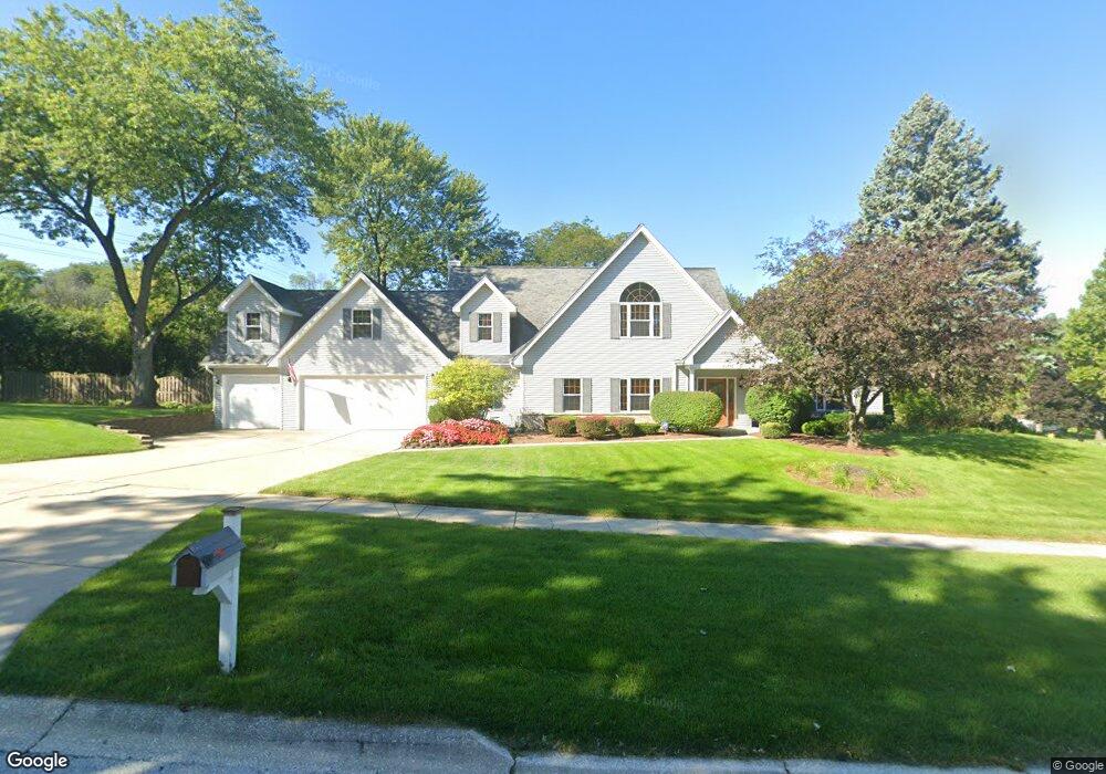
2S656 Bob o Link Rd Lombard, IL 60148
Estimated Value: $698,870 - $917,000
--
Bed
--
Bath
4,382
Sq Ft
$180/Sq Ft
Est. Value
About This Home
This home is located at 2S656 Bob o Link Rd, Lombard, IL 60148 and is currently estimated at $786,968, approximately $179 per square foot. 2S656 Bob o Link Rd is a home located in DuPage County with nearby schools including Butterfield Elementary School, Madison Elementary School, and Wm Hammerschmidt Elementary School.
Ownership History
Date
Name
Owned For
Owner Type
Purchase Details
Closed on
Jul 9, 2012
Sold by
Steadman Linda R
Bought by
Steadman Linda R and Linda R Steadman Trust
Current Estimated Value
Purchase Details
Closed on
Apr 3, 2001
Sold by
Steadman Linda R
Bought by
Steadman Linda R and Steadman Jeffrey H
Home Financials for this Owner
Home Financials are based on the most recent Mortgage that was taken out on this home.
Original Mortgage
$385,000
Outstanding Balance
$142,243
Interest Rate
7.05%
Estimated Equity
$644,725
Purchase Details
Closed on
Mar 3, 1998
Sold by
Kroeker Helen Mae
Bought by
Steadman Linda R
Home Financials for this Owner
Home Financials are based on the most recent Mortgage that was taken out on this home.
Original Mortgage
$85,000
Interest Rate
7.14%
Create a Home Valuation Report for This Property
The Home Valuation Report is an in-depth analysis detailing your home's value as well as a comparison with similar homes in the area
Home Values in the Area
Average Home Value in this Area
Purchase History
| Date | Buyer | Sale Price | Title Company |
|---|---|---|---|
| Steadman Linda R | -- | None Available | |
| Steadman Linda R | -- | -- | |
| Steadman Linda R | $125,000 | Chicago Title Insurance Co |
Source: Public Records
Mortgage History
| Date | Status | Borrower | Loan Amount |
|---|---|---|---|
| Open | Steadman Linda R | $385,000 | |
| Closed | Steadman Linda R | $85,000 |
Source: Public Records
Tax History Compared to Growth
Tax History
| Year | Tax Paid | Tax Assessment Tax Assessment Total Assessment is a certain percentage of the fair market value that is determined by local assessors to be the total taxable value of land and additions on the property. | Land | Improvement |
|---|---|---|---|---|
| 2024 | $12,668 | $193,803 | $37,405 | $156,398 |
| 2023 | $12,539 | $178,390 | $34,430 | $143,960 |
| 2022 | $12,537 | $183,000 | $34,450 | $148,550 |
| 2021 | $12,172 | $178,660 | $33,630 | $145,030 |
| 2020 | $12,053 | $177,000 | $33,320 | $143,680 |
| 2019 | $11,717 | $172,330 | $32,440 | $139,890 |
| 2018 | $11,439 | $162,380 | $30,560 | $131,820 |
| 2017 | $11,250 | $156,390 | $29,430 | $126,960 |
| 2016 | $11,165 | $150,140 | $28,250 | $121,890 |
| 2015 | $11,101 | $143,230 | $26,950 | $116,280 |
| 2014 | $11,077 | $139,290 | $18,450 | $120,840 |
| 2013 | $11,082 | $139,700 | $18,500 | $121,200 |
Source: Public Records
Map
Nearby Homes
- 21W246 Audubon Rd
- 21W117 Glen Park Rd
- 21W353 Drury Ln
- 2S225 Lawler Ln
- 2S200 Valley Rd
- 21W745 Glen Valley Dr
- 2S165 Huntington Ct
- 2S137 Beaumont Ln Unit 9
- 22W041 Pinegrove Ct
- 1151 Whitehall St
- 2100 S Lloyd Ave
- 1128 Hunter St
- 1073 Foxworth Blvd
- 2S365 Milton Ave
- 298 Gazebo Ln Unit 47
- 175 Arboretum Dr Unit 187
- 3S240 Burr Oak Dr
- 2005 S Finley Rd Unit 901
- 2005 S Finley Rd Unit 1204
- 2005 S Finley Rd Unit 1102
- 2S655 Bob o Link Rd
- 21W241 Ahlstrand Rd
- 21W174 Butterfield Rd
- 2S645 Bob o Link Rd
- 21W251 Ahlstrand Rd
- 21W177 Briarcliff Rd
- 21W205 Ahlstrand Rd
- 21W162 Butterfield Rd
- 21W222 Ahlstrand Rd
- 21W165 Briarcliff Rd
- 21W152 Butterfield Rd
- 21W210 Ahlstrand Rd
- 21W261 Ahlstrand Rd
- 21W250 Audubon Rd
- 21W155 Briarcliff Rd
- 21W266 Ahlstrand Rd
- 21W142 Butterfield Rd
- 21W271 Ahlstrand Rd
- 21W225 Briarcliff Rd
- 21W258 Audubon Rd