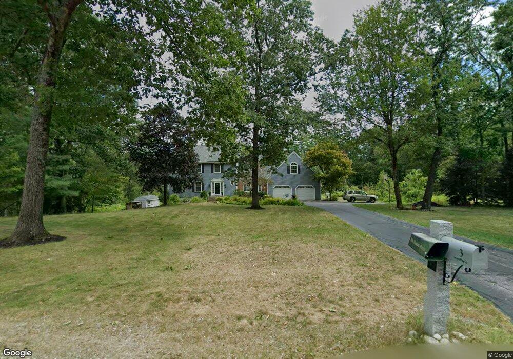
3 Beaver Pond Dr Brookline, NH 03033
Estimated Value: $734,000 - $869,000
4
Beds
3
Baths
3,339
Sq Ft
$233/Sq Ft
Est. Value
About This Home
This home is located at 3 Beaver Pond Dr, Brookline, NH 03033 and is currently estimated at $779,537, approximately $233 per square foot. 3 Beaver Pond Dr is a home located in Hillsborough County with nearby schools including Richard Maghakian Memorial School, Captain Samuel Douglass Academy, and Hollis-Brookline Middle School.
Ownership History
Date
Name
Owned For
Owner Type
Purchase Details
Closed on
Jan 29, 2008
Sold by
Hayden George M and Hayden Connie C
Bought by
Flaum Harris C and Flaum Fanny M
Current Estimated Value
Home Financials for this Owner
Home Financials are based on the most recent Mortgage that was taken out on this home.
Original Mortgage
$312,000
Interest Rate
6.17%
Mortgage Type
Purchase Money Mortgage
Purchase Details
Closed on
Oct 31, 2003
Sold by
Connor James J and Connor Carol A
Bought by
Hayden George M and Hayden Connie C
Home Financials for this Owner
Home Financials are based on the most recent Mortgage that was taken out on this home.
Original Mortgage
$322,700
Interest Rate
6.05%
Create a Home Valuation Report for This Property
The Home Valuation Report is an in-depth analysis detailing your home's value as well as a comparison with similar homes in the area
Home Values in the Area
Average Home Value in this Area
Purchase History
| Date | Buyer | Sale Price | Title Company |
|---|---|---|---|
| Flaum Harris C | $390,000 | -- | |
| Hayden George M | $400,500 | -- |
Source: Public Records
Mortgage History
| Date | Status | Borrower | Loan Amount |
|---|---|---|---|
| Open | Hayden George M | $307,000 | |
| Closed | Hayden George M | $312,000 | |
| Closed | Hayden George M | $312,000 | |
| Previous Owner | Hayden George M | $322,700 |
Source: Public Records
Tax History
| Year | Tax Paid | Tax Assessment Tax Assessment Total Assessment is a certain percentage of the fair market value that is determined by local assessors to be the total taxable value of land and additions on the property. | Land | Improvement |
|---|---|---|---|---|
| 2025 | $16,201 | $657,500 | $210,400 | $447,100 |
| 2024 | $14,866 | $657,500 | $210,400 | $447,100 |
| 2023 | $13,663 | $657,500 | $210,400 | $447,100 |
| 2022 | $11,484 | $386,400 | $126,700 | $259,700 |
| 2021 | $10,886 | $380,900 | $126,700 | $254,200 |
| 2020 | $10,589 | $380,900 | $126,700 | $254,200 |
| 2019 | $11,377 | $380,900 | $126,700 | $254,200 |
| 2018 | $11,112 | $375,900 | $126,700 | $249,200 |
| 2017 | $10,472 | $317,900 | $107,500 | $210,400 |
| 2016 | $10,370 | $318,500 | $107,600 | $210,900 |
| 2015 | $9,889 | $318,500 | $107,600 | $210,900 |
| 2014 | $10,463 | $318,500 | $107,600 | $210,900 |
| 2013 | $10,074 | $318,500 | $107,600 | $210,900 |
Source: Public Records
Map
Nearby Homes
- 9 Winterberry Rd
- 7 Winterberry Rd
- 3 Winterberry Rd
- 61 Russell Hill Rd
- 198 N End Rd
- 364 Townsend Hill Rd
- 1235 Townsend Rd
- 0 Brookline St
- 9 Quigley Way
- 25 Pepperell Rd
- 6 Skyline Dr
- 6 High Oaks Path
- 6 Flint Meadow Dr
- 8B Louis Dr
- 5 Turnpike Rd Unit 213 TWO
- 9 Kaneohe Ct
- 49 Countryside Dr
- 16 Worcester Rd
- 1 Depot Street Extension Unit 5
- 1 Depot Street Extension Unit 2
- 5 Beaver Pond Dr
- 1 Beaver Pond Dr Unit 33-6
- 1 Beaver Pond Dr
- 6 Beaver Pond Dr
- 0 Wallace Brook Rd Unit 4319481
- 2 Beaver Pond Dr
- 7 Beaver Pond Dr
- 15 Wallace Brook Rd
- 25 Wallace Brook Rd
- 8 Beaver Pond Dr
- 20 Wallace Brook Rd
- 9 Beaver Pond Dr
- 11 Wallace Brook Rd
- 22 Wallace Brook Rd
- 27 Wallace Brook Rd
- 14 Wallace Brook Rd
- 24 Wallace Brook Rd
- 10 Beaver Pond Dr
- 12 Wallace Brook Rd
Your Personal Tour Guide
Ask me questions while you tour the home.