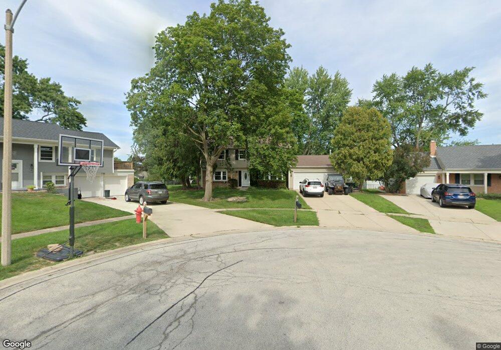
3 Bernard Ct Buffalo Grove, IL 60089
South Buffalo Grove NeighborhoodEstimated Value: $472,151 - $523,000
4
Beds
3
Baths
2,068
Sq Ft
$241/Sq Ft
Est. Value
About This Home
This home is located at 3 Bernard Ct, Buffalo Grove, IL 60089 and is currently estimated at $498,288, approximately $240 per square foot. 3 Bernard Ct is a home located in Cook County with nearby schools including Henry W Longfellow Elementary School, Cooper Middle School, and Buffalo Grove High School.
Ownership History
Date
Name
Owned For
Owner Type
Purchase Details
Closed on
Oct 24, 2006
Sold by
Stangohr James B and Stangohr Valerie J
Bought by
Golden Allen
Current Estimated Value
Home Financials for this Owner
Home Financials are based on the most recent Mortgage that was taken out on this home.
Original Mortgage
$250,000
Outstanding Balance
$149,097
Interest Rate
6.45%
Mortgage Type
Unknown
Estimated Equity
$349,191
Create a Home Valuation Report for This Property
The Home Valuation Report is an in-depth analysis detailing your home's value as well as a comparison with similar homes in the area
Home Values in the Area
Average Home Value in this Area
Purchase History
| Date | Buyer | Sale Price | Title Company |
|---|---|---|---|
| Golden Allen | $369,000 | Chicago Title Insurance Co |
Source: Public Records
Mortgage History
| Date | Status | Borrower | Loan Amount |
|---|---|---|---|
| Open | Golden Allen | $250,000 |
Source: Public Records
Tax History Compared to Growth
Tax History
| Year | Tax Paid | Tax Assessment Tax Assessment Total Assessment is a certain percentage of the fair market value that is determined by local assessors to be the total taxable value of land and additions on the property. | Land | Improvement |
|---|---|---|---|---|
| 2024 | $9,980 | $32,118 | $7,054 | $25,064 |
| 2023 | $9,569 | $34,497 | $7,054 | $27,443 |
| 2022 | $9,569 | $34,497 | $7,054 | $27,443 |
| 2021 | $8,793 | $28,220 | $4,506 | $23,714 |
| 2020 | $8,636 | $28,220 | $4,506 | $23,714 |
| 2019 | $8,625 | $31,287 | $4,506 | $26,781 |
| 2018 | $8,307 | $27,556 | $3,919 | $23,637 |
| 2017 | $8,174 | $27,556 | $3,919 | $23,637 |
| 2016 | $8,195 | $28,590 | $3,919 | $24,671 |
| 2015 | $6,880 | $22,874 | $3,331 | $19,543 |
| 2014 | $7,316 | $24,466 | $3,331 | $21,135 |
| 2013 | $7,547 | $27,064 | $3,331 | $23,733 |
Source: Public Records
Map
Nearby Homes
- 329 Timber Hill Rd
- 921 Bernard Dr
- 408 Indian Hill Dr
- 98 Stonegate Rd
- 1130 Bernard Dr
- 410 Chatham Cir
- 535 Estate Dr
- 859 Beechwood Rd
- 4116 N Terramere Ave
- 476 W Happfield Dr Unit 10AL
- 720 Weidner Rd Unit 302
- 1112 Auburn Ln
- 813 Stradford Cir Unit 21B2
- 715 W Whiting Ln
- 780 Weidner Rd Unit 300
- 310 Rosewood Ave
- 455 Mayfair Ln
- 812 W Whiting Ln
- 705 Grove Dr Unit 101
- 820 Weidner Rd Unit 409
- 4 Bernard Ct
- 2 Bernard Ct
- 306 Terrace Place
- 296 Terrace Place
- 318 Terrace Place Unit 1
- 985 Plum Grove Cir
- 997 Plum Grove Cir
- 284 Terrace Place
- 5 Bernard Ct
- 1 Bernard Ct
- 1009 Plum Grove Cir
- 962 Bernard Dr
- 270 Terrace Place
- 6 Bernard Ct
- 7 Bernard Ct
- 1015 Plum Grove Cir
- 8 Bernard Ct
- 305 Terrace Place
- 1033 Plum Grove Cir
- 317 Terrace Place