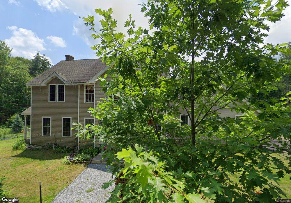
3 Brien Rd Goffstown, NH 03045
Estimated Value: $556,000 - $637,878
3
Beds
2
Baths
2,920
Sq Ft
$203/Sq Ft
Est. Value
About This Home
This home is located at 3 Brien Rd, Goffstown, NH 03045 and is currently estimated at $591,720, approximately $202 per square foot. 3 Brien Rd is a home with nearby schools including Mountain View Middle School, Goffstown High School, and Namaste Montessori School.
Ownership History
Date
Name
Owned For
Owner Type
Purchase Details
Closed on
Oct 2, 1998
Sold by
Brien Raymond J and Brien Shirley A
Bought by
Brien Richard S
Current Estimated Value
Home Financials for this Owner
Home Financials are based on the most recent Mortgage that was taken out on this home.
Original Mortgage
$42,000
Interest Rate
6.89%
Create a Home Valuation Report for This Property
The Home Valuation Report is an in-depth analysis detailing your home's value as well as a comparison with similar homes in the area
Home Values in the Area
Average Home Value in this Area
Purchase History
| Date | Buyer | Sale Price | Title Company |
|---|---|---|---|
| Brien Richard S | $60,000 | -- |
Source: Public Records
Mortgage History
| Date | Status | Borrower | Loan Amount |
|---|---|---|---|
| Open | Brien Richard S | $197,000 | |
| Closed | Brien Richard S | $215,000 | |
| Closed | Brien Richard S | $190,000 | |
| Closed | Brien Richard S | $42,000 |
Source: Public Records
Tax History
| Year | Tax Paid | Tax Assessment Tax Assessment Total Assessment is a certain percentage of the fair market value that is determined by local assessors to be the total taxable value of land and additions on the property. | Land | Improvement |
|---|---|---|---|---|
| 2024 | $9,926 | $485,600 | $169,200 | $316,400 |
| 2023 | $9,158 | $485,600 | $169,200 | $316,400 |
| 2022 | $8,564 | $325,500 | $110,300 | $215,200 |
| 2021 | $8,079 | $325,500 | $110,300 | $215,200 |
| 2020 | $8,079 | $325,500 | $110,300 | $215,200 |
| 2019 | $8,001 | $325,500 | $110,300 | $215,200 |
| 2018 | $6,054 | $325,500 | $110,300 | $215,200 |
| 2017 | $7,664 | $279,500 | $90,700 | $188,800 |
| 2016 | $7,387 | $279,500 | $90,700 | $188,800 |
| 2015 | $7,158 | $254,200 | $77,600 | $176,600 |
| 2014 | $6,863 | $254,200 | $77,600 | $176,600 |
Source: Public Records
Map
Nearby Homes
- 99 Cambridge Rd
- 129 Mountain Base Rd
- 9 Cherry Ln
- 28 Olde Lantern Rd
- 30 Mill Stone Terrace
- 16 Angel Point Cir Unit A
- Lot 6 Aisling Ln Unit Lot 6 - The Silverto
- 0 Mast Rd Unit 49 5054665
- 5 Harvest Ln
- 29 Marion St
- 3A Dearborn Cir
- 3B Dearborn Cir
- 5B Dearborn Cir
- 120 S Mast St
- 4C Dearborn Cir
- 4D Dearborn Cir
- 2 Timberwood Dr Unit 103
- 31 Libbey St
- 18 Holbrook Rd
- 2 Larch St Unit 13
- 173 Shirley Hill Rd
- 166 Shirley Hill Rd
- 129 Shirley Hill Rd
- 180 Stephen Dr
- 106 Shirley Hill Rd
- 97 Shirley Hill Rd
- 155 Stephen Dr
- 134 Stephen Dr
- 35 Stephen Dr
- 8 Tipping Rock Rd
- 130 Stephen Dr
- 972 Back Mountain Rd
- 85 Shirley Hill Rd
- 84 Shirley Hill Rd
- 63 Stephen Dr
- 11 Tipping Rock Rd
- 123 Stephen Dr
- 26 Tipping Rock Rd
- 80 Shirley Hill Rd
- 973 Back Mountain Rd
Your Personal Tour Guide
Ask me questions while you tour the home.