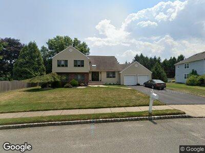
3 Cannonade Dr Marlboro, NJ 07746
Estimated Value: $768,000 - $921,000
4
Beds
2
Baths
2,475
Sq Ft
$342/Sq Ft
Est. Value
About This Home
This home is located at 3 Cannonade Dr, Marlboro, NJ 07746 and is currently estimated at $845,966, approximately $341 per square foot. 3 Cannonade Dr is a home located in Monmouth County with nearby schools including Frank J. Dugan Elementary School, Marlboro Middle School, and Marlboro High School.
Ownership History
Date
Name
Owned For
Owner Type
Purchase Details
Closed on
Apr 10, 2023
Sold by
Whitenack John and Whitenack Cheryl L
Bought by
Cheryl Lee Friedman-Whitenack Living Trust and John Carter Whitenack Living Trust
Current Estimated Value
Purchase Details
Closed on
Apr 13, 2001
Sold by
Friedman Larry
Bought by
Whitenack John and Whitenack Cheryl
Home Financials for this Owner
Home Financials are based on the most recent Mortgage that was taken out on this home.
Original Mortgage
$180,000
Interest Rate
7.09%
Create a Home Valuation Report for This Property
The Home Valuation Report is an in-depth analysis detailing your home's value as well as a comparison with similar homes in the area
Home Values in the Area
Average Home Value in this Area
Purchase History
| Date | Buyer | Sale Price | Title Company |
|---|---|---|---|
| Cheryl Lee Friedman-Whitenack Living Trust | -- | None Listed On Document | |
| Whitenack John | $67,500 | -- |
Source: Public Records
Mortgage History
| Date | Status | Borrower | Loan Amount |
|---|---|---|---|
| Previous Owner | Whitenack John | $235,000 | |
| Previous Owner | Whitenack John | $180,000 |
Source: Public Records
Tax History Compared to Growth
Tax History
| Year | Tax Paid | Tax Assessment Tax Assessment Total Assessment is a certain percentage of the fair market value that is determined by local assessors to be the total taxable value of land and additions on the property. | Land | Improvement |
|---|---|---|---|---|
| 2024 | $9,891 | $414,900 | $183,600 | $231,300 |
| 2023 | $9,891 | $414,900 | $183,600 | $231,300 |
| 2022 | $9,638 | $414,900 | $183,600 | $231,300 |
| 2021 | $9,638 | $414,900 | $183,600 | $231,300 |
| 2020 | $9,539 | $414,900 | $183,600 | $231,300 |
| 2019 | $9,543 | $414,900 | $183,600 | $231,300 |
| 2018 | $9,381 | $414,900 | $183,600 | $231,300 |
| 2017 | $9,198 | $414,900 | $183,600 | $231,300 |
| 2016 | $9,097 | $412,000 | $183,600 | $228,400 |
| 2015 | $8,833 | $406,100 | $183,600 | $222,500 |
| 2014 | $8,594 | $391,000 | $193,600 | $197,400 |
Source: Public Records
Map
Nearby Homes
- 27 Suffolk Way
- 44 Cannonade Dr
- 14 Murray Hill Terrace
- 29 Coventry Terrace
- 24 Clubhouse Ln
- 11 Hansom Ln
- 55 Lakeview Dr
- 9 Crossridge Cir
- 44 Manor Dr
- 2 Palomino Way
- 14 Weston Ct
- 27 Peasley Dr
- 28 Pheasant Dr
- 3 Hampton Dr
- 37 Lakeview Dr
- 265 Plum Dr
- 114 Murray Hill Terrace
- 74 Kingfisher Ct
- 115 Peasley Dr
- 63 Caldwell Terrace
- 3 Cannonade Dr
- 5 Cannonade Dr
- 16 Damascus Dr
- 20 Damascus Dr
- 24 Damascus Dr
- 4 Cannonade Dr
- 7 Cannonade Dr
- 10 Damascus Dr
- 4 Nashua Dr
- 26 Damascus Dr
- 2 Secretariat Square
- 19 Damascus Dr
- 107 Cannonade Dr
- 6 Nashua Dr
- 9 Cannonade Dr
- 8 Damascus Dr
- 17 Damascus Dr
- 15 Damascus Dr
- 4 Secretariat Square
- 23 Damascus Dr