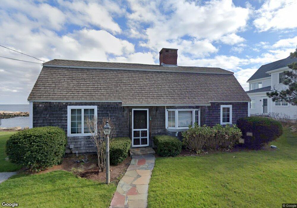
3 Chapel Ln Unit 1 Rockport, MA 01966
Estimated Value: $1,885,000 - $2,334,000
3
Beds
1
Bath
1,070
Sq Ft
$1,915/Sq Ft
Est. Value
About This Home
This home is located at 3 Chapel Ln Unit 1, Rockport, MA 01966 and is currently estimated at $2,048,517, approximately $1,914 per square foot. 3 Chapel Ln Unit 1 is a home located in Essex County with nearby schools including Rockport Elementary School, Rockport Middle School, and Rockport High School.
Ownership History
Date
Name
Owned For
Owner Type
Purchase Details
Closed on
Oct 17, 2014
Sold by
Leet Florence J
Bought by
Hennessy Janet L and Brennan John P
Current Estimated Value
Purchase Details
Closed on
Oct 5, 1999
Sold by
Boland Colin P and Boland Matthew B
Bought by
Kist Frederick J and Kist-Vanholthe Joana E
Create a Home Valuation Report for This Property
The Home Valuation Report is an in-depth analysis detailing your home's value as well as a comparison with similar homes in the area
Home Values in the Area
Average Home Value in this Area
Purchase History
| Date | Buyer | Sale Price | Title Company |
|---|---|---|---|
| Hennessy Janet L | $1,000,000 | -- | |
| Hennessy Janet L | $1,000,000 | -- | |
| Kist Frederick J | $650,000 | -- | |
| Kist Frederick J | $650,000 | -- |
Source: Public Records
Tax History Compared to Growth
Tax History
| Year | Tax Paid | Tax Assessment Tax Assessment Total Assessment is a certain percentage of the fair market value that is determined by local assessors to be the total taxable value of land and additions on the property. | Land | Improvement |
|---|---|---|---|---|
| 2025 | $17,615 | $2,010,800 | $1,668,500 | $342,300 |
| 2024 | $15,351 | $1,823,100 | $1,520,200 | $302,900 |
| 2023 | $14,641 | $1,552,600 | $1,267,300 | $285,300 |
| 2022 | $15,043 | $1,531,900 | $1,269,600 | $262,300 |
| 2021 | $14,209 | $1,458,800 | $1,209,000 | $249,800 |
| 2020 | $13,692 | $1,355,600 | $1,151,400 | $204,200 |
| 2019 | $13,456 | $1,364,700 | $1,160,500 | $204,200 |
| 2018 | $13,356 | $1,321,100 | $1,123,000 | $198,100 |
| 2017 | $12,021 | $1,065,700 | $916,800 | $148,900 |
| 2016 | $11,698 | $1,039,800 | $890,900 | $148,900 |
| 2015 | $11,424 | $1,038,500 | $890,900 | $147,600 |
| 2014 | -- | $977,600 | $831,500 | $146,100 |
Source: Public Records
Map
Nearby Homes
- 165 Granite St
- 13 Phillips Ave
- 2 Wharf Rd
- 25 Stockholm Ave
- 2 Boulder Top
- 13 Rowe Point
- 73 Phillips Ave
- 1 Doctors Run
- 63R Main St Unit 2
- 73-77 Main St
- 2 Mount Pleasant St Unit 3
- 36 Broadway Ave
- 15 High St Unit D
- 5 Allen Ave
- 123 Main St Unit 2
- 4 Norwood Ave
- 135 A&B Main St
- 13 Pleasant St Unit 3
- 57 Mt Pleasant St Unit 2B
- 5 Marshall Ln
- 3 Chapel Ln
- 3 Chapel Ln
- 5 Chapel Ln
- 5 Chapel Ln
- 1 Chapel Ln
- 1 Chapel Ln Unit 1
- 1 Chapel Ln
- 2 Chapel Ln
- 147 Granite St
- 153 Granite St
- 153 Granite St Unit 1
- 149 Granite St Unit 151
- 157 Granite St
- 145 Granite St
- 159 Granite St Unit R
- 159 Granite St
- 159 Granite St Unit 2
- 159 Granite St Unit 1
- 143 Granite St
- 133RR Granite St