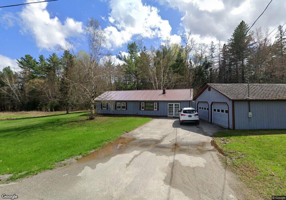
3 Cookson Rd Burnham, ME 04922
Estimated Value: $164,878 - $302,000
4
Beds
1
Bath
1,300
Sq Ft
$203/Sq Ft
Est. Value
About This Home
This home is located at 3 Cookson Rd, Burnham, ME 04922 and is currently estimated at $263,970, approximately $203 per square foot. 3 Cookson Rd is a home located in Waldo County with nearby schools including Manson Park School, Vickery School, and Sad #53 Alternative Education.
Ownership History
Date
Name
Owned For
Owner Type
Purchase Details
Closed on
Jul 23, 2014
Sold by
Lane Andrew and Lane Kevin
Bought by
Garbinski Jason W
Current Estimated Value
Home Financials for this Owner
Home Financials are based on the most recent Mortgage that was taken out on this home.
Original Mortgage
$98,979
Outstanding Balance
$74,564
Interest Rate
4.18%
Mortgage Type
New Conventional
Estimated Equity
$189,406
Purchase Details
Closed on
May 12, 2009
Sold by
Fnma
Bought by
Lane Andrew and Lane Kevin
Purchase Details
Closed on
Aug 19, 2008
Sold by
Countrywide Home Loans
Bought by
Federal National Mortgage Association
Create a Home Valuation Report for This Property
The Home Valuation Report is an in-depth analysis detailing your home's value as well as a comparison with similar homes in the area
Purchase History
| Date | Buyer | Sale Price | Title Company |
|---|---|---|---|
| Garbinski Jason W | -- | -- | |
| Lane Andrew | -- | -- | |
| Federal National Mortgage Association | -- | -- |
Source: Public Records
Mortgage History
| Date | Status | Borrower | Loan Amount |
|---|---|---|---|
| Open | Garbinski Jason W | $98,979 |
Source: Public Records
Tax History
| Year | Tax Paid | Tax Assessment Tax Assessment Total Assessment is a certain percentage of the fair market value that is determined by local assessors to be the total taxable value of land and additions on the property. | Land | Improvement |
|---|---|---|---|---|
| 2025 | $2,353 | $125,500 | $31,600 | $93,900 |
| 2024 | $2,221 | $125,500 | $31,600 | $93,900 |
| 2023 | $2,096 | $125,500 | $31,600 | $93,900 |
| 2022 | $1,822 | $88,900 | $22,300 | $66,600 |
| 2021 | $1,840 | $88,900 | $22,300 | $66,600 |
| 2020 | $1,716 | $88,900 | $22,300 | $66,600 |
| 2019 | $1,716 | $88,900 | $22,300 | $66,600 |
| 2018 | $1,716 | $88,900 | $22,300 | $66,600 |
| 2016 | -- | $88,900 | $22,300 | $66,600 |
| 2010 | -- | $88,100 | $22,300 | $65,800 |
Source: Public Records
Map
Nearby Homes
- 69 N Horse Back Rd
- Lot 4A Off Morgan Rd
- M 5 Lot 41 Morgan Rd
- M 5 Lot 40 Morgan Rd
- M5 Lot 43 Morgan Rd
- Lot 14-2,3 Perkins Rd
- 3 Pine Ln
- 1423 Main St
- 550 Troy Rd
- 126 Rancourt Ln
- 44 Charles Taylor Ln
- 12-03 Horseback Rd
- Lot # 5 Locust Ln
- 0 Mccarty Rd Unit 1653866
- 15-A Snakeroot Rd
- Lot 45-1 Maine 220
- 410 Peltoma Ave
- 616 Peltoma Ave
- Lot #049 Main St
- 366 Webb Rd
- 6 Cookson Rd
- 11 Cookson Rd
- 52 N Horseback Rd
- 0 Horseback Rd Cross Rd
- 69 N Horseback Rd
- 50 N Horseback Rd
- 75 N Horseback Rd
- 44 N Horseback Rd
- 77 N Horseback Rd
- 28 Cookson Rd
- 79 N Horseback Rd
- 30 Cookson Rd
- 38 N Horseback Rd
- 31 Cookson Rd
- 34 N Horseback Rd
- 29 N Horseback Rd
- 40 Cookson Rd
- 6 Myron Ln
- 8 Myron Ln
- 109 N Horseback Rd
Your Personal Tour Guide
Ask me questions while you tour the home.