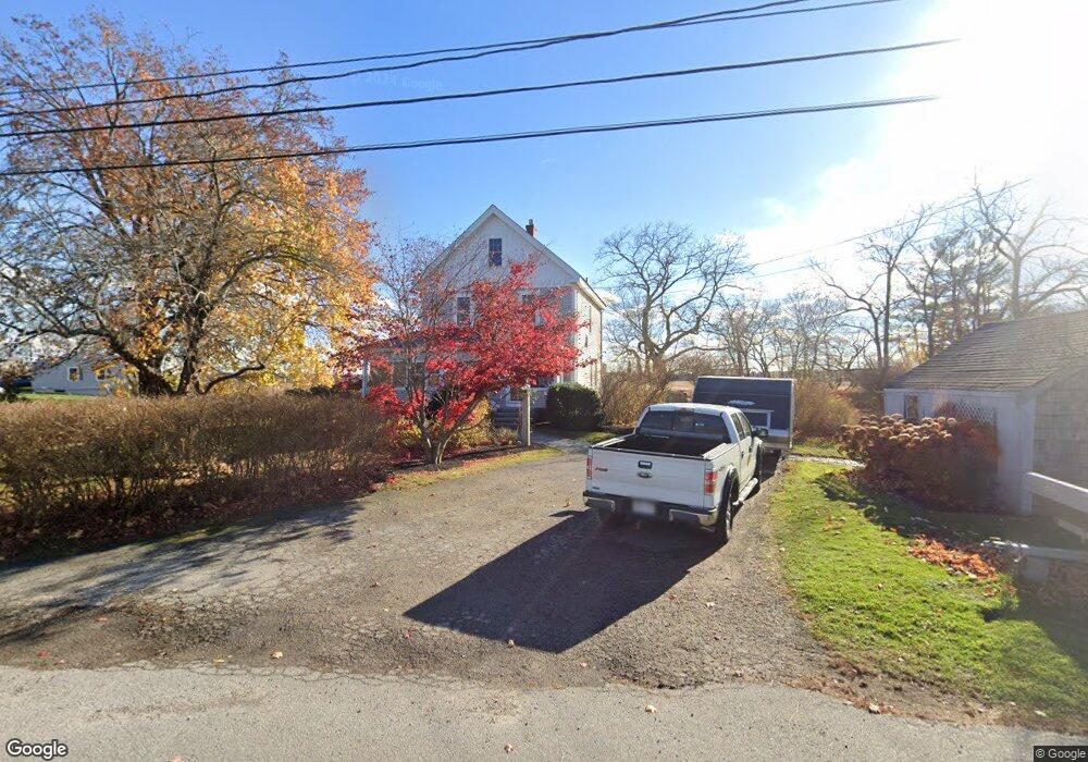
3 Ferry Lots Ln Salisbury, MA 01952
Estimated Value: $627,542 - $699,000
4
Beds
2
Baths
2,091
Sq Ft
$312/Sq Ft
Est. Value
About This Home
This home is located at 3 Ferry Lots Ln, Salisbury, MA 01952 and is currently estimated at $653,136, approximately $312 per square foot. 3 Ferry Lots Ln is a home located in Essex County with nearby schools including Triton Regional High School.
Ownership History
Date
Name
Owned For
Owner Type
Purchase Details
Closed on
Jun 9, 2006
Sold by
Twomey Rachel T
Bought by
Baumann Derek and Baumann Sharon
Current Estimated Value
Home Financials for this Owner
Home Financials are based on the most recent Mortgage that was taken out on this home.
Original Mortgage
$304,000
Interest Rate
6.62%
Mortgage Type
Purchase Money Mortgage
Create a Home Valuation Report for This Property
The Home Valuation Report is an in-depth analysis detailing your home's value as well as a comparison with similar homes in the area
Home Values in the Area
Average Home Value in this Area
Purchase History
| Date | Buyer | Sale Price | Title Company |
|---|---|---|---|
| Baumann Derek | $320,000 | -- |
Source: Public Records
Mortgage History
| Date | Status | Borrower | Loan Amount |
|---|---|---|---|
| Open | Baumann Derek | $278,000 | |
| Closed | Baumann Derek | $290,000 | |
| Closed | Baumann Derek | $304,000 | |
| Previous Owner | Baumann Derek | $15,003 |
Source: Public Records
Tax History Compared to Growth
Tax History
| Year | Tax Paid | Tax Assessment Tax Assessment Total Assessment is a certain percentage of the fair market value that is determined by local assessors to be the total taxable value of land and additions on the property. | Land | Improvement |
|---|---|---|---|---|
| 2025 | $4,838 | $480,000 | $209,100 | $270,900 |
| 2024 | $4,752 | $454,700 | $198,200 | $256,500 |
| 2023 | $4,644 | $430,000 | $198,200 | $231,800 |
| 2022 | $4,351 | $390,600 | $176,400 | $214,200 |
| 2021 | $4,183 | $371,500 | $176,400 | $195,100 |
| 2020 | $3,885 | $339,000 | $185,200 | $153,800 |
| 2019 | $3,796 | $320,100 | $176,700 | $143,400 |
| 2018 | $3,510 | $298,000 | $165,900 | $132,100 |
| 2017 | $3,326 | $279,000 | $158,200 | $120,800 |
| 2016 | $2,995 | $256,600 | $141,300 | $115,300 |
| 2015 | $3,217 | $273,800 | $136,400 | $137,400 |
Source: Public Records
Map
Nearby Homes
- 8 Meadowview Ln Unit B
- 16 Mudnock Rd
- 27 True Rd Unit 2
- 7 Palis Dr
- 48 Beach Rd Unit A
- 48 Beach Rd Unit C
- 12 Baker Rd
- 3 Lighthouse Cir Unit A
- 9 Partridge Ln Unit A
- 14 Partridge Ln Unit C
- 86 Ferry Rd
- 157 Bridge Rd
- 1 Jefferson St
- 191 Elm St
- 175 Bridge Rd
- 105 Forest Rd
- 19 Jefferson St
- 266 Merrimac St Unit F
- 288 Merrimac St
- 42 Kendell Ln
- 1 Ferry Lots Ln
- 5 Ferry Lots Ln
- 49 Mudnock Rd
- 2 Ferry Lots Ln
- 2 Ferry Rd Unit B
- 2 Ferry Rd Unit B (Left)
- 2 Ferry Rd Unit A (Right)
- 2 Ferry Rd
- 4 Ferry Lots Ln
- 7 Ferry Lots Ln
- 47 Mudnock Rd
- 9 Ferry Lots Ln
- 10 Ferry Lots Ln
- 53 Mudnock Rd
- 48 Mudnock Rd
- 50 Mudnock Rd
- 45 Mudnock Rd
- 43 Mudnock Rd
- 44 Mudnock Rd
- 11 Ferry Lots Ln