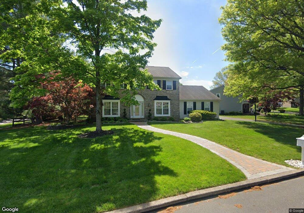
3 Forrest Dr Southampton, PA 18966
Estimated Value: $729,000 - $819,000
3
Beds
3
Baths
2,810
Sq Ft
$277/Sq Ft
Est. Value
About This Home
This home is located at 3 Forrest Dr, Southampton, PA 18966 and is currently estimated at $779,429, approximately $277 per square foot. 3 Forrest Dr is a home located in Bucks County with nearby schools including Hillcrest El School, Holland Middle School, and Council Rock High School - South.
Ownership History
Date
Name
Owned For
Owner Type
Purchase Details
Closed on
May 27, 2004
Sold by
Collins John P and Collins Donna M
Bought by
Hedricks James S and Hedricks Rosemary E
Current Estimated Value
Home Financials for this Owner
Home Financials are based on the most recent Mortgage that was taken out on this home.
Original Mortgage
$180,000
Outstanding Balance
$89,873
Interest Rate
6.32%
Mortgage Type
Purchase Money Mortgage
Estimated Equity
$689,556
Create a Home Valuation Report for This Property
The Home Valuation Report is an in-depth analysis detailing your home's value as well as a comparison with similar homes in the area
Home Values in the Area
Average Home Value in this Area
Purchase History
| Date | Buyer | Sale Price | Title Company |
|---|---|---|---|
| Hedricks James S | $370,000 | -- |
Source: Public Records
Mortgage History
| Date | Status | Borrower | Loan Amount |
|---|---|---|---|
| Open | Hedricks James S | $180,000 |
Source: Public Records
Tax History Compared to Growth
Tax History
| Year | Tax Paid | Tax Assessment Tax Assessment Total Assessment is a certain percentage of the fair market value that is determined by local assessors to be the total taxable value of land and additions on the property. | Land | Improvement |
|---|---|---|---|---|
| 2025 | $9,168 | $47,600 | $7,840 | $39,760 |
| 2024 | $9,168 | $47,600 | $7,840 | $39,760 |
| 2023 | $8,641 | $47,600 | $7,840 | $39,760 |
| 2022 | $8,562 | $47,600 | $7,840 | $39,760 |
| 2021 | $8,291 | $47,600 | $7,840 | $39,760 |
| 2020 | $8,104 | $47,600 | $7,840 | $39,760 |
| 2019 | $7,757 | $47,600 | $7,840 | $39,760 |
| 2018 | $7,619 | $47,600 | $7,840 | $39,760 |
| 2017 | $7,326 | $47,600 | $7,840 | $39,760 |
| 2016 | $7,326 | $47,600 | $7,840 | $39,760 |
| 2015 | -- | $47,600 | $7,840 | $39,760 |
| 2014 | -- | $47,600 | $7,840 | $39,760 |
Source: Public Records
Map
Nearby Homes
- 6 Rolling Hills Dr
- 258 Woodlake Dr
- 41 Grant Dr
- 178 Buckshire Dr
- 27 Rocking Horse Way
- 270 Rocksville Rd
- 29 Langhorne Ave
- 147 Watergate Dr
- 7 Bennett Place
- 21019 Bennett Place Unit 7
- 52 Dalton Way
- 527 Ashton Cir
- 537 Ashton Cir
- 518 Pebble Ridge Ct
- 6 Springwood Place
- 15 Dover Place
- 935 Edgewood Ln
- 2604 Beacon Hill Dr Unit 2
- 6 Windy Knoll Dr
- 415 Fox Hollow Dr