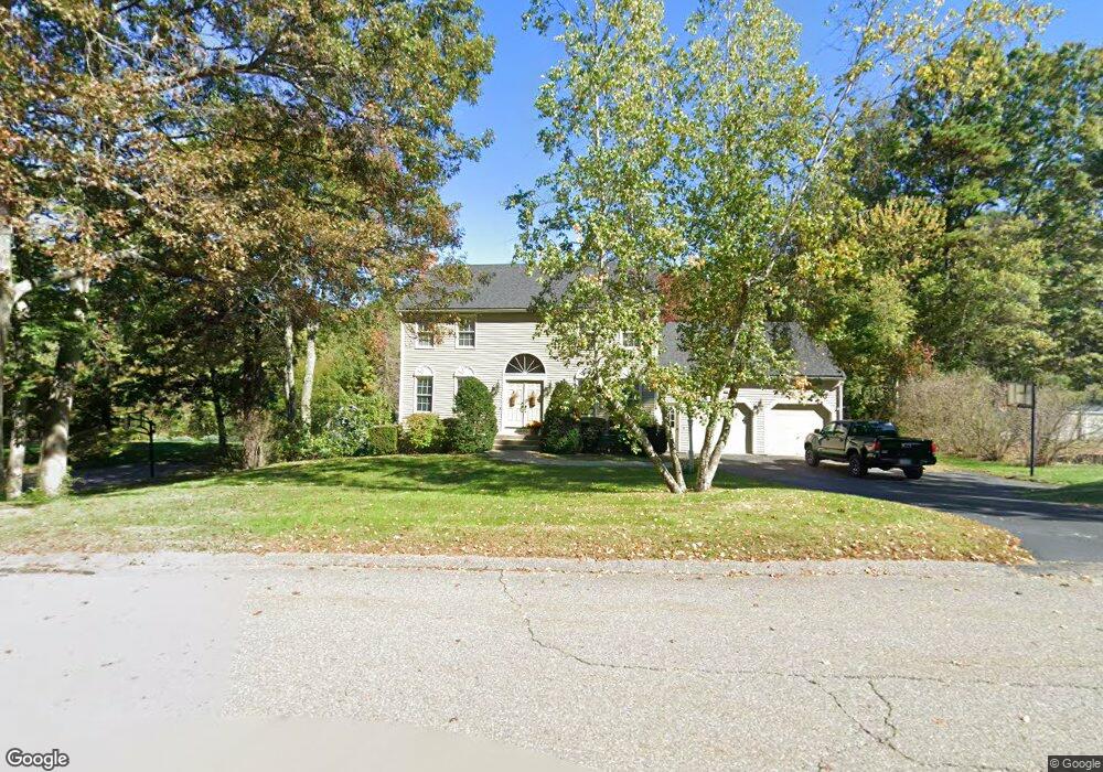
3 Fox Run Dr Clinton, MA 01510
Estimated Value: $593,000 - $737,000
4
Beds
3
Baths
1,872
Sq Ft
$350/Sq Ft
Est. Value
About This Home
This home is located at 3 Fox Run Dr, Clinton, MA 01510 and is currently estimated at $656,063, approximately $350 per square foot. 3 Fox Run Dr is a home located in Worcester County with nearby schools including Clinton Elementary School, Clinton Senior High School, and Clinton Middle School.
Ownership History
Date
Name
Owned For
Owner Type
Purchase Details
Closed on
Jan 15, 2025
Sold by
Hazel David P and Hazel Lee A
Bought by
Hazel Ft and Hazel
Current Estimated Value
Purchase Details
Closed on
Apr 20, 2001
Sold by
Escape Estates Inc
Bought by
Goyette David A and Goyette Joanne M
Purchase Details
Closed on
Nov 24, 1992
Sold by
Melanson Bros Inc
Bought by
Hazel David P and Hazel Lee A
Home Financials for this Owner
Home Financials are based on the most recent Mortgage that was taken out on this home.
Original Mortgage
$136,500
Interest Rate
7.95%
Mortgage Type
Purchase Money Mortgage
Create a Home Valuation Report for This Property
The Home Valuation Report is an in-depth analysis detailing your home's value as well as a comparison with similar homes in the area
Home Values in the Area
Average Home Value in this Area
Purchase History
| Date | Buyer | Sale Price | Title Company |
|---|---|---|---|
| Hazel Ft | -- | None Available | |
| Hazel Ft | -- | None Available | |
| Goyette David A | $237,178 | -- | |
| Hazel David P | $170,730 | -- | |
| Goyette David A | $237,178 | -- | |
| Hazel David P | $170,730 | -- |
Source: Public Records
Mortgage History
| Date | Status | Borrower | Loan Amount |
|---|---|---|---|
| Previous Owner | Hazel David P | $150,000 | |
| Previous Owner | Hazel David P | $138,000 | |
| Previous Owner | Hazel David P | $136,500 |
Source: Public Records
Tax History Compared to Growth
Tax History
| Year | Tax Paid | Tax Assessment Tax Assessment Total Assessment is a certain percentage of the fair market value that is determined by local assessors to be the total taxable value of land and additions on the property. | Land | Improvement |
|---|---|---|---|---|
| 2025 | $7,532 | $566,300 | $157,900 | $408,400 |
| 2024 | $7,411 | $564,000 | $157,900 | $406,100 |
| 2023 | $6,976 | $521,800 | $143,500 | $378,300 |
| 2022 | $6,894 | $462,400 | $130,500 | $331,900 |
| 2021 | $6,526 | $409,400 | $124,400 | $285,000 |
| 2020 | $6,342 | $409,400 | $124,400 | $285,000 |
| 2019 | $6,351 | $398,700 | $120,800 | $277,900 |
| 2018 | $6,362 | $374,700 | $120,800 | $253,900 |
| 2017 | $6,335 | $358,500 | $120,800 | $237,700 |
| 2016 | $6,276 | $363,400 | $120,800 | $242,600 |
| 2015 | $5,804 | $348,400 | $125,400 | $223,000 |
| 2014 | $5,627 | $348,400 | $125,400 | $223,000 |
Source: Public Records
Map
Nearby Homes
- 103 Ridgefield Cir Unit B
- 112 Ridgefield Cir Unit B
- 920 Ridgefield Cir Unit C
- 303 Ridgefield Cir Unit C
- 12 Woodruff Rd
- 238 Mill Street Extension
- 18 Sargent Rd
- 6 Mcnulty Rd
- 453 Blue Heron Dr Unit 453
- 155 Cedar St
- 459 High St
- 216 Walnut St
- 324 1/2 Chestnut St
- 25 Pearl St
- 201 Stone St Unit 203
- 201-203 Stone St
- 132 Kilbourn Rd
- 861 Main St
- 57 Clark St
- 167 Lancaster Rd