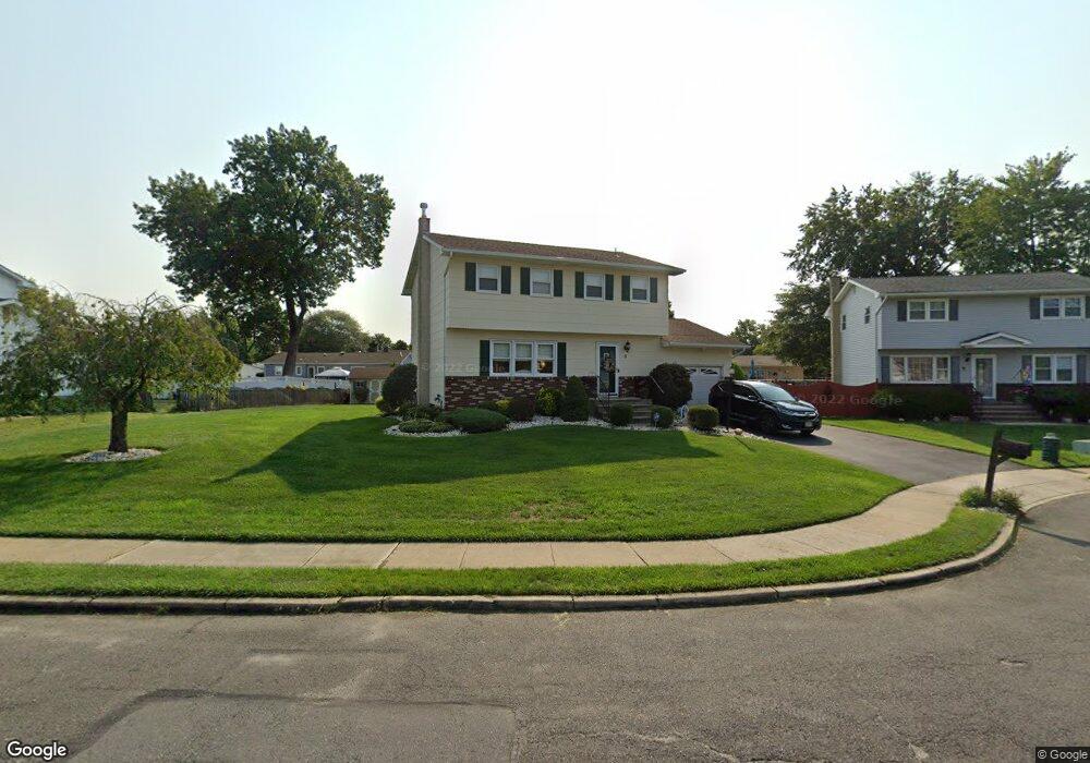
3 Gla Dean Ct Trenton, NJ 08610
Estimated Value: $480,869 - $576,000
--
Bed
--
Bath
2,070
Sq Ft
$261/Sq Ft
Est. Value
About This Home
This home is located at 3 Gla Dean Ct, Trenton, NJ 08610 and is currently estimated at $540,467, approximately $261 per square foot. 3 Gla Dean Ct is a home located in Mercer County with nearby schools including Robinson Elementary School, Albert E. Grice Middle School, and Hamilton West-Watson High School.
Ownership History
Date
Name
Owned For
Owner Type
Purchase Details
Closed on
Jan 21, 1999
Sold by
Guido Michael
Bought by
Manukas Marie and Manukas Alexander
Current Estimated Value
Home Financials for this Owner
Home Financials are based on the most recent Mortgage that was taken out on this home.
Original Mortgage
$118,000
Outstanding Balance
$27,157
Interest Rate
6.67%
Mortgage Type
Purchase Money Mortgage
Estimated Equity
$513,310
Create a Home Valuation Report for This Property
The Home Valuation Report is an in-depth analysis detailing your home's value as well as a comparison with similar homes in the area
Home Values in the Area
Average Home Value in this Area
Purchase History
| Date | Buyer | Sale Price | Title Company |
|---|---|---|---|
| Manukas Marie | $168,000 | -- |
Source: Public Records
Mortgage History
| Date | Status | Borrower | Loan Amount |
|---|---|---|---|
| Open | Manukas Marie | $118,000 |
Source: Public Records
Tax History Compared to Growth
Tax History
| Year | Tax Paid | Tax Assessment Tax Assessment Total Assessment is a certain percentage of the fair market value that is determined by local assessors to be the total taxable value of land and additions on the property. | Land | Improvement |
|---|---|---|---|---|
| 2025 | $9,043 | $256,600 | $76,000 | $180,600 |
| 2024 | $8,476 | $256,600 | $76,000 | $180,600 |
| 2023 | $8,476 | $256,600 | $76,000 | $180,600 |
| 2022 | $8,342 | $256,600 | $76,000 | $180,600 |
| 2021 | $8,963 | $256,600 | $76,000 | $180,600 |
| 2020 | $8,039 | $256,600 | $76,000 | $180,600 |
| 2019 | $7,865 | $256,600 | $76,000 | $180,600 |
| 2018 | $7,796 | $256,600 | $76,000 | $180,600 |
| 2017 | $7,600 | $256,600 | $76,000 | $180,600 |
| 2016 | $6,938 | $256,600 | $76,000 | $180,600 |
| 2015 | $7,562 | $163,000 | $48,500 | $114,500 |
| 2014 | $7,434 | $163,000 | $48,500 | $114,500 |
Source: Public Records
Map
Nearby Homes
- 50 Kenwood Terrace
- 45 Kenwood Terrace
- 27 Olden Terrace
- 74 Taft Ave
- 20 Dodge Dr
- 153 Knapp Ave
- 1782 Orchard Ave
- 2490 Sylvan Ave
- 40 Unwin Dr
- 2 Godfrey Dr
- 2501 Sylvan Ave
- 376 White Horse Ave
- 234 Thropp Ave
- 15 Marlow Ct
- 22 Wolf Dr
- 19 Wolf Dr
- 204 Thropp Ave
- 156 Maddock Ave
- 158 Churchill Ave
- 1782 Exton Ave