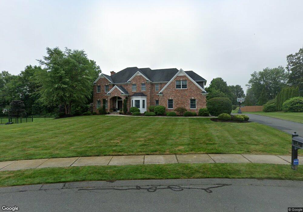
3 Lise Cir Suffield, CT 06078
Estimated Value: $974,000 - $1,077,000
4
Beds
5
Baths
3,456
Sq Ft
$295/Sq Ft
Est. Value
About This Home
This home is located at 3 Lise Cir, Suffield, CT 06078 and is currently estimated at $1,017,831, approximately $294 per square foot. 3 Lise Cir is a home with nearby schools including A. Ward Spaulding School, Mcalister Intermediate School, and Suffield Middle School.
Ownership History
Date
Name
Owned For
Owner Type
Purchase Details
Closed on
Jan 2, 2015
Sold by
Briarwood Homes Inc
Bought by
Goings Christopher L and Goings Dara P
Current Estimated Value
Home Financials for this Owner
Home Financials are based on the most recent Mortgage that was taken out on this home.
Original Mortgage
$625,000
Outstanding Balance
$481,359
Interest Rate
3.99%
Mortgage Type
Purchase Money Mortgage
Estimated Equity
$536,472
Create a Home Valuation Report for This Property
The Home Valuation Report is an in-depth analysis detailing your home's value as well as a comparison with similar homes in the area
Home Values in the Area
Average Home Value in this Area
Purchase History
| Date | Buyer | Sale Price | Title Company |
|---|---|---|---|
| Goings Christopher L | $782,250 | -- |
Source: Public Records
Mortgage History
| Date | Status | Borrower | Loan Amount |
|---|---|---|---|
| Open | Goings Christopher L | $79,800 | |
| Open | Goings Christopher L | $625,000 |
Source: Public Records
Tax History
| Year | Tax Paid | Tax Assessment Tax Assessment Total Assessment is a certain percentage of the fair market value that is determined by local assessors to be the total taxable value of land and additions on the property. | Land | Improvement |
|---|---|---|---|---|
| 2025 | $14,506 | $619,640 | $98,770 | $520,870 |
| 2024 | $14,022 | $619,640 | $98,770 | $520,870 |
| 2023 | $15,467 | $540,610 | $98,280 | $442,330 |
| 2022 | $15,467 | $540,610 | $98,280 | $442,330 |
| 2021 | $15,483 | $540,610 | $98,280 | $442,330 |
| 2020 | $15,483 | $540,610 | $98,280 | $442,330 |
| 2019 | $15,526 | $540,610 | $98,280 | $442,330 |
| 2018 | $16,709 | $569,870 | $85,470 | $484,400 |
| 2017 | $16,395 | $567,490 | $85,470 | $482,020 |
| 2016 | $16,003 | $567,490 | $85,470 | $482,020 |
| 2015 | $14,083 | $506,940 | $85,470 | $421,470 |
| 2014 | $2,318 | $85,470 | $85,470 | $0 |
Source: Public Records
Map
Nearby Homes
- 278 Thompsonville Rd
- 120 2nd St
- 98 1st St
- 45 Douglas St
- Lot 54 North St
- 4 Pebblestone Cir
- 24 Pebblestone Cir Unit 24
- 0 Suffield St Unit 24093452
- 0 Suffield St Unit 24057050
- 155 Mountain Laurel Way
- 83 Landing Cir Unit 83
- 1 E Elaine Dr
- 78 Landing Cir Unit 78
- 713 Thrall Ave
- 3 Martin St
- 424 Bridge St
- 57 Asnuntuck St
- 80 S River St
- 30 Church St
- 26 Church St
Your Personal Tour Guide
Ask me questions while you tour the home.