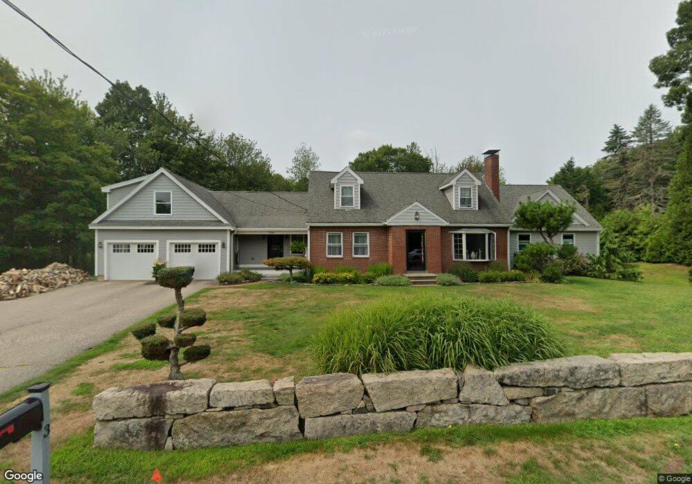
3 Newington Rd Greenland, NH 03840
Estimated Value: $798,000 - $931,205
3
Beds
3
Baths
2,316
Sq Ft
$378/Sq Ft
Est. Value
About This Home
This home is located at 3 Newington Rd, Greenland, NH 03840 and is currently estimated at $875,301, approximately $377 per square foot. 3 Newington Rd is a home located in Rockingham County with nearby schools including Greenland Central School, St Patrick School, and The Cornerstone School.
Ownership History
Date
Name
Owned For
Owner Type
Purchase Details
Closed on
Jul 2, 2001
Sold by
Richards David and Richards Brenda L
Bought by
Givens Deborah F
Current Estimated Value
Home Financials for this Owner
Home Financials are based on the most recent Mortgage that was taken out on this home.
Original Mortgage
$163,900
Interest Rate
7.14%
Mortgage Type
Purchase Money Mortgage
Create a Home Valuation Report for This Property
The Home Valuation Report is an in-depth analysis detailing your home's value as well as a comparison with similar homes in the area
Home Values in the Area
Average Home Value in this Area
Purchase History
| Date | Buyer | Sale Price | Title Company |
|---|---|---|---|
| Givens Deborah F | $204,900 | -- |
Source: Public Records
Mortgage History
| Date | Status | Borrower | Loan Amount |
|---|---|---|---|
| Open | Givens Deborah F | $140,000 | |
| Closed | Givens Deborah F | $163,900 |
Source: Public Records
Tax History Compared to Growth
Tax History
| Year | Tax Paid | Tax Assessment Tax Assessment Total Assessment is a certain percentage of the fair market value that is determined by local assessors to be the total taxable value of land and additions on the property. | Land | Improvement |
|---|---|---|---|---|
| 2024 | $10,130 | $779,800 | $277,400 | $502,400 |
| 2023 | $9,564 | $779,500 | $277,400 | $502,100 |
| 2022 | $8,307 | $459,200 | $193,500 | $265,700 |
| 2021 | $8,596 | $459,200 | $193,500 | $265,700 |
| 2020 | $6,929 | $417,900 | $193,500 | $224,400 |
| 2019 | $6,255 | $381,400 | $193,500 | $187,900 |
| 2018 | $6,022 | $381,400 | $193,500 | $187,900 |
| 2017 | $5,756 | $345,900 | $149,300 | $196,600 |
| 2016 | $5,729 | $344,100 | $149,300 | $194,800 |
| 2015 | $5,819 | $344,100 | $149,300 | $194,800 |
| 2014 | $5,478 | $344,100 | $149,300 | $194,800 |
| 2013 | $5,334 | $344,100 | $149,300 | $194,800 |
Source: Public Records
Map
Nearby Homes
- 34 Meadow Ln
- 41 Newington Rd
- 326 Portsmouth Ave
- 603 Portsmouth Ave Unit 203
- 603 Portsmouth Ave Unit 202
- 1000 Greenland Rd
- 20 Doris Ave
- 64 Boxwood Path Unit 64
- 114 Saratoga Way Unit 4
- 445 Ocean Rd Unit 4
- 166 Decatur Rd
- 12 Founders Square Unit A
- 291 Colonial Dr
- Unit 31 Summerwind Place Unit 31
- Unit 25 Summerwind Place Unit 25
- Unit 1 Summerwind Place Unit 1
- Unit 15 Summerwind Place Unit 15
- Unit 3 Summerwind Place Unit 3
- 4 Brown Ave
- Unit 6 Summerwind Place Unit 6
- 3 Newington Rd
- 1 Newington Rd
- 7 Newington Rd
- 2 Hillside Dr
- 170 Portsmouth Ave
- 137 Portsmouth Ave
- 6 Hillside Dr
- 11 Newington Rd
- 10 Granite Post Ln
- 174 Portsmouth Ave
- 133 Portsmouth Ave
- 4 Newington Rd
- 10 Hillside Dr
- Lot 2 Newington Rd
- 3 Sanderson Rd
- 128 Portsmouth Ave
- 8 Granite Post Ln
- 7 Hillside Dr
- 15 Newington Rd
- 178 Portsmouth Ave