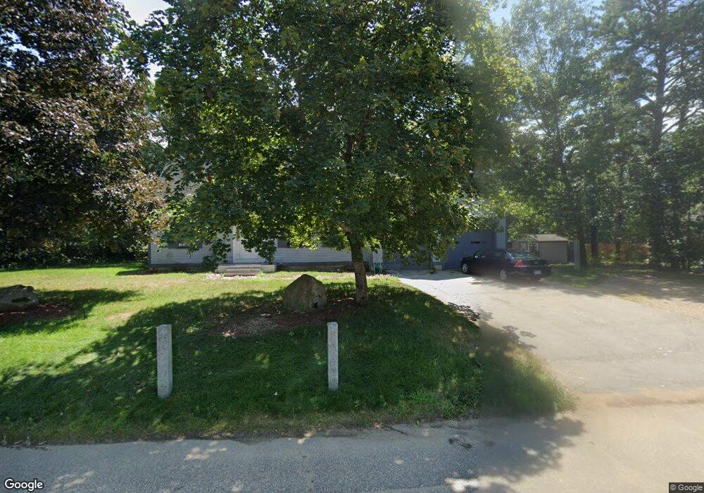
3 Plum St Concord, NH 03301
Concord Heights NeighborhoodEstimated Value: $517,000 - $702,000
3
Beds
3
Baths
2,807
Sq Ft
$224/Sq Ft
Est. Value
About This Home
This home is located at 3 Plum St, Concord, NH 03301 and is currently estimated at $628,298, approximately $223 per square foot. 3 Plum St is a home located in Merrimack County with nearby schools including Broken Ground School, Rundlett Middle School, and Concord High School.
Ownership History
Date
Name
Owned For
Owner Type
Purchase Details
Closed on
Dec 8, 2020
Sold by
Smiglowski Eileen P
Bought by
Eileen P Smiglowski Ret
Current Estimated Value
Purchase Details
Closed on
May 28, 2003
Sold by
Pelchat Keith A and Pelchat Kelly D
Bought by
Smiglowski Michal J and Smiglowski Eileen P
Home Financials for this Owner
Home Financials are based on the most recent Mortgage that was taken out on this home.
Original Mortgage
$190,000
Interest Rate
5.86%
Mortgage Type
Purchase Money Mortgage
Purchase Details
Closed on
Sep 2, 1997
Sold by
West Norman E and West Carmella V
Bought by
Pelchat Keith A and Pelchat Kelly D
Home Financials for this Owner
Home Financials are based on the most recent Mortgage that was taken out on this home.
Original Mortgage
$150,000
Interest Rate
7.41%
Mortgage Type
Purchase Money Mortgage
Create a Home Valuation Report for This Property
The Home Valuation Report is an in-depth analysis detailing your home's value as well as a comparison with similar homes in the area
Home Values in the Area
Average Home Value in this Area
Purchase History
We collect this data history from publicly available records. To have your information removed, we recommend requesting removal directly through your county’s website.
| Date | Buyer | Sale Price | Title Company |
|---|---|---|---|
| Eileen P Smiglowski Ret | -- | None Available | |
| Smiglowski Michal J | $290,000 | -- | |
| Pelchat Keith A | $167,000 | -- |
Source: Public Records
Mortgage History
We collect this data history from publicly available records. To have your information removed, we recommend requesting removal directly through your county’s website.
| Date | Status | Borrower | Loan Amount |
|---|---|---|---|
| Previous Owner | Pelchat Keith A | $190,000 | |
| Previous Owner | Pelchat Keith A | $150,000 |
Source: Public Records
Tax History
| Year | Tax Paid | Tax Assessment Tax Assessment Total Assessment is a certain percentage of the fair market value that is determined by local assessors to be the total taxable value of land and additions on the property. | Land | Improvement |
|---|---|---|---|---|
| 2025 | $12,410 | $426,300 | $124,000 | $302,300 |
| 2024 | $11,804 | $426,300 | $124,000 | $302,300 |
| 2023 | $11,450 | $426,300 | $124,000 | $302,300 |
| 2022 | $11,037 | $426,300 | $124,000 | $302,300 |
| 2021 | $10,570 | $420,800 | $124,000 | $296,800 |
| 2020 | $10,276 | $384,000 | $91,000 | $293,000 |
| 2019 | $10,231 | $368,300 | $91,900 | $276,400 |
| 2018 | $9,152 | $341,400 | $91,900 | $249,500 |
| 2017 | $9,068 | $321,100 | $87,300 | $233,800 |
| 2016 | $9,956 | $359,800 | $87,300 | $272,500 |
| 2015 | $9,602 | $338,900 | $84,200 | $254,700 |
| 2014 | $9,086 | $338,900 | $84,200 | $254,700 |
| 2013 | -- | $334,000 | $84,200 | $249,800 |
| 2012 | -- | $334,000 | $84,200 | $249,800 |
Source: Public Records
Map
Nearby Homes
- 176 Airport Rd
- 47 Mulberry St Unit 4
- 22 Fairfield Dr
- 6 Centerwood Dr
- 40 Pembroke Rd
- 5 Thomas St
- 38 Hazel Dr
- 111 -113 South Main St
- 9 Longmeadow Dr
- 19 Burns Ave Unit 5
- 273-279 S Main St
- 2 Cricket Ln
- 171 Loudon Rd Unit 7
- 58 Branch Turnpike Unit 73
- 114 Garvins Falls Rd
- 115 Garvins Falls Rd
- 12 E Side Dr Unit 406
- 12 E Side Dr Unit 4-13
- 12 E Side Dr Unit 2-14
- 4 Eastern Ave
Your Personal Tour Guide
Ask me questions while you tour the home.