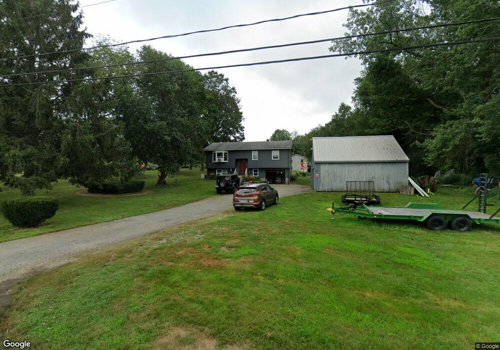
3 Thompson Rd North Franklin, CT 06254
Estimated Value: $288,000 - $344,000
3
Beds
2
Baths
1,026
Sq Ft
$311/Sq Ft
Est. Value
About This Home
This home is located at 3 Thompson Rd, North Franklin, CT 06254 and is currently estimated at $319,512, approximately $311 per square foot. 3 Thompson Rd is a home located in New London County with nearby schools including St. Joseph Elementary School and Academy of the Holy Family.
Ownership History
Date
Name
Owned For
Owner Type
Purchase Details
Closed on
May 16, 2019
Sold by
Rowe Donna A
Bought by
Gosselin Michael J
Current Estimated Value
Home Financials for this Owner
Home Financials are based on the most recent Mortgage that was taken out on this home.
Original Mortgage
$151,692
Outstanding Balance
$132,823
Interest Rate
4%
Mortgage Type
Purchase Money Mortgage
Estimated Equity
$186,689
Purchase Details
Closed on
Oct 31, 1991
Sold by
Pompei Joseph and Pompei Patricia
Bought by
Harrington Patrick and Harrington Donna
Home Financials for this Owner
Home Financials are based on the most recent Mortgage that was taken out on this home.
Original Mortgage
$114,076
Interest Rate
8.9%
Mortgage Type
Purchase Money Mortgage
Create a Home Valuation Report for This Property
The Home Valuation Report is an in-depth analysis detailing your home's value as well as a comparison with similar homes in the area
Home Values in the Area
Average Home Value in this Area
Purchase History
| Date | Buyer | Sale Price | Title Company |
|---|---|---|---|
| Gosselin Michael J | $148,500 | -- | |
| Harrington Patrick | $113,900 | -- |
Source: Public Records
Mortgage History
| Date | Status | Borrower | Loan Amount |
|---|---|---|---|
| Open | Gosselin Michael J | $151,692 | |
| Previous Owner | Harrington Patrick | $42,000 | |
| Previous Owner | Harrington Patrick | $137,700 | |
| Previous Owner | Harrington Patrick | $112,476 | |
| Previous Owner | Harrington Patrick | $114,076 |
Source: Public Records
Tax History Compared to Growth
Tax History
| Year | Tax Paid | Tax Assessment Tax Assessment Total Assessment is a certain percentage of the fair market value that is determined by local assessors to be the total taxable value of land and additions on the property. | Land | Improvement |
|---|---|---|---|---|
| 2025 | $3,671 | $172,760 | $48,020 | $124,740 |
| 2024 | $3,498 | $172,760 | $48,020 | $124,740 |
| 2023 | $2,911 | $126,710 | $38,620 | $88,090 |
| 2022 | $2,911 | $126,710 | $38,620 | $88,090 |
| 2021 | $2,911 | $126,710 | $38,620 | $88,090 |
| 2020 | $2,942 | $126,710 | $38,620 | $88,090 |
| 2019 | $3,006 | $126,710 | $38,620 | $88,090 |
| 2018 | $2,778 | $108,000 | $27,170 | $80,830 |
| 2017 | $2,724 | $108,000 | $27,170 | $80,830 |
| 2016 | $2,724 | $108,000 | $27,170 | $80,830 |
| 2015 | $2,670 | $108,000 | $27,170 | $80,830 |
| 2014 | $2,670 | $108,000 | $27,170 | $80,830 |
Source: Public Records
Map
Nearby Homes
- 43 Connecticut 32
- 450 Route 32
- 34 Plains Rd
- 64 Whippoorwill Rd
- 110 Meeting House Hill Rd
- 22 Plains Rd
- 20 Holton Rd
- 243 Champion Rd
- 15 Country Club Dr
- 201 Willimantic Rd
- 18 Pautipaug Hill Rd
- 33 Farm View Dr
- 73 Blue Hill Rd
- 6 Farm View Dr
- 26 Farm View Dr
- 927 Trumbull Hwy
- 27 W Main St
- 123 High St
- 12 W Main St
- 38 White Plains Rd