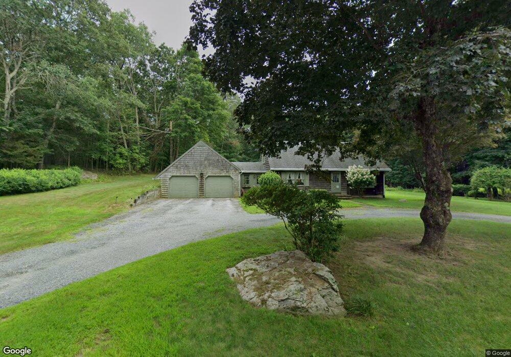
3 Whip Poor Will Dr Moosup, CT 06354
Estimated Value: $396,000 - $426,000
2
Beds
2
Baths
1,820
Sq Ft
$226/Sq Ft
Est. Value
About This Home
This home is located at 3 Whip Poor Will Dr, Moosup, CT 06354 and is currently estimated at $410,826, approximately $225 per square foot. 3 Whip Poor Will Dr is a home located in Windham County with nearby schools including Plainfield Memorial School, Plainfield Central Middle School, and Plainfield High School.
Ownership History
Date
Name
Owned For
Owner Type
Purchase Details
Closed on
Jun 1, 2022
Sold by
Obrien John E
Bought by
John Edward Obrien Irt
Current Estimated Value
Purchase Details
Closed on
Dec 27, 2019
Sold by
Obrien Leslie
Bought by
Obrien John E
Purchase Details
Closed on
Jul 2, 1965
Bought by
Obrien John and Obrien Lesley
Create a Home Valuation Report for This Property
The Home Valuation Report is an in-depth analysis detailing your home's value as well as a comparison with similar homes in the area
Home Values in the Area
Average Home Value in this Area
Purchase History
| Date | Buyer | Sale Price | Title Company |
|---|---|---|---|
| John Edward Obrien Irt | -- | None Available | |
| John Edward Obrien Irt | -- | None Available | |
| Obrien John E | -- | None Available | |
| Obrien John E | -- | None Available | |
| Obrien John | -- | -- |
Source: Public Records
Tax History Compared to Growth
Tax History
| Year | Tax Paid | Tax Assessment Tax Assessment Total Assessment is a certain percentage of the fair market value that is determined by local assessors to be the total taxable value of land and additions on the property. | Land | Improvement |
|---|---|---|---|---|
| 2025 | $5,412 | $229,240 | $36,010 | $193,230 |
| 2024 | $5,284 | $229,240 | $36,010 | $193,230 |
| 2023 | $5,259 | $229,240 | $36,010 | $193,230 |
| 2022 | $7,153 | $146,030 | $31,140 | $114,890 |
| 2021 | $4,488 | $146,030 | $31,140 | $114,890 |
| 2020 | $4,458 | $146,030 | $31,140 | $114,890 |
| 2019 | $4,458 | $146,030 | $31,140 | $114,890 |
| 2018 | $4,390 | $146,030 | $31,140 | $114,890 |
| 2017 | $4,376 | $136,670 | $31,140 | $105,530 |
| 2016 | $4,230 | $136,670 | $31,140 | $105,530 |
| 2015 | $4,122 | $136,670 | $31,140 | $105,530 |
| 2014 | $4,122 | $136,670 | $31,140 | $105,530 |
Source: Public Records
Map
Nearby Homes
- 8 Juniper Ln
- 181 Snake Meadow Rd
- 279 Moosup Pond Rd
- 277 Moosup Pond Rd
- 11 Stone House Dr
- 50 High St
- 58 Milner Ave
- 100 Squaw Rock Rd
- 247 Green Hollow Rd
- 12 Walas Rd
- 24 Marie St
- 44-46 S Chestnut St
- 160 Ross Rd
- 6 Grace Ln
- 150 Ross Rd
- 0 Wauregan Rd NE Unit 24143170
- 0 Wauregan Rd NE Unit 24117158
- 143 Goshen Rd
- 6 Ward Ln
- 29 Union St
- 11 Whip Poor Will Dr
- 453 Squaw Rock Rd
- 4 Bob White Way
- 14 Bob White Way
- 462 Squaw Rock Rd
- 4 Whip Poor Will Dr
- 10 Whip Poor Will Dr
- 452 Squaw Rock Rd
- 18 Bob White Way
- 445 Squaw Rock Rd
- 109 Whip Poor Will Dr
- 25 Bob White Way
- 23 Whip Poor Will Dr
- 444 Squaw Rock Rd
- 32 Whip Poor Will Dr
- 81 Whip Poor Will Dr
- - Squaw Rock Rd
- 31 Whip Poor Will Dr
- 436 Squaw Rock Rd