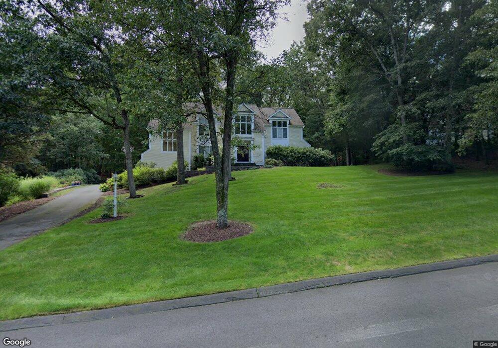
3 Wildflower Ln West Simsbury, CT 06092
Estimated Value: $739,000 - $889,000
4
Beds
6
Baths
3,768
Sq Ft
$219/Sq Ft
Est. Value
About This Home
This home is located at 3 Wildflower Ln, West Simsbury, CT 06092 and is currently estimated at $824,077, approximately $218 per square foot. 3 Wildflower Ln is a home located in Hartford County with nearby schools including Tootin' Hills School, Henry James Memorial School, and Simsbury High School.
Ownership History
Date
Name
Owned For
Owner Type
Purchase Details
Closed on
Dec 6, 1991
Sold by
Katcher Anne and Katcher Mitchell
Bought by
Carley Matthew and Carley Nina
Current Estimated Value
Home Financials for this Owner
Home Financials are based on the most recent Mortgage that was taken out on this home.
Original Mortgage
$393,600
Interest Rate
8.82%
Mortgage Type
Unknown
Purchase Details
Closed on
Jul 14, 1989
Sold by
Hartwell H John
Bought by
Katcher Anne
Create a Home Valuation Report for This Property
The Home Valuation Report is an in-depth analysis detailing your home's value as well as a comparison with similar homes in the area
Home Values in the Area
Average Home Value in this Area
Purchase History
| Date | Buyer | Sale Price | Title Company |
|---|---|---|---|
| Carley Matthew | $492,000 | -- | |
| Katcher Anne | $652,369 | -- |
Source: Public Records
Mortgage History
| Date | Status | Borrower | Loan Amount |
|---|---|---|---|
| Open | Katcher Anne | $300,000 | |
| Closed | Katcher Anne | $250,000 | |
| Closed | Katcher Anne | $211,000 | |
| Closed | Katcher Anne | $393,600 |
Source: Public Records
Tax History Compared to Growth
Tax History
| Year | Tax Paid | Tax Assessment Tax Assessment Total Assessment is a certain percentage of the fair market value that is determined by local assessors to be the total taxable value of land and additions on the property. | Land | Improvement |
|---|---|---|---|---|
| 2025 | $15,693 | $459,410 | $112,000 | $347,410 |
| 2024 | $15,303 | $459,410 | $112,000 | $347,410 |
| 2023 | $14,618 | $459,410 | $112,000 | $347,410 |
| 2022 | $13,811 | $357,530 | $119,000 | $238,530 |
| 2021 | $13,811 | $357,530 | $119,000 | $238,530 |
| 2020 | $13,261 | $357,530 | $119,000 | $238,530 |
| 2019 | $13,343 | $357,530 | $119,000 | $238,530 |
| 2018 | $13,440 | $357,530 | $119,000 | $238,530 |
| 2017 | $13,319 | $343,630 | $111,720 | $231,910 |
| 2016 | $12,756 | $343,630 | $111,720 | $231,910 |
| 2015 | $12,756 | $343,630 | $111,720 | $231,910 |
| 2014 | $12,762 | $343,630 | $111,720 | $231,910 |
Source: Public Records
Map
Nearby Homes
- 18 Meadowlark Rd
- 47 Long View Dr
- 10 Sachems Trail
- 8 Quorn Hunt Rd
- 301 Bushy Hill Rd
- 16 Stratton Forest Way
- 143 N Mountain Rd
- 269 W Mountain Rd
- 395 Bushy Hill Rd
- 23 Red Fox Run
- 15 Sand Hill Rd
- 3 Stebbins Brook Ln
- 4 Stebbins Brook Ln
- 15 Red Fox Run
- 21 Christmas Tree Hill
- 121 Gracey Rd
- 3 Minister Brook Dr
- 8 Crane Place
- 40 Firetown Rd Unit 39
- 1 West St Unit 206
- 5 Wildflower Ln
- 1 Wildflower Ln
- 2 Wildflower Ln
- 4 Wildflower Ln
- 6 Wildflower Ln
- 7 Camille Ln
- 9 Camille Ln
- 11 Camille Ln
- 6 Camille Ln
- 3 Camille Ln
- 2 Tanglewood Trail
- 3 Tanglewood Trail
- 15 Camille Ln
- 4 Camille Ln
- 4 Tanglewood Trail
- 53 Farmstead Ln
- 12 Camille Ln
- 5 Tanglewood Trail
- 57 Farmstead Ln
- 51 Farmstead Ln