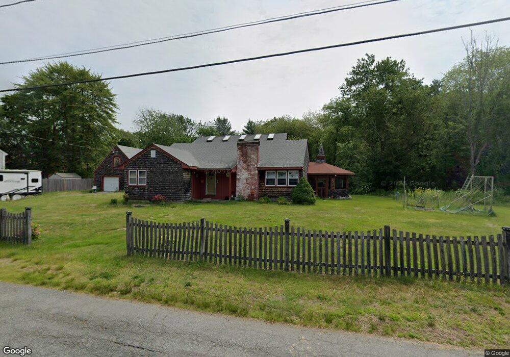
30 12th Ave Brockton, MA 02302
Campello NeighborhoodEstimated Value: $539,000 - $612,000
2
Beds
1
Bath
2,223
Sq Ft
$262/Sq Ft
Est. Value
About This Home
This home is located at 30 12th Ave, Brockton, MA 02302 and is currently estimated at $582,454, approximately $262 per square foot. 30 12th Ave is a home located in Plymouth County with nearby schools including Gilmore Elementary School, Davis K-8 School, and John F. Kennedy Elementary School.
Ownership History
Date
Name
Owned For
Owner Type
Purchase Details
Closed on
Jun 1, 2016
Sold by
Lagerstedt Richard E and Lagerstedt Kathleen A
Bought by
Lagerstedt Ft
Current Estimated Value
Create a Home Valuation Report for This Property
The Home Valuation Report is an in-depth analysis detailing your home's value as well as a comparison with similar homes in the area
Home Values in the Area
Average Home Value in this Area
Purchase History
| Date | Buyer | Sale Price | Title Company |
|---|---|---|---|
| Lagerstedt Ft | -- | -- |
Source: Public Records
Tax History Compared to Growth
Tax History
| Year | Tax Paid | Tax Assessment Tax Assessment Total Assessment is a certain percentage of the fair market value that is determined by local assessors to be the total taxable value of land and additions on the property. | Land | Improvement |
|---|---|---|---|---|
| 2025 | $6,198 | $511,800 | $198,800 | $313,000 |
| 2024 | $5,824 | $484,500 | $198,800 | $285,700 |
| 2023 | $6,094 | $469,500 | $155,500 | $314,000 |
| 2022 | $5,894 | $421,900 | $141,400 | $280,500 |
| 2021 | $5,581 | $384,900 | $116,200 | $268,700 |
| 2020 | $5,242 | $346,000 | $101,300 | $244,700 |
| 2019 | $4,984 | $320,700 | $96,000 | $224,700 |
| 2018 | $4,584 | $285,400 | $96,000 | $189,400 |
| 2017 | $4,621 | $287,000 | $96,000 | $191,000 |
| 2016 | $4,238 | $244,100 | $92,800 | $151,300 |
| 2015 | $4,102 | $226,000 | $92,800 | $133,200 |
| 2014 | $3,931 | $216,800 | $92,800 | $124,000 |
Source: Public Records
Map
Nearby Homes