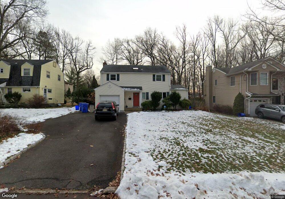
30 Buff Rd Tenafly, NJ 07670
Estimated Value: $955,108 - $1,256,000
Studio
--
Bath
1,855
Sq Ft
$591/Sq Ft
Est. Value
About This Home
This home is located at 30 Buff Rd, Tenafly, NJ 07670 and is currently estimated at $1,095,777, approximately $590 per square foot. 30 Buff Rd is a home located in Bergen County with nearby schools including Tenafly Middle School, Tenafly High School, and Lubavitch On The Palisades.
Ownership History
Date
Name
Owned For
Owner Type
Purchase Details
Closed on
Feb 20, 2013
Sold by
Babcock Randall and Wang Xin
Bought by
Wang Xin
Current Estimated Value
Purchase Details
Closed on
Dec 16, 2009
Sold by
Cohen Michael and Cohen Nicole
Bought by
Babcock Randall and Wang Xin
Home Financials for this Owner
Home Financials are based on the most recent Mortgage that was taken out on this home.
Original Mortgage
$450,000
Interest Rate
4.85%
Mortgage Type
Purchase Money Mortgage
Purchase Details
Closed on
Mar 22, 2001
Sold by
Hanley Raymond J
Bought by
Cohen Michael and Cohen Nicole
Home Financials for this Owner
Home Financials are based on the most recent Mortgage that was taken out on this home.
Original Mortgage
$275,000
Interest Rate
6.88%
Create a Home Valuation Report for This Property
The Home Valuation Report is an in-depth analysis detailing your home's value as well as a comparison with similar homes in the area
Home Values in the Area
Average Home Value in this Area
Purchase History
| Date | Buyer | Sale Price | Title Company |
|---|---|---|---|
| Wang Xin | $50,000 | -- | |
| Babcock Randall | $620,000 | -- | |
| Cohen Michael | $355,000 | -- |
Source: Public Records
Mortgage History
| Date | Status | Borrower | Loan Amount |
|---|---|---|---|
| Previous Owner | Babcock Randall | $450,000 | |
| Previous Owner | Cohen Michael | $275,000 |
Source: Public Records
Tax History
| Year | Tax Paid | Tax Assessment Tax Assessment Total Assessment is a certain percentage of the fair market value that is determined by local assessors to be the total taxable value of land and additions on the property. | Land | Improvement |
|---|---|---|---|---|
| 2025 | $15,935 | $560,900 | $326,800 | $234,100 |
| 2024 | $15,548 | $560,900 | $326,800 | $234,100 |
| 2023 | $15,172 | $560,900 | $326,800 | $234,100 |
| 2022 | $15,172 | $560,900 | $326,800 | $234,100 |
| 2021 | $14,903 | $560,900 | $326,800 | $234,100 |
| 2020 | $14,684 | $560,900 | $326,800 | $234,100 |
| 2019 | $14,426 | $560,900 | $326,800 | $234,100 |
| 2018 | $14,202 | $560,900 | $326,800 | $234,100 |
| 2017 | $14,152 | $560,900 | $326,800 | $234,100 |
| 2016 | $13,871 | $560,900 | $326,800 | $234,100 |
| 2015 | $13,563 | $560,900 | $326,800 | $234,100 |
| 2014 | $13,310 | $560,900 | $326,800 | $234,100 |
Source: Public Records
Map
Nearby Homes
- 17 Wight Place
- 121 Lylewood Dr
- 368 Knickerbocker Rd
- 50 Lylewood Dr
- 118 Sunset Ln
- 364 W Clinton Ave
- 241 E Main St Unit 1D
- 168 4th St
- 67 Norman Place
- 136 Stonegate Trail Unit 37
- 181 Phelps Ave
- 119 Stonegate Trail
- 248 E Clinton Ave
- 175 Hillside Ave
- 174 Pleasant Ave
- 15 Dunn Place
- 14 Hudson St
- 136 Elm St
- 50 S 1st St Unit 3A
- 125 E Main St
Your Personal Tour Guide
Ask me questions while you tour the home.