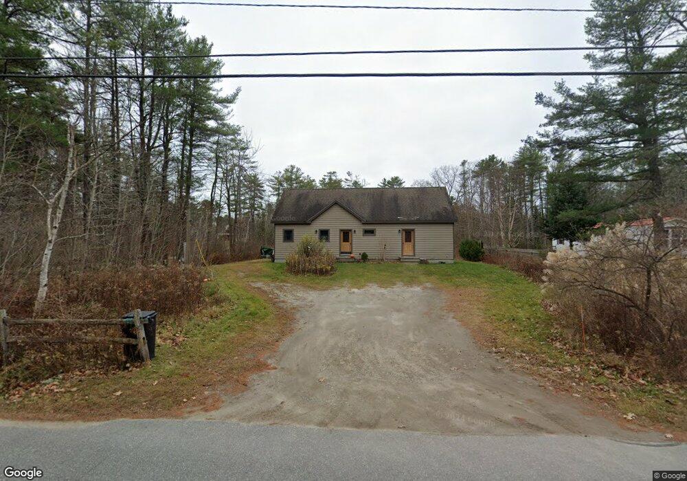
30 Byram Ave Freeport, ME 04032
Estimated Value: $684,679 - $1,030,000
2
Beds
2
Baths
1,344
Sq Ft
$614/Sq Ft
Est. Value
About This Home
This home is located at 30 Byram Ave, Freeport, ME 04032 and is currently estimated at $825,560, approximately $614 per square foot. 30 Byram Ave is a home located in Cumberland County with nearby schools including Morse Street School, Mast Landing School, and Freeport Middle School.
Ownership History
Date
Name
Owned For
Owner Type
Purchase Details
Closed on
Nov 1, 2017
Sold by
Kennedy Patricia L
Bought by
Kennedy Patricia L and Hill Michael A
Current Estimated Value
Purchase Details
Closed on
Oct 2, 2007
Sold by
Martin Janet I
Bought by
Kennedy Patricia L
Create a Home Valuation Report for This Property
The Home Valuation Report is an in-depth analysis detailing your home's value as well as a comparison with similar homes in the area
Home Values in the Area
Average Home Value in this Area
Purchase History
| Date | Buyer | Sale Price | Title Company |
|---|---|---|---|
| Kennedy Patricia L | -- | -- | |
| Kennedy Patricia L | -- | -- |
Source: Public Records
Mortgage History
| Date | Status | Borrower | Loan Amount |
|---|---|---|---|
| Open | Kennedy Patricia L | $178,773 | |
| Closed | Kennedy Patricia L | $177,910 |
Source: Public Records
Tax History
| Year | Tax Paid | Tax Assessment Tax Assessment Total Assessment is a certain percentage of the fair market value that is determined by local assessors to be the total taxable value of land and additions on the property. | Land | Improvement |
|---|---|---|---|---|
| 2025 | $5,738 | $414,300 | $188,300 | $226,000 |
| 2024 | $5,412 | $405,400 | $179,400 | $226,000 |
| 2023 | $4,940 | $359,300 | $163,000 | $196,300 |
| 2022 | $4,666 | $341,800 | $145,500 | $196,300 |
| 2021 | $4,563 | $341,800 | $145,500 | $196,300 |
| 2020 | $4,416 | $315,400 | $134,800 | $180,600 |
| 2019 | $4,247 | $297,000 | $127,100 | $169,900 |
| 2018 | $4,100 | $272,400 | $115,200 | $157,200 |
| 2017 | $3,930 | $262,900 | $112,900 | $150,000 |
| 2016 | $3,745 | $237,000 | $98,300 | $138,700 |
| 2015 | $3,686 | $219,400 | $87,800 | $131,600 |
Source: Public Records
Map
Nearby Homes
- 70 Maquoit Dr
- 71 Merganser Way
- 10 Lower Flying Point Rd
- 52 Birch Point Rd
- 83 Central Ave
- 29 S Freeport Rd
- 46 Blackstone Club Rd
- 26 Harvest Ridge Rd Unit 24
- 20 Harvest Ridge Rd Unit 23
- 7 Shearwater Way
- 15 Linwood Rd Unit 15
- 11 Orchard Hill Rd
- 853 Mere Point Rd
- Map 80 Lot 18-0 White Island
- 15 Tinkers Way
- 39 Hunter Rd
- 10 Durham Rd
- 42 Durham Rd
- 10 Prout Rd
- 1260 Us Route 1
- 0 Retreiver Unit 947228
- 22 Byram Ave
- 32 Byram Ave
- 40 Byram Ave
- 291 Lower Flying Point Rd
- 291 Lower Flying Point Rd
- 44 Byram Ave Unit 44B
- 44 Byram Ave
- 15 Byram Ave
- 43 Byram Ave
- 295 Lower Flying Point Rd
- 8 Retriever Ln
- 16 Retriever Ln
- 7 Byram Ave
- 55 Maquoit Dr
- 284 Lower Flying Point Rd
- 51 Maquoit Dr
- 52 Byram Ave
- 0 Lower Flying Point Rd
- 292 Lower Flying Point Rd
Your Personal Tour Guide
Ask me questions while you tour the home.