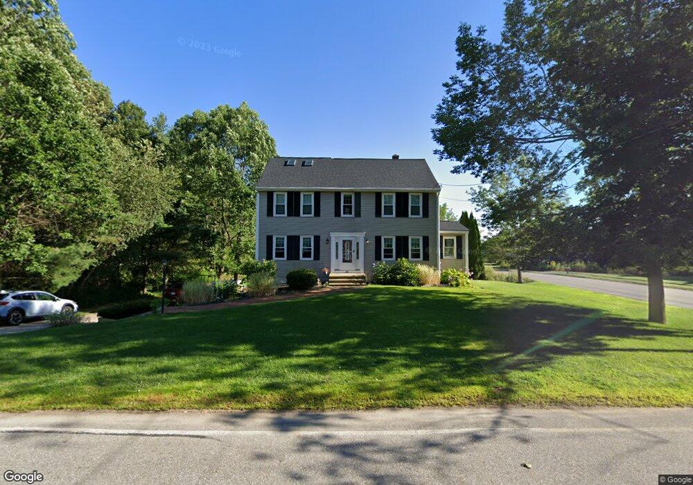
30 Central Tree Rd Rutland, MA 01543
Estimated Value: $612,000 - $651,000
4
Beds
3
Baths
2,400
Sq Ft
$262/Sq Ft
Est. Value
About This Home
This home is located at 30 Central Tree Rd, Rutland, MA 01543 and is currently estimated at $628,134, approximately $261 per square foot. 30 Central Tree Rd is a home located in Worcester County with nearby schools including Wachusett Regional High School.
Ownership History
Date
Name
Owned For
Owner Type
Purchase Details
Closed on
Oct 3, 2022
Sold by
Hermance Benjamin
Bought by
Pringle Robert and Pringle Margaret A
Current Estimated Value
Home Financials for this Owner
Home Financials are based on the most recent Mortgage that was taken out on this home.
Original Mortgage
$391,920
Outstanding Balance
$372,456
Interest Rate
5.13%
Mortgage Type
Purchase Money Mortgage
Estimated Equity
$255,678
Purchase Details
Closed on
Jul 15, 2019
Sold by
Mcdonald William T and Mcdonald Nicole D
Bought by
Hermance Benjamin
Home Financials for this Owner
Home Financials are based on the most recent Mortgage that was taken out on this home.
Original Mortgage
$286,875
Interest Rate
3.82%
Mortgage Type
New Conventional
Purchase Details
Closed on
Dec 19, 2013
Sold by
Powers Mary M
Bought by
Mcdonald William T and Mcdonald Nicole D
Home Financials for this Owner
Home Financials are based on the most recent Mortgage that was taken out on this home.
Original Mortgage
$272,944
Interest Rate
4.15%
Mortgage Type
FHA
Purchase Details
Closed on
Jan 15, 2010
Sold by
Powers William M
Bought by
Powers Mary M
Home Financials for this Owner
Home Financials are based on the most recent Mortgage that was taken out on this home.
Original Mortgage
$232,325
Interest Rate
4.71%
Mortgage Type
Purchase Money Mortgage
Purchase Details
Closed on
Dec 24, 1992
Sold by
Central Tree Est Inc
Bought by
Powers William and Powers Mary M
Create a Home Valuation Report for This Property
The Home Valuation Report is an in-depth analysis detailing your home's value as well as a comparison with similar homes in the area
Home Values in the Area
Average Home Value in this Area
Purchase History
| Date | Buyer | Sale Price | Title Company |
|---|---|---|---|
| Pringle Robert | $489,900 | None Available | |
| Hermance Benjamin | $337,500 | -- | |
| Mcdonald William T | $278,000 | -- | |
| Mcdonald William T | $278,000 | -- | |
| Mcdonald William T | $278,000 | -- | |
| Powers Mary M | -- | -- | |
| Powers Mary M | -- | -- | |
| Powers William | $157,773 | -- |
Source: Public Records
Mortgage History
| Date | Status | Borrower | Loan Amount |
|---|---|---|---|
| Open | Pringle Robert | $391,920 | |
| Previous Owner | Hermance Benjamin | $286,875 | |
| Previous Owner | Mcdonald William T | $272,944 | |
| Previous Owner | Powers Mary M | $232,325 | |
| Previous Owner | Powers William | $143,000 |
Source: Public Records
Tax History
| Year | Tax Paid | Tax Assessment Tax Assessment Total Assessment is a certain percentage of the fair market value that is determined by local assessors to be the total taxable value of land and additions on the property. | Land | Improvement |
|---|---|---|---|---|
| 2025 | $7,083 | $497,400 | $116,700 | $380,700 |
| 2024 | $6,945 | $468,300 | $104,000 | $364,300 |
| 2023 | $5,989 | $436,500 | $98,300 | $338,200 |
| 2022 | $5,617 | $355,700 | $83,300 | $272,400 |
| 2021 | $5,391 | $322,800 | $83,300 | $239,500 |
| 2020 | $5,327 | $302,500 | $78,300 | $224,200 |
| 2019 | $5,251 | $293,500 | $71,800 | $221,700 |
| 2018 | $5,011 | $276,400 | $71,800 | $204,600 |
| 2017 | $5,065 | $276,500 | $71,800 | $204,700 |
| 2016 | $4,944 | $284,600 | $68,700 | $215,900 |
| 2015 | $4,884 | $276,700 | $68,700 | $208,000 |
| 2014 | $4,734 | $276,700 | $68,700 | $208,000 |
Source: Public Records
Map
Nearby Homes
- 19 Fernwood Dr
- 20 Fernwood Dr
- 21 Highland Park Rd
- 5 Karen Way
- 39 Laurelwood Rd
- 27 Lewis St
- 22 Village Way
- 11 Lewis St
- 21 Lewis St
- 17 Village Way
- 12 Lewis St
- 6 Lewis St
- 85 Maple Ave Unit A
- 2226 Main St
- 28 Forest Hill Dr
- 132 Fidelity Dr Unit 61
- 210 Fidelity Dr Unit 84
- 212 Fidelity Dr Unit 83
- 10 Fidelity Dr Unit 5
- 12 Fidelity Dr Unit 6
- 30 Central Tree Rd
- 27 Central Tree Rd
- 2 John Robert Dr
- 32 Central Tree Rd
- 29 Central Tree Rd
- 25 Central Tree Rd
- 31 Central Tree Rd
- 4 Skyline Dr
- 2 Skyline Dr
- 2 William Cir
- 34 Central Tree Rd
- 22 Central Tree Rd Unit 5
- 22 Central Tree Rd Unit 4
- 22 Central Tree Rd Unit 1
- 22 Central Tree Rd
- 22 Central Tree Rd Unit 3
- 35 Central Tree Rd
- 6 Skyline Dr
- 21 Central Tree Rd
- 4 William Cir
Your Personal Tour Guide
Ask me questions while you tour the home.