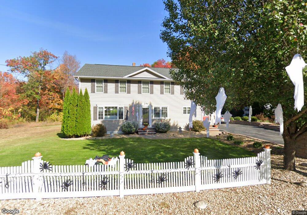
30 Curtis Ln Bedford, NH 03110
Bedford NeighborhoodEstimated Value: $661,000 - $795,000
4
Beds
3
Baths
2,464
Sq Ft
$295/Sq Ft
Est. Value
About This Home
This home is located at 30 Curtis Ln, Bedford, NH 03110 and is currently estimated at $727,185, approximately $295 per square foot. 30 Curtis Ln is a home located in Hillsborough County with nearby schools including Mckelvie Intermediate School, Ross A. Lurgio Middle School, and Bedford High School.
Ownership History
Date
Name
Owned For
Owner Type
Purchase Details
Closed on
May 10, 2024
Sold by
Paula Kefalas Ret and Moutsioulis
Bought by
Marmarou Elizabeth and Marmarou Maria
Current Estimated Value
Home Financials for this Owner
Home Financials are based on the most recent Mortgage that was taken out on this home.
Original Mortgage
$0
Interest Rate
7.09%
Mortgage Type
Purchase Money Mortgage
Purchase Details
Closed on
Apr 20, 2018
Sold by
Panakis Paula
Bought by
Paula Panakis Ret and Panakis
Create a Home Valuation Report for This Property
The Home Valuation Report is an in-depth analysis detailing your home's value as well as a comparison with similar homes in the area
Home Values in the Area
Average Home Value in this Area
Purchase History
| Date | Buyer | Sale Price | Title Company |
|---|---|---|---|
| Marmarou Elizabeth | -- | None Available | |
| Marmarou Elizabeth | -- | None Available | |
| Paula Panakis Ret | -- | -- | |
| Paula Panakis Ret | -- | -- |
Source: Public Records
Mortgage History
| Date | Status | Borrower | Loan Amount |
|---|---|---|---|
| Closed | Marmarou Elizabeth | $0 |
Source: Public Records
Tax History Compared to Growth
Tax History
| Year | Tax Paid | Tax Assessment Tax Assessment Total Assessment is a certain percentage of the fair market value that is determined by local assessors to be the total taxable value of land and additions on the property. | Land | Improvement |
|---|---|---|---|---|
| 2024 | $10,803 | $683,300 | $236,300 | $447,000 |
| 2023 | $9,894 | $668,500 | $236,300 | $432,200 |
| 2022 | $8,976 | $510,000 | $175,100 | $334,900 |
| 2021 | $8,741 | $510,000 | $175,100 | $334,900 |
| 2020 | $8,386 | $418,900 | $127,500 | $291,400 |
| 2019 | $7,938 | $418,900 | $127,500 | $291,400 |
| 2018 | $7,762 | $380,500 | $120,300 | $260,200 |
| 2017 | $7,195 | $380,500 | $120,300 | $260,200 |
| 2016 | $7,259 | $324,500 | $90,500 | $234,000 |
| 2015 | $7,386 | $324,500 | $90,500 | $234,000 |
| 2014 | $7,301 | $324,500 | $90,500 | $234,000 |
| 2013 | $7,194 | $324,500 | $90,500 | $234,000 |
Source: Public Records
Map
Nearby Homes
- 90 Glenwood Ave
- 122 Patterson St
- 21 Prairie Ct
- 52 Erie St
- 60 Geneva St
- 30 Tanglewood Ct
- 46 Geneva St
- 0 Huntress St
- 133 Bismark St
- 3 Churchill Ct Unit UN111
- 49 Harvell St Unit 9
- 80 Wendover Way
- 34 Briston Ct
- 3 Danforth Dr
- 99 Becker St
- 220 Mast Rd
- 58 Violet St
- 166 Varney St
- 139 Dunbar St
- 412 W Mitchell St