Estimated payment $3,132/month
Highlights
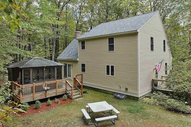
- Spa
- Deck
- Softwood Flooring
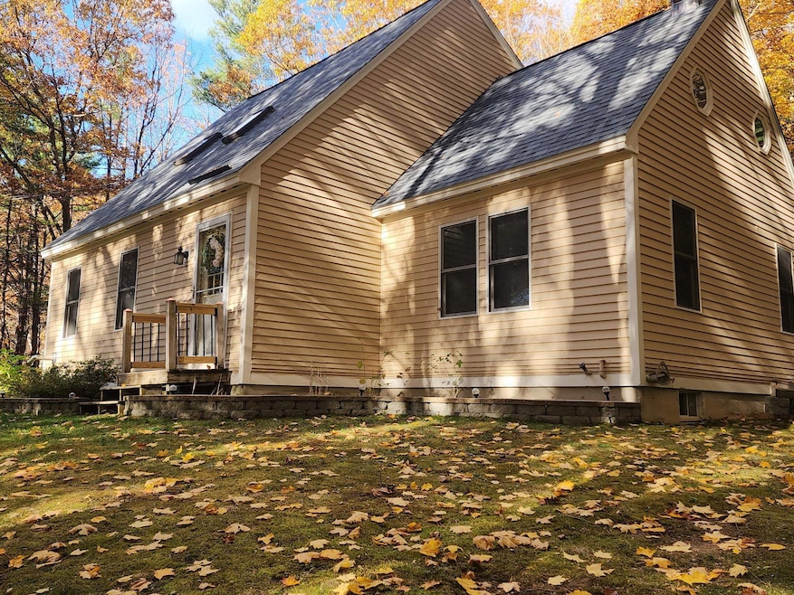
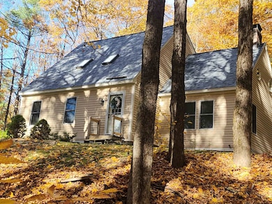
- Cape Cod Architecture
- Recreation Room
- Skylights
About This Home
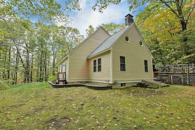
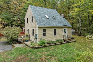
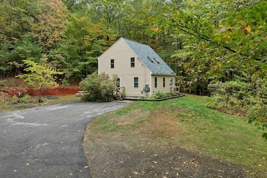
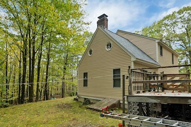
Charming 3 bedroom, 1 1/2 bath Cape on 2 acres in peaceful country setting on a dead end street. Offering a spacious eat-in kitchen with ample oak cabinets, Samsung appliances and attractive newer laminate floor, leads to living room with a efficient pellet stove with a thermostat; it is used as main source of heat with FHW/Oil back-up. Newer tile floor in the half bath on first floor, great convenience. Family room that gives space for relaxation and office/computer space & a slider w/vertical blinds to back deck. The second floor with a fully renovated full bath with tile floor and 3 bedrooms. Having the added finished area in basement makes great recreational/game room. You will appreciate the whole house generator if power goes out run by propane. Utility room with washer & dryer, storage space, heat system and workshop area. You will love escaping & entertaining in the year round cedar wood well-built cabana with windows & screens with a well-maintained 6-person hot tub on the back deck. Home exterior recently painted & in a refreshing lovely color, new 50 year architectural shingles, new stainless-steel lining and chimney cap, attractive rails installed at entries, 14 Marvin windows with tilt-ins added a few years ago. Move-in condition in this loved home and ready for your own personal touches.
Listing Agent
EXP Realty Brokerage Phone: 603-344-3455 License #010303 Listed on: 10/15/2025

Home Details
Home Type
- Single Family
Est. Annual Taxes
- $6,665
Year Built
- Built in 1993
Lot Details
- 2 Acre Lot
- Property fronts a private road
- Level Lot
Parking
- Paved Parking
Home Design
- Cape Cod Architecture
- Concrete Foundation
Interior Spaces
- Property has 1.75 Levels
- Skylights
- Blinds
- Family Room
- Living Room
- Recreation Room
- Utility Room
- Basement
- Interior Basement Entry
Kitchen
- Range Hood
- Dishwasher
Flooring
- Softwood
- Carpet
- Laminate
- Tile
Bedrooms and Bathrooms
- 3 Bedrooms
Laundry
- Dryer
- Washer
Outdoor Features
- Spa
- Deck
Schools
- Center Woods Elementary School
- Weare Middle School
- John Stark Regional High School
Utilities
- Baseboard Heating
- Private Water Source
- Drilled Well
- Septic Tank
- High Speed Internet
- Cable TV Available
Listing and Financial Details
- Tax Lot 9
- Assessor Parcel Number 404
Map
Home Values in the Area
Average Home Value in this Area
Tax History
| Year | Tax Paid | Tax Assessment Tax Assessment Total Assessment is a certain percentage of the fair market value that is determined by local assessors to be the total taxable value of land and additions on the property. | Land | Improvement |
|---|---|---|---|---|
| 2024 | $6,419 | $314,800 | $117,200 | $197,600 |
| 2023 | $5,931 | $314,800 | $117,200 | $197,600 |
| 2022 | $5,478 | $314,800 | $117,200 | $197,600 |
| 2021 | $5,415 | $314,800 | $117,200 | $197,600 |
| 2020 | $5,154 | $215,200 | $82,400 | $132,800 |
| 2019 | $5,102 | $215,200 | $82,400 | $132,800 |
| 2018 | $4,869 | $211,400 | $82,400 | $129,000 |
| 2016 | $4,729 | $211,400 | $82,400 | $129,000 |
| 2015 | $4,699 | $209,700 | $82,300 | $127,400 |
| 2014 | $4,657 | $209,700 | $82,300 | $127,400 |
| 2013 | $4,561 | $209,700 | $82,300 | $127,400 |
Property History
| Date | Event | Price | List to Sale | Price per Sq Ft |
|---|---|---|---|---|
| 11/07/2025 11/07/25 | Price Changed | $489,000 | -1.2% | $224 / Sq Ft |
| 10/15/2025 10/15/25 | For Sale | $495,000 | -- | $227 / Sq Ft |
Purchase History
| Date | Type | Sale Price | Title Company |
|---|---|---|---|
| Deed | $224,300 | -- | |
| Warranty Deed | $202,000 | -- |
Mortgage History
| Date | Status | Loan Amount | Loan Type |
|---|---|---|---|
| Open | $110,000 | Unknown | |
| Open | $195,000 | Stand Alone Refi Refinance Of Original Loan | |
| Closed | $201,883 | Purchase Money Mortgage | |
| Previous Owner | $10,083 | Unknown |
Source: PrimeMLS
MLS Number: 5065837
APN: WEAR-000404-000000-000049
Disclaimer: Certain information contained herein is derived from information provided by parties other than Homes.com. All information provided is deemed reliable, but is not guaranteed to be accurate and should be independently verified.
![]() Copyright 2025 PrimeMLS, Inc. All rights reserved. This information is deemed reliable, but not guaranteed. The data relating to real estate displayed on this display comes in part from the IDX Program of PrimeMLS. The information being provided is for consumers’ personal, non-commercial use and may not be used for any purpose other than to identify prospective properties consumers may be interested in purchasing.
Copyright 2025 PrimeMLS, Inc. All rights reserved. This information is deemed reliable, but not guaranteed. The data relating to real estate displayed on this display comes in part from the IDX Program of PrimeMLS. The information being provided is for consumers’ personal, non-commercial use and may not be used for any purpose other than to identify prospective properties consumers may be interested in purchasing.
- 107 Branch Rd
- 281 Hodgdon Rd
- 194 Buckley Rd Unit 2
- 194 Buckley Rd Unit 44
- 108 E Shore Dr
- Lot 13 E Deering Rd
- 457 Reservoir Dr
- 101-125 Winslow Rd
- 1376 Deering Center Rd
- 233 N Stark Hwy
- 11 Ski Tow Rd
- 92 Woodbury Rd
- 10 Sap House Rd
- 116 Martin Rd
- 200 Mountain Rd
- 196 Deering Center Rd
- 463 Craney Hill Rd
- 9 Reservoir Rd
- 24 Etta Ln Unit 3
- 126 Fisher Rd
- 86 Reservoir Dr
- 867 Quaker St
- 115 High Rock Rd Unit A
- 16 Preston St Unit 1A
- 2337 2nd Nh Turnpike
- 436 Western Ave Unit Apartment 3
- 95 Hall Ave Unit B2-C
- 69 Putney Hill Rd Unit The East Wing
- 119 Keene Rd Unit 2
- 119 Keene Rd Unit 5
- 163 Gould Hill Rd Unit A
- 15 Factory St
- 15 Mountain Rd Unit 204
- 15 Mountain Rd Unit 106
- 15 Mountain Rd Unit 105
- 15 Mountain Rd Unit 202
- 15 Mountain Rd Unit 201
- 15 Mountain Rd Unit 101
- 15 Mountain Rd Unit 203
- 15 Mountain Rd Unit 102