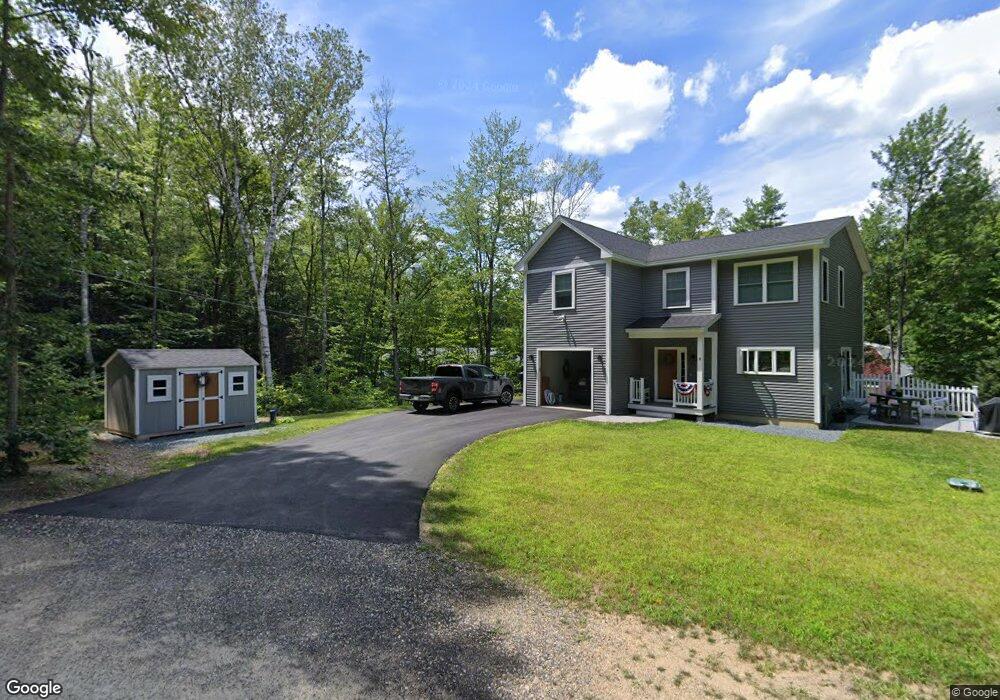
30 Dillion Dr E Strafford, NH 03884
Estimated Value: $479,037 - $544,000
2
Beds
2
Baths
1,402
Sq Ft
$373/Sq Ft
Est. Value
About This Home
This home is located at 30 Dillion Dr E, Strafford, NH 03884 and is currently estimated at $522,259, approximately $372 per square foot. 30 Dillion Dr E is a home located in Strafford County with nearby schools including Strafford School and Coe-Brown Northwood Academy.
Ownership History
Date
Name
Owned For
Owner Type
Purchase Details
Closed on
Aug 15, 2025
Sold by
Mcelreavy Thomas G and Mcelreavy Jennifer R
Bought by
Henderson Connor J
Current Estimated Value
Home Financials for this Owner
Home Financials are based on the most recent Mortgage that was taken out on this home.
Original Mortgage
$518,725
Outstanding Balance
$518,276
Interest Rate
6.72%
Mortgage Type
New Conventional
Estimated Equity
$3,983
Purchase Details
Closed on
Sep 4, 2002
Sold by
Ryan Sean M and Ryan Heather N
Bought by
Mcelreavy Thomas G and Mcelreavy Jennifer R
Home Financials for this Owner
Home Financials are based on the most recent Mortgage that was taken out on this home.
Original Mortgage
$136,000
Interest Rate
6.39%
Mortgage Type
Purchase Money Mortgage
Create a Home Valuation Report for This Property
The Home Valuation Report is an in-depth analysis detailing your home's value as well as a comparison with similar homes in the area
Home Values in the Area
Average Home Value in this Area
Purchase History
| Date | Buyer | Sale Price | Title Company |
|---|---|---|---|
| Henderson Connor J | $546,000 | -- | |
| Henderson Connor J | $546,000 | -- | |
| Mcelreavy Thomas G | $146,000 | -- | |
| Mcelreavy Thomas G | $146,000 | -- |
Source: Public Records
Mortgage History
| Date | Status | Borrower | Loan Amount |
|---|---|---|---|
| Open | Henderson Connor J | $518,725 | |
| Closed | Henderson Connor J | $518,725 | |
| Previous Owner | Mcelreavy Thomas G | $136,000 |
Source: Public Records
Tax History Compared to Growth
Tax History
| Year | Tax Paid | Tax Assessment Tax Assessment Total Assessment is a certain percentage of the fair market value that is determined by local assessors to be the total taxable value of land and additions on the property. | Land | Improvement |
|---|---|---|---|---|
| 2024 | $6,351 | $321,400 | $83,800 | $237,600 |
| 2023 | $5,991 | $321,400 | $83,800 | $237,600 |
| 2022 | $5,506 | $321,400 | $83,800 | $237,600 |
| 2021 | $5,933 | $321,400 | $83,800 | $237,600 |
| 2020 | $8,660 | $249,900 | $90,400 | $159,500 |
| 2019 | $9,207 | $211,500 | $90,400 | $121,100 |
| 2018 | $9,114 | $196,200 | $90,400 | $105,800 |
| 2016 | $4,169 | $196,200 | $90,400 | $105,800 |
| 2015 | $4,048 | $185,600 | $110,700 | $74,900 |
| 2014 | $4,298 | $185,600 | $110,700 | $74,900 |
| 2013 | $4,209 | $185,600 | $110,700 | $74,900 |
| 2012 | $4,134 | $184,700 | $110,700 | $74,000 |
Source: Public Records
Map
Nearby Homes
- 133 & 137 Browns Pasture Rd
- 129 Water St
- 10 Pump House Rd
- 11 Drake Hill Rd
- 1139 Province Rd
- Map 219 Lot 6-8 Ridge Rd
- 150A 1st New Hampshire Turnpike
- 0 1st New Hampshire Turnpike Unit 5026030
- 0 1st New Hampshire Turnpike
- 6 Ridge Rd
- 72 Beaver Rd
- 16 Deer Run Ln
- 27 Deer Run Ln
- 239 Long Pond Rd
- 268 Province Rd
- 263 Province Rd
- 207 Long Pond Rd
- 67 Spruce Pond Dr
- 105 Harvey Lake Rd
- 51 Kelsey Mill Rd
- 57 Dillon Dr E
- 31 Dillion Dr E
- 0 Dillon Dr E Unit Lot 67 4671481
- Map 33 Lot 69 Dillon Dr E
- Map 33 Lot 65 Dillon Dr E
- 8 Bunnell Dr
- 22 Bunnell Dr
- 133 Browns Pasture Rd
- 30 Bunnell Dr
- 137 Browns Pasture Rd
- 122 Browns Pasture Rd
- 72 Bunnell Dr
- Lot 72 Bunnell Dr
- 105 Browns Pasture Rd
- 10 Thorne Ln
- 10 Thorne Ln Unit 67
- 15 Lake Shore Dr
- 8 Thorne Ln
- 33 Bunnell Dr
- 140 Browns Pasture Rd