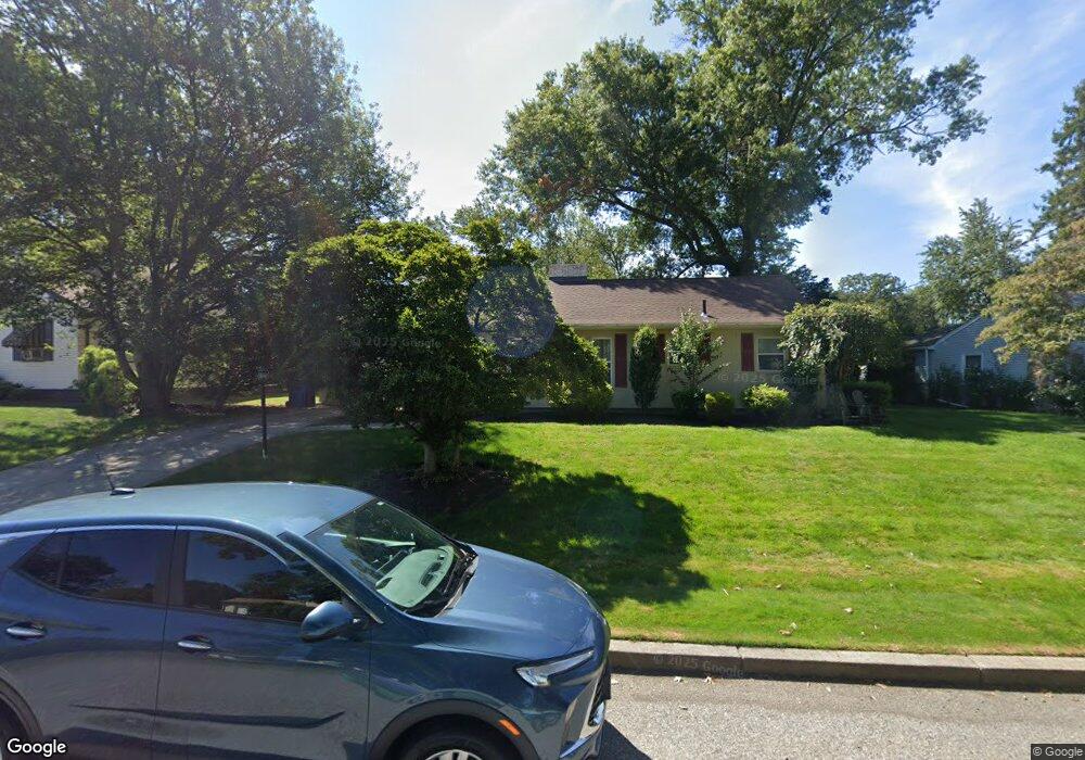
30 Firglade Dr Cranston, RI 02920
Meshanticut NeighborhoodEstimated Value: $481,245 - $564,000
2
Beds
1
Bath
2,078
Sq Ft
$244/Sq Ft
Est. Value
About This Home
This home is located at 30 Firglade Dr, Cranston, RI 02920 and is currently estimated at $506,811, approximately $243 per square foot. 30 Firglade Dr is a home located in Providence County with nearby schools including Woodridge Elementary School, Western Hills Middle School, and Cranston High School West.
Ownership History
Date
Name
Owned For
Owner Type
Purchase Details
Closed on
Feb 18, 2015
Sold by
Caduto Thomas J
Bought by
Caduto Thomas J
Current Estimated Value
Purchase Details
Closed on
Sep 26, 1997
Sold by
Quinn Rita M
Bought by
Casale John P and Casale Jennifer
Home Financials for this Owner
Home Financials are based on the most recent Mortgage that was taken out on this home.
Original Mortgage
$118,750
Interest Rate
7.47%
Create a Home Valuation Report for This Property
The Home Valuation Report is an in-depth analysis detailing your home's value as well as a comparison with similar homes in the area
Home Values in the Area
Average Home Value in this Area
Purchase History
| Date | Buyer | Sale Price | Title Company |
|---|---|---|---|
| Caduto Thomas J | -- | -- | |
| Casale John P | $125,000 | -- |
Source: Public Records
Mortgage History
| Date | Status | Borrower | Loan Amount |
|---|---|---|---|
| Previous Owner | Casale John P | $55,000 | |
| Previous Owner | Casale John P | $149,000 | |
| Previous Owner | Casale John P | $144,000 | |
| Previous Owner | Casale John P | $118,750 |
Source: Public Records
Tax History Compared to Growth
Tax History
| Year | Tax Paid | Tax Assessment Tax Assessment Total Assessment is a certain percentage of the fair market value that is determined by local assessors to be the total taxable value of land and additions on the property. | Land | Improvement |
|---|---|---|---|---|
| 2025 | $5,452 | $392,800 | $143,500 | $249,300 |
| 2024 | $5,346 | $392,800 | $143,500 | $249,300 |
| 2023 | $4,942 | $261,500 | $99,000 | $162,500 |
| 2022 | $4,840 | $261,500 | $99,000 | $162,500 |
| 2021 | $4,707 | $261,500 | $99,000 | $162,500 |
| 2020 | $4,841 | $233,100 | $109,600 | $123,500 |
| 2019 | $4,841 | $233,100 | $109,600 | $123,500 |
| 2018 | $4,730 | $233,100 | $109,600 | $123,500 |
| 2017 | $5,079 | $221,400 | $109,600 | $111,800 |
| 2016 | $4,970 | $221,400 | $109,600 | $111,800 |
| 2015 | $4,970 | $221,400 | $109,600 | $111,800 |
| 2014 | $4,822 | $211,100 | $106,100 | $105,000 |
Source: Public Records
Map
Nearby Homes
- 46 Lilyana Way
- 275 Meshanticut Valley Pkwy
- 141 Glen Ridge Rd
- 51 E Bel Air Rd
- 145 E Hill Dr
- 45 Hamden Rd
- 189 Summit Dr
- 203 Dean Ridge Ct
- 7 Oak Tree Ln
- 200 Hoffman Ave Unit 505
- 446 Budlong Rd
- 10 Sheffield Rd
- 132 Hoffman Ave Unit 115
- 132 Hoffman Ave Unit 207
- 132 Hoffman Ave Unit 110
- 29 Valley St
- 0 Rutland St
- 143 Hoffman Ave Unit 109
- 143 Hoffman Ave Unit 110
- 143 Hoffman Ave Unit 206
- 38 Firglade Dr
- 22 Firglade Dr
- 298 Meshanticut Valley Pkwy
- 23 Firglade Dr
- 310 Meshanticut Valley Pkwy
- 310 Meshanicut Valley Pkwy
- 44 Firglade Dr
- 19 Firglade Dr
- 14 Firglade Dr
- 30 Red Cedar Dr
- 290 Meshanticut Valley Pkwy
- 22 Red Cedar Dr
- 16 Red Cedar Dr
- 40 Red Cedar Dr
- 316 Meshanticut Valley Pkwy
- 52 Firglade Dr
- 11 Firglade Dr
- 295 Meshanticut Valley Pkwy
- 231 Brettonwoods Dr
- 282 Meshanticut Valley Pkwy