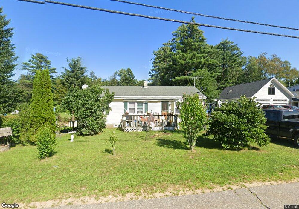
30 Forrest Rd Northfield, NH 03276
Estimated Value: $344,000 - $387,000
3
Beds
1
Bath
1,264
Sq Ft
$291/Sq Ft
Est. Value
About This Home
This home is located at 30 Forrest Rd, Northfield, NH 03276 and is currently estimated at $367,868, approximately $291 per square foot. 30 Forrest Rd is a home located in Merrimack County with nearby schools including Southwick School, Winnisquam Regional Middle School, and Winnisquam Regional High School.
Ownership History
Date
Name
Owned For
Owner Type
Purchase Details
Closed on
Oct 18, 2024
Sold by
Sharon A Barclay Ret and Huckins
Bought by
Navoy Jesse
Current Estimated Value
Purchase Details
Closed on
Mar 19, 2024
Sold by
Barclay Sharon A
Bought by
Sharon A Barclay Ret and Barclay
Create a Home Valuation Report for This Property
The Home Valuation Report is an in-depth analysis detailing your home's value as well as a comparison with similar homes in the area
Home Values in the Area
Average Home Value in this Area
Purchase History
| Date | Buyer | Sale Price | Title Company |
|---|---|---|---|
| Navoy Jesse | -- | None Available | |
| Sharon A Barclay Ret | -- | None Available | |
| Sharon A Barclay Ret | -- | None Available |
Source: Public Records
Tax History
| Year | Tax Paid | Tax Assessment Tax Assessment Total Assessment is a certain percentage of the fair market value that is determined by local assessors to be the total taxable value of land and additions on the property. | Land | Improvement |
|---|---|---|---|---|
| 2025 | $4,129 | $279,200 | $127,300 | $151,900 |
| 2024 | $4,124 | $279,200 | $127,300 | $151,900 |
| 2023 | $3,923 | $279,200 | $127,300 | $151,900 |
| 2022 | $4,062 | $279,200 | $127,300 | $151,900 |
| 2021 | $3,312 | $149,100 | $60,300 | $88,800 |
| 2020 | $85 | $149,100 | $60,300 | $88,800 |
| 2019 | $111 | $149,100 | $60,300 | $88,800 |
| 2018 | $106 | $149,100 | $60,300 | $88,800 |
| 2017 | $3,277 | $149,100 | $60,300 | $88,800 |
| 2016 | $103 | $128,300 | $46,100 | $82,200 |
| 2015 | $3,188 | $127,400 | $46,100 | $81,300 |
| 2014 | $3,263 | $127,400 | $46,100 | $81,300 |
| 2012 | $3,567 | $127,400 | $46,100 | $81,300 |
Source: Public Records
Map
Nearby Homes
- 67 Park St
- 5 Greenwood Dr
- 195 Zion Hill Rd
- 8 West St
- 495 W Main St
- 124 E Main St
- 24 Morrison Ave
- 10 Woodlawn Ave
- 12 Stonehenge Cir
- 14 Stonehenge Cir Unit 11
- R02-13 Calef Hill Rd
- 22 Stonehenge Cir Unit 7
- 11 Stonehenge Cir Unit 2
- 15 Millstone Dr Unit 15
- 41 Village Way Unit 22
- 9 Stonehenge Cir Unit 1
- 12 Village Way Unit 38
- 50 Millstone Dr Unit 57
- 48 Millstone Dr Unit 58
- 40 Millstone Dr Unit 60
- 38 Forrest Rd
- 38 Forrest Rd Unit 4
- 46 Forrest Rd
- 54 Forrest Rd
- 14 Forrest Rd
- 91 Forrest Rd
- 15 Forrest Rd
- 13 Forrest Rd Unit 15
- 14 Sargent St Unit 3
- 14 Sargent St Unit 2
- 14 Sargent St Unit 4
- 14 Sargent St
- 1 Forrest Rd
- 60 Forrest Rd Unit 64
- 87 Forrest Rd
- 16 Sargent St
- 18 Sargent St
- 143 Park St
- 145 Park St
- 20 Sargent St
Your Personal Tour Guide
Ask me questions while you tour the home.