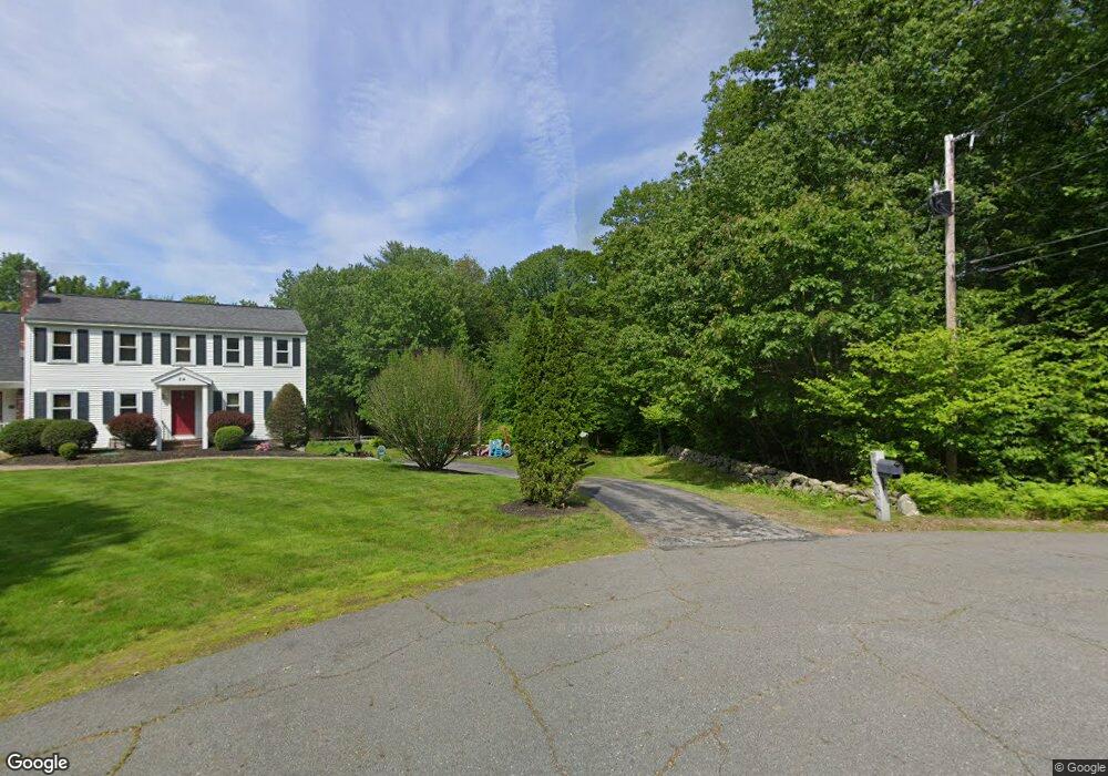
30 Geoff's Way Unit 2 Hampstead, NH 03841
Estimated Value: $477,000 - $642,000
3
Beds
3
Baths
2,200
Sq Ft
$252/Sq Ft
Est. Value
About This Home
This home is located at 30 Geoff's Way Unit 2, Hampstead, NH 03841 and is currently estimated at $554,200, approximately $251 per square foot. 30 Geoff's Way Unit 2 is a home located in Rockingham County with nearby schools including Hampstead Central School, Hampstead Middle School, and Pinkerton Academy.
Ownership History
Date
Name
Owned For
Owner Type
Purchase Details
Closed on
Mar 28, 2014
Sold by
Geoffs Way Rt
Bought by
Conroy Denise A
Current Estimated Value
Purchase Details
Closed on
Dec 16, 2005
Sold by
Wentworth Stephen M
Bought by
Unknown
Home Financials for this Owner
Home Financials are based on the most recent Mortgage that was taken out on this home.
Original Mortgage
$65,000
Interest Rate
6.34%
Mortgage Type
Purchase Money Mortgage
Create a Home Valuation Report for This Property
The Home Valuation Report is an in-depth analysis detailing your home's value as well as a comparison with similar homes in the area
Home Values in the Area
Average Home Value in this Area
Purchase History
| Date | Buyer | Sale Price | Title Company |
|---|---|---|---|
| Conroy Denise A | $269,900 | -- | |
| Conroy Denise A | $269,900 | -- | |
| Unknown | $315,000 | -- | |
| Unknown | $315,000 | -- |
Source: Public Records
Mortgage History
| Date | Status | Borrower | Loan Amount |
|---|---|---|---|
| Previous Owner | Unknown | $65,000 | |
| Closed | Unknown | $0 |
Source: Public Records
Tax History Compared to Growth
Tax History
| Year | Tax Paid | Tax Assessment Tax Assessment Total Assessment is a certain percentage of the fair market value that is determined by local assessors to be the total taxable value of land and additions on the property. | Land | Improvement |
|---|---|---|---|---|
| 2024 | $7,477 | $403,300 | $0 | $403,300 |
| 2023 | $8,354 | $328,400 | $0 | $328,400 |
| 2022 | $7,777 | $328,400 | $0 | $328,400 |
| 2021 | $7,471 | $328,400 | $0 | $328,400 |
| 2020 | $7,077 | $328,400 | $0 | $328,400 |
| 2016 | $6,515 | $269,200 | $0 | $269,200 |
| 2015 | $6,038 | $269,200 | $0 | $269,200 |
| 2014 | $6,038 | $269,200 | $0 | $269,200 |
| 2006 | $5,331 | $294,200 | $0 | $294,200 |
Source: Public Records
Map
Nearby Homes
- 1 Cameron Ct Unit 1
- 14 N Salem Rd Unit B
- 12 Spollett Dr
- 50 Page Ln
- 37 Houstons Way
- 73 Drew Rd
- 264 Hampstead Rd
- 260 Hampstead Rd
- 10 Pinewood Dr
- 20 Kristin Dr
- 21 Chase Rd
- 156 Little Mill Rd Unit A
- 46 Granite Cir
- 34 Norfolk St
- 48 Drew Rd
- 4 Chase Rd
- 20 Richardson Dr Unit R
- 33 Johnson Meadow Rd Unit A & B
- 19 Johnson Meadow Rd Unit A & B
- 5 Johnson Meadow Rd Unit A & B
- 30 Geoff's Way Unit 1
- 30 Geoffs Way Unit 2
- 30 Geoffs Way Unit 1
- 30 Geoffs Way Unit 2
- 29 Geoffs Way Unit 2
- 29 Geoffs Way Unit 1
- 29 Geoff's Way Unit 1
- 40 Redcoat Dr
- 24 Gingerbread Ln
- 39 Redcoat Dr
- 3 Shaker Ln
- 21 Gingerbread Ln
- 28 Redcoat Dr
- 20 Gingerbread Ln
- 31 Redcoat Dr
- 10 Tory Ln
- 20 Redcoat Dr
- 31 Depot Rd
- 15 Gingerbread Ln
- 14 Tory Ln