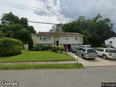
30 Heath Dr Neptune, NJ 07753
Neptune NeighborhoodEstimated Value: $589,884 - $624,000
3
Beds
2
Baths
1,880
Sq Ft
$322/Sq Ft
Est. Value
About This Home
This home is located at 30 Heath Dr, Neptune, NJ 07753 and is currently estimated at $604,721, approximately $321 per square foot. 30 Heath Dr is a home located in Monmouth County with nearby schools including Neptune High School and Ilan High School.
Ownership History
Date
Name
Owned For
Owner Type
Purchase Details
Closed on
Oct 2, 2008
Sold by
Jetter Marvin R and Jetter Tamica R
Bought by
Marquis Jones D 4 A Special Needs Trust
Current Estimated Value
Purchase Details
Closed on
Jan 3, 2002
Sold by
Moore Gisela
Bought by
Jetter Marvin and Jetter Tamica
Home Financials for this Owner
Home Financials are based on the most recent Mortgage that was taken out on this home.
Original Mortgage
$165,000
Interest Rate
7.01%
Create a Home Valuation Report for This Property
The Home Valuation Report is an in-depth analysis detailing your home's value as well as a comparison with similar homes in the area
Home Values in the Area
Average Home Value in this Area
Purchase History
| Date | Buyer | Sale Price | Title Company |
|---|---|---|---|
| Marquis Jones D 4 A Special Needs Trust | $325,000 | Fidelity Natl Title Ins Co | |
| Jetter Marvin | $190,000 | -- |
Source: Public Records
Mortgage History
| Date | Status | Borrower | Loan Amount |
|---|---|---|---|
| Previous Owner | Jetter Marvin R | $185,825 | |
| Previous Owner | Jetter Ii Marvin R | $180,000 | |
| Previous Owner | Jetter Marvin | $165,000 |
Source: Public Records
Tax History Compared to Growth
Tax History
| Year | Tax Paid | Tax Assessment Tax Assessment Total Assessment is a certain percentage of the fair market value that is determined by local assessors to be the total taxable value of land and additions on the property. | Land | Improvement |
|---|---|---|---|---|
| 2024 | $8,438 | $578,100 | $262,400 | $315,700 |
| 2023 | $8,438 | $467,200 | $194,600 | $272,600 |
| 2022 | $7,461 | $395,700 | $154,600 | $241,100 |
| 2021 | $7,461 | $353,100 | $167,800 | $185,300 |
| 2020 | $6,379 | $301,200 | $125,600 | $175,600 |
| 2019 | $6,227 | $290,300 | $125,600 | $164,700 |
| 2018 | $6,404 | $295,100 | $131,600 | $163,500 |
| 2017 | $6,393 | $283,000 | $131,600 | $151,400 |
| 2016 | $6,242 | $275,600 | $126,600 | $149,000 |
| 2015 | $5,922 | $265,900 | $120,500 | $145,400 |
| 2014 | $6,873 | $253,700 | $110,500 | $143,200 |
Source: Public Records
Map
Nearby Homes
- 28 Ash Dr
- 200 Iris Dr
- 9 Ash Dr
- 2920 W Bangs Ave
- 703 Marsha Dr
- 309 Deal Ave
- 401 Slocum Ave
- 3205 W Bangs Ave
- 712 W Lawn Dr
- 456 Lexington Ave Unit 456
- 425 Slocum Ave
- 720 Doris Terrace
- 726 Stephen Terrace
- 112 Louisville Ave
- 139 Louisville Ave
- 728 Wayside Rd
- 13 Brook Dr
- 3581 Shafto Rd
- 1000 Corlies Ave
- 35 Shorebrook Cir