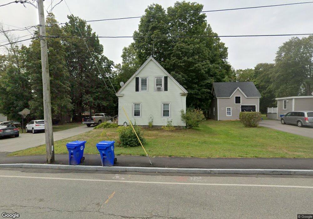
30 Highland St Rockland, MA 02370
Estimated Value: $497,000 - $534,000
3
Beds
1
Bath
1,552
Sq Ft
$334/Sq Ft
Est. Value
About This Home
This home is located at 30 Highland St, Rockland, MA 02370 and is currently estimated at $517,926, approximately $333 per square foot. 30 Highland St is a home located in Plymouth County with nearby schools including Rockland Senior High School, Calvary Chapel Academy, and St Bridget School.
Ownership History
Date
Name
Owned For
Owner Type
Purchase Details
Closed on
Aug 25, 2006
Sold by
Williams Donna M
Bought by
Johnston William M and Johnston Lisa M
Current Estimated Value
Home Financials for this Owner
Home Financials are based on the most recent Mortgage that was taken out on this home.
Original Mortgage
$221,600
Outstanding Balance
$134,236
Interest Rate
6.83%
Mortgage Type
Purchase Money Mortgage
Estimated Equity
$383,690
Purchase Details
Closed on
Aug 25, 1992
Sold by
Lucas Scottr and Loughlin Patricia
Bought by
Williams Theodore and Williams Donna M
Create a Home Valuation Report for This Property
The Home Valuation Report is an in-depth analysis detailing your home's value as well as a comparison with similar homes in the area
Home Values in the Area
Average Home Value in this Area
Purchase History
| Date | Buyer | Sale Price | Title Company |
|---|---|---|---|
| Johnston William M | $277,000 | -- | |
| Williams Theodore | $117,000 | -- |
Source: Public Records
Mortgage History
| Date | Status | Borrower | Loan Amount |
|---|---|---|---|
| Open | Williams Theodore | $221,600 | |
| Closed | Williams Theodore | $55,400 | |
| Previous Owner | Williams Theodore | $15,000 |
Source: Public Records
Tax History Compared to Growth
Tax History
| Year | Tax Paid | Tax Assessment Tax Assessment Total Assessment is a certain percentage of the fair market value that is determined by local assessors to be the total taxable value of land and additions on the property. | Land | Improvement |
|---|---|---|---|---|
| 2025 | $6,190 | $452,800 | $222,700 | $230,100 |
| 2024 | $6,008 | $427,300 | $210,100 | $217,200 |
| 2023 | $6,123 | $402,300 | $202,900 | $199,400 |
| 2022 | $5,863 | $350,000 | $176,400 | $173,600 |
| 2021 | $5,507 | $318,700 | $160,400 | $158,300 |
| 2020 | $5,183 | $303,500 | $152,700 | $150,800 |
| 2019 | $5,184 | $289,300 | $145,500 | $143,800 |
| 2018 | $4,929 | $270,500 | $145,500 | $125,000 |
| 2017 | $4,788 | $259,100 | $145,500 | $113,600 |
| 2016 | $4,608 | $249,200 | $139,900 | $109,300 |
| 2015 | $4,409 | $231,700 | $130,800 | $100,900 |
| 2014 | $4,194 | $228,700 | $128,200 | $100,500 |
Source: Public Records
Map
Nearby Homes
- 140 W Water St
- 225 W Water St
- 103 Grove St Unit 337
- 135 Grove St Unit 110
- 119 Grove St Unit 238
- 119 Grove St Unit 223
- 50 Linden Park
- 94-96 Crescent St
- 149 Concord St
- 133 Spring St
- 133 Crescent St
- 122 Reed St
- 158 Central St
- 45-47 Park St
- 440 Market St
- 92 Liberty St
- 63 Webster St
- 100 North Ave
- 49 Liberty St
- 28 Nevens Cir