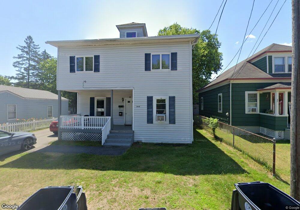
30 New Dunstable Rd Unit 82 Nashua, NH 03060
South End Nashua NeighborhoodEstimated Value: $421,000 - $659,000
6
Beds
2
Baths
3,605
Sq Ft
$150/Sq Ft
Est. Value
About This Home
This home is located at 30 New Dunstable Rd Unit 82, Nashua, NH 03060 and is currently estimated at $540,727, approximately $149 per square foot. 30 New Dunstable Rd Unit 82 is a home located in Hillsborough County with nearby schools including Ledge Street Elementary School, Fairgrounds Middle School, and Nashua High School South.
Ownership History
Date
Name
Owned For
Owner Type
Purchase Details
Closed on
Dec 22, 2008
Sold by
Wells Fargo Bank Na
Bought by
30 New Dunstable Rd Ll
Current Estimated Value
Purchase Details
Closed on
May 16, 2008
Sold by
Routhier Joanne and Option One Mortgage Co
Bought by
Wells Fargo Bank Na
Create a Home Valuation Report for This Property
The Home Valuation Report is an in-depth analysis detailing your home's value as well as a comparison with similar homes in the area
Home Values in the Area
Average Home Value in this Area
Purchase History
| Date | Buyer | Sale Price | Title Company |
|---|---|---|---|
| 30 New Dunstable Rd Ll | $143,900 | -- | |
| Wells Fargo Bank Na | $195,800 | -- |
Source: Public Records
Mortgage History
| Date | Status | Borrower | Loan Amount |
|---|---|---|---|
| Open | Wells Fargo Bank Na | $150,000 | |
| Closed | Wells Fargo Bank Na | $119,250 |
Source: Public Records
Tax History Compared to Growth
Tax History
| Year | Tax Paid | Tax Assessment Tax Assessment Total Assessment is a certain percentage of the fair market value that is determined by local assessors to be the total taxable value of land and additions on the property. | Land | Improvement |
|---|---|---|---|---|
| 2024 | $7,015 | $441,200 | $139,300 | $301,900 |
| 2023 | $6,543 | $358,900 | $111,400 | $247,500 |
| 2022 | $6,485 | $358,900 | $111,400 | $247,500 |
| 2021 | $5,427 | $233,700 | $74,300 | $159,400 |
| 2020 | $5,284 | $233,700 | $74,300 | $159,400 |
| 2019 | $5,085 | $233,700 | $74,300 | $159,400 |
| 2018 | $4,957 | $233,700 | $74,300 | $159,400 |
| 2017 | $5,109 | $198,100 | $63,600 | $134,500 |
| 2016 | $4,966 | $198,100 | $63,600 | $134,500 |
| 2015 | $4,859 | $198,100 | $63,600 | $134,500 |
| 2014 | $4,764 | $198,100 | $63,600 | $134,500 |
Source: Public Records
Map
Nearby Homes
- 22 New Dunstable Rd Unit 132133
- 41 New Dunstable Rd Unit 371
- 172 Ledge St
- 22 Kern Dr
- 30 Gingras Dr
- 169A W Hollis St Unit 193
- 4 Badger St
- 97 Linwood St
- 247 Main Dunstable Rd
- 22 Wilder St
- 30 Ledge St
- 63 Dexter St
- 38 Central St
- 8 Buck St Unit 10
- 7 Bitirnas St Unit U7
- 8 Althea Ln Unit U26
- 4 Henry David Dr Unit 203
- 15 Lovell St Unit 3
- 15 Lovell St Unit 10
- 30 Gendron St
- 28 New Dunstable Rd Unit 84
- 32 New Dunstable Rd Unit 7980
- 26 New Dunstable Rd Unit 8687
- 29 New Dunstable Rd Unit 322
- 12 Joffre St Unit 7677
- 34 New Dunstable Rd Unit 44
- 7-7 1/2 Joffre St
- 17 Edwards St Unit 8993
- 6 Joffre St
- 77 1/2 Joffre St Unit 328-331
- 14 Joffre St
- 1 Joffre St Unit 340341
- 36 New Dunstable Rd Unit 4142
- 11 Joffre St Unit 4647
- 7 Edwards St Unit 301
- 21 New Dunstable Rd Unit 291294
- 6 Edwards St Unit 128130
- 26 Joffre St Unit 6970
- 21 Edwards St
- 5 Joffre St