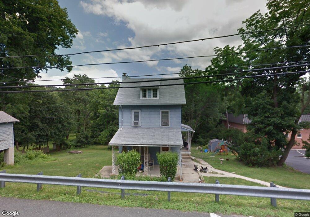
30 New Rd Aston, PA 19014
Estimated Value: $344,371 - $366,000
4
Beds
1
Bath
1,520
Sq Ft
$231/Sq Ft
Est. Value
About This Home
This home is located at 30 New Rd, Aston, PA 19014 and is currently estimated at $350,843, approximately $230 per square foot. 30 New Rd is a home located in Delaware County.
Ownership History
Date
Name
Owned For
Owner Type
Purchase Details
Closed on
May 24, 2013
Sold by
Devlin Michael A and Devlin Melissa A
Bought by
Brown Daniel J and Brown Michele
Current Estimated Value
Home Financials for this Owner
Home Financials are based on the most recent Mortgage that was taken out on this home.
Original Mortgage
$156,750
Outstanding Balance
$110,624
Interest Rate
3.39%
Mortgage Type
New Conventional
Estimated Equity
$240,219
Purchase Details
Closed on
Sep 15, 2006
Sold by
Devlin Michael A
Bought by
Devlin Michael A and Devlin Melissa A
Home Financials for this Owner
Home Financials are based on the most recent Mortgage that was taken out on this home.
Original Mortgage
$53,000
Interest Rate
6.47%
Mortgage Type
Stand Alone Second
Purchase Details
Closed on
Aug 13, 2003
Sold by
Conway Verna J and Estate Of Harry C Gilmore Jr
Bought by
Devlin Michael A
Home Financials for this Owner
Home Financials are based on the most recent Mortgage that was taken out on this home.
Original Mortgage
$127,988
Interest Rate
5.46%
Mortgage Type
FHA
Create a Home Valuation Report for This Property
The Home Valuation Report is an in-depth analysis detailing your home's value as well as a comparison with similar homes in the area
Home Values in the Area
Average Home Value in this Area
Purchase History
| Date | Buyer | Sale Price | Title Company |
|---|---|---|---|
| Brown Daniel J | $165,000 | None Available | |
| Devlin Michael A | -- | None Available | |
| Devlin Michael A | $129,000 | Fidelity National Title Insu |
Source: Public Records
Mortgage History
| Date | Status | Borrower | Loan Amount |
|---|---|---|---|
| Open | Brown Daniel J | $156,750 | |
| Previous Owner | Devlin Michael A | $53,000 | |
| Previous Owner | Devlin Michael A | $127,988 |
Source: Public Records
Tax History Compared to Growth
Tax History
| Year | Tax Paid | Tax Assessment Tax Assessment Total Assessment is a certain percentage of the fair market value that is determined by local assessors to be the total taxable value of land and additions on the property. | Land | Improvement |
|---|---|---|---|---|
| 2025 | $5,140 | $185,770 | $72,110 | $113,660 |
| 2024 | $4,821 | $185,770 | $72,110 | $113,660 |
| 2023 | $4,604 | $185,770 | $72,110 | $113,660 |
| 2022 | $4,440 | $185,770 | $72,110 | $113,660 |
| 2021 | $6,852 | $185,770 | $72,110 | $113,660 |
| 2020 | $4,419 | $108,190 | $66,250 | $41,940 |
| 2019 | $4,334 | $108,190 | $66,250 | $41,940 |
| 2018 | $4,150 | $108,190 | $0 | $0 |
| 2017 | $4,062 | $108,190 | $0 | $0 |
| 2016 | $594 | $108,190 | $0 | $0 |
| 2015 | $594 | $108,190 | $0 | $0 |
| 2014 | $594 | $108,190 | $0 | $0 |
Source: Public Records
Map
Nearby Homes
- 346 Lenni Rd
- 305 Crozerville Rd
- 234 Elm Ave
- 3 Rolling Heights Ln
- 208 S Pennell Rd
- 220 Spring Valley Way
- 206 Chestnut Ave
- 131 Junction Rd
- 440 Derry Dr Unit 440
- 117 Segel Dr
- 268 Miley Rd Unit 268
- 237 Harvey Ln
- 21 Hoag Ln
- 209 Martins Ln
- 242 Moria Place
- 108 Grace Ln
- 226 Moria Place
- 30 Rampart W
- 23 Rampart W
- 630 Mount Alverno Rd