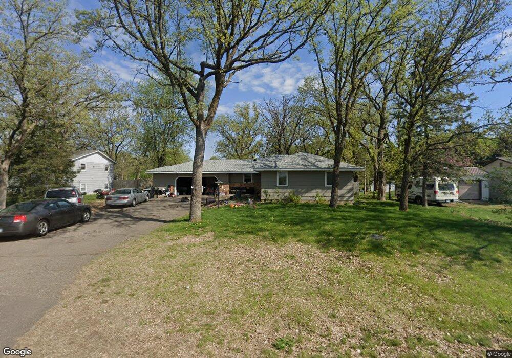
30 Sherburne Ave Big Lake, MN 55309
Estimated Value: $334,000 - $604,000
4
Beds
2
Baths
1,716
Sq Ft
$237/Sq Ft
Est. Value
About This Home
This home is located at 30 Sherburne Ave, Big Lake, MN 55309 and is currently estimated at $407,370, approximately $237 per square foot. 30 Sherburne Ave is a home located in Sherburne County with nearby schools including Liberty Elementary School, Independence Elementary School, and Big Lake Middle School.
Ownership History
Date
Name
Owned For
Owner Type
Purchase Details
Closed on
Apr 18, 2017
Sold by
Poplinski Charlotte F
Bought by
Blomquest John
Current Estimated Value
Home Financials for this Owner
Home Financials are based on the most recent Mortgage that was taken out on this home.
Original Mortgage
$191,468
Outstanding Balance
$163,652
Interest Rate
5.25%
Mortgage Type
FHA
Estimated Equity
$243,718
Create a Home Valuation Report for This Property
The Home Valuation Report is an in-depth analysis detailing your home's value as well as a comparison with similar homes in the area
Home Values in the Area
Average Home Value in this Area
Purchase History
| Date | Buyer | Sale Price | Title Company |
|---|---|---|---|
| Blomquest John | $195,000 | Custom Home Builders Title |
Source: Public Records
Mortgage History
| Date | Status | Borrower | Loan Amount |
|---|---|---|---|
| Open | Blomquest John | $191,468 |
Source: Public Records
Tax History Compared to Growth
Tax History
| Year | Tax Paid | Tax Assessment Tax Assessment Total Assessment is a certain percentage of the fair market value that is determined by local assessors to be the total taxable value of land and additions on the property. | Land | Improvement |
|---|---|---|---|---|
| 2025 | $4,902 | $336,100 | $93,400 | $242,700 |
| 2024 | $4,948 | $338,800 | $93,400 | $245,400 |
| 2023 | $4,562 | $342,500 | $97,700 | $244,800 |
| 2022 | $4,004 | $300,400 | $82,600 | $217,800 |
| 2020 | $3,290 | $224,200 | $46,800 | $177,400 |
| 2019 | $3,068 | $207,500 | $41,300 | $166,200 |
| 2018 | $2,776 | $190,200 | $37,800 | $152,400 |
| 2017 | $2,662 | $183,000 | $34,400 | $148,600 |
| 2016 | $2,502 | $171,100 | $31,000 | $140,100 |
| 2015 | $2,270 | $141,000 | $26,200 | $114,800 |
| 2014 | $2,074 | $135,000 | $26,000 | $109,000 |
| 2013 | -- | $117,000 | $24,900 | $92,100 |
Source: Public Records
Map
Nearby Homes
- TBD Highway 10 NW
- 241 Leighton Dr
- 491 Highland Ave
- 679 Lakeshore Dr
- 637 Norwood Ln
- 20050 County Road 81 NW
- 240 Wyoming Ave
- 20311 Gordon Ln
- TBD Manitou St
- 100 Park Ave
- 874 Independence Dr NW
- 3300 Lake View Ln
- 541 William St
- 110 Powell Cir E
- 4637 Pond View Cir
- 5008 Bluff Rd
- 20189 Esther Pkwy
- 3250 Lake Ridge Dr
- 4265 Lake Ridge Dr
- 585 Glenwood Ave
- 20 Sherburne Ave
- 130 Sherburne Ave
- 140 Leighton Cir
- 140 Sherburne Ave
- XXXX Sherburne Ave
- 110 Lakeshore Dr
- 150 Leighton Cir
- 100 Lakeshore Dr
- 111 Lakeshore Dr
- 104 Leighton Cir
- 150 Sherburne Ave
- 121 Us Highway 10
- 121 Us Highway 10
- 121 Us Highway 10
- 121 Us Highway 10
- 121 Us Highway 10
- 90 Lakeshore Dr
- 117 Lakeshore Dr
- 109 Oak Cir
- 141 Sherburne Ave