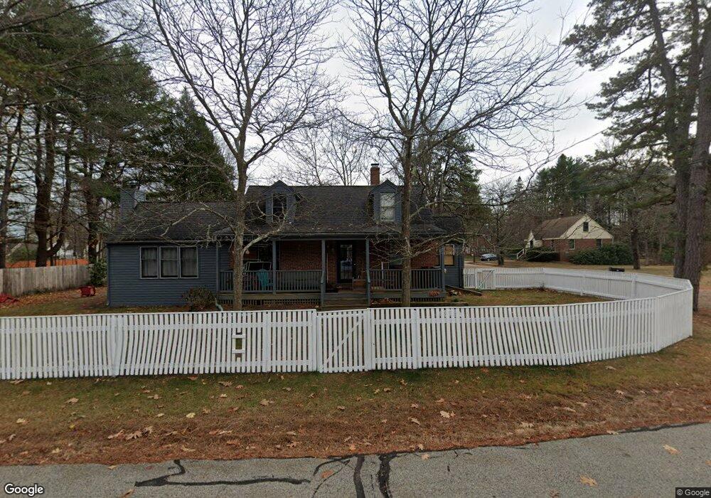
30 Sutton Ave Portsmouth, NH 03801
Estimated Value: $710,280 - $821,000
3
Beds
2
Baths
2,028
Sq Ft
$374/Sq Ft
Est. Value
About This Home
This home is located at 30 Sutton Ave, Portsmouth, NH 03801 and is currently estimated at $758,820, approximately $374 per square foot. 30 Sutton Ave is a home located in Rockingham County with nearby schools including New Franklin School, Portsmouth Middle School, and Portsmouth High School.
Ownership History
Date
Name
Owned For
Owner Type
Purchase Details
Closed on
Mar 11, 2024
Sold by
Purcell Perrie
Bought by
Purcell William
Current Estimated Value
Purchase Details
Closed on
Jun 21, 2007
Sold by
Lemire Jennifer A and Lemire Roger A
Bought by
Purcell William and Purcell Perrie
Home Financials for this Owner
Home Financials are based on the most recent Mortgage that was taken out on this home.
Original Mortgage
$337,359
Interest Rate
6.14%
Mortgage Type
Purchase Money Mortgage
Purchase Details
Closed on
Oct 18, 2002
Sold by
Alexandropoulos Frank M and Alexandropoulos Kiska B
Bought by
Lemire Jennifer A and Lemire Roger A
Purchase Details
Closed on
Mar 28, 1996
Sold by
Soucy Beverly E
Bought by
Alexandropoulo Frank M and Alexandropoulo Kiska B
Create a Home Valuation Report for This Property
The Home Valuation Report is an in-depth analysis detailing your home's value as well as a comparison with similar homes in the area
Home Values in the Area
Average Home Value in this Area
Purchase History
| Date | Buyer | Sale Price | Title Company |
|---|---|---|---|
| Purcell William | -- | None Available | |
| Purcell William | -- | None Available | |
| Purcell William | $336,000 | -- | |
| Purcell William | $336,000 | -- | |
| Lemire Jennifer A | $290,000 | -- | |
| Lemire Jennifer A | $290,000 | -- | |
| Alexandropoulo Frank M | $83,000 | -- | |
| Alexandropoulo Frank M | $83,000 | -- |
Source: Public Records
Mortgage History
| Date | Status | Borrower | Loan Amount |
|---|---|---|---|
| Previous Owner | Alexandropoulo Frank M | $312,000 | |
| Previous Owner | Alexandropoulo Frank M | $337,359 |
Source: Public Records
Tax History Compared to Growth
Tax History
| Year | Tax Paid | Tax Assessment Tax Assessment Total Assessment is a certain percentage of the fair market value that is determined by local assessors to be the total taxable value of land and additions on the property. | Land | Improvement |
|---|---|---|---|---|
| 2024 | $6,490 | $580,500 | $267,700 | $312,800 |
| 2023 | $7,255 | $449,800 | $162,300 | $287,500 |
| 2022 | $6,837 | $449,800 | $162,300 | $287,500 |
| 2021 | $6,760 | $449,800 | $162,300 | $287,500 |
| 2020 | $6,612 | $449,800 | $162,300 | $287,500 |
| 2019 | $6,677 | $449,300 | $162,300 | $287,000 |
| 2018 | $6,336 | $400,000 | $147,500 | $252,500 |
| 2017 | $6,152 | $400,000 | $147,500 | $252,500 |
| 2016 | $5,681 | $333,400 | $128,000 | $205,400 |
| 2015 | $5,598 | $333,400 | $128,000 | $205,400 |
| 2014 | $5,819 | $321,500 | $135,000 | $186,500 |
| 2013 | $5,758 | $321,500 | $135,000 | $186,500 |
| 2012 | $5,655 | $322,200 | $135,000 | $187,200 |
Source: Public Records
Map
Nearby Homes
- 7 Hall Ct
- 283 Decatur Rd
- 166 Decatur Rd
- 291 Colonial Dr
- 6 Shipwright Way
- 255 Melbourne St
- 777 Middle Rd Unit 45
- 15 Woodworth Ave
- Lot 44 Sims Ave
- 1230 Islington St
- 41 Newington Rd
- 88 Farm Ln
- 6 Boyd Rd
- 224 Cate St
- 216 Woodbury Ave
- 171 Echo Ave
- 60 Ocean Rd
- 50 Cate St Unit 4
- 150 Us Highway 1 Bypass Unit 209
- 25 Morning St
- 455 Greenside Ave
- 445 Greenside Ave
- 470 Greenside Ave
- 422 Sherburne Rd
- 29 Sutton Ave
- 450 Greenside Ave
- 27 Sutton Ave
- 435 Greenside Ave
- 420 Sherburne Rd
- 496 Greenside Ave
- 436 Sherburne Rd
- 24 Sutton Ave
- 424 Greenside Ave
- 418 Sherburne Rd
- 423 Greenside Ave
- 456 Sherburne Rd
- 28 Doris Ave
- 21 Sutton Ave
- 20 Doris Ave
- 516 Greenside Ave