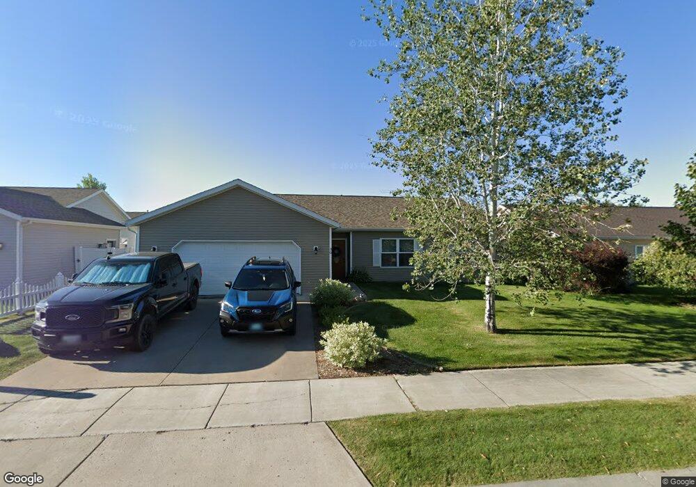
30 Vanderbilt Dr Kalispell, MT 59901
Estimated Value: $481,000 - $513,000
4
Beds
2
Baths
1,516
Sq Ft
$328/Sq Ft
Est. Value
About This Home
This home is located at 30 Vanderbilt Dr, Kalispell, MT 59901 and is currently estimated at $497,382, approximately $328 per square foot. 30 Vanderbilt Dr is a home located in Flathead County with nearby schools including Edgerton School, Kalispell Middle School, and Glacier High School.
Ownership History
Date
Name
Owned For
Owner Type
Purchase Details
Closed on
Nov 22, 2016
Sold by
Mills Debra A and Norton Tim J
Bought by
Vernarsky Dana R and Vernarsky Jennifer E
Current Estimated Value
Home Financials for this Owner
Home Financials are based on the most recent Mortgage that was taken out on this home.
Original Mortgage
$220,644
Outstanding Balance
$177,139
Interest Rate
3.42%
Mortgage Type
VA
Estimated Equity
$320,243
Purchase Details
Closed on
May 2, 2016
Sold by
Dropps Justin Vincent
Bought by
Mills Debra A and Norton Tim J
Purchase Details
Closed on
Jan 31, 2013
Sold by
Dropps Layla Marie
Bought by
Dropps Justin Vincent
Create a Home Valuation Report for This Property
The Home Valuation Report is an in-depth analysis detailing your home's value as well as a comparison with similar homes in the area
Purchase History
| Date | Buyer | Sale Price | Title Company |
|---|---|---|---|
| Vernarsky Dana R | -- | Insured Titles | |
| Mills Debra A | $149,000 | None Available | |
| Dropps Justin Vincent | -- | None Available |
Source: Public Records
Mortgage History
| Date | Status | Borrower | Loan Amount |
|---|---|---|---|
| Open | Vernarsky Dana R | $220,644 |
Source: Public Records
Tax History
| Year | Tax Paid | Tax Assessment Tax Assessment Total Assessment is a certain percentage of the fair market value that is determined by local assessors to be the total taxable value of land and additions on the property. | Land | Improvement |
|---|---|---|---|---|
| 2025 | $2,362 | $461,100 | $0 | $0 |
| 2024 | $3,318 | $426,100 | $0 | $0 |
| 2023 | $3,574 | $426,100 | $0 | $0 |
| 2022 | $3,080 | $272,400 | $0 | $0 |
| 2021 | $2,931 | $272,400 | $0 | $0 |
| 2020 | $2,770 | $228,800 | $0 | $0 |
| 2019 | $2,776 | $228,800 | $0 | $0 |
| 2018 | $2,687 | $211,500 | $0 | $0 |
| 2017 | $2,217 | $211,500 | $0 | $0 |
| 2016 | $2,208 | $186,500 | $0 | $0 |
| 2015 | $2,208 | $186,500 | $0 | $0 |
| 2014 | $2,005 | $100,488 | $0 | $0 |
Source: Public Records
Map
Nearby Homes
- 38 Vanderbilt Dr
- 63 Empire Loop
- 17 Empire Loop
- 90 Empire Loop
- 249 Three Mile Dr
- 140 Barron Way
- 174 Empire Loop
- 119 Barron Way
- 210 Kara Dr
- 240 Kara Dr
- 287 Kara Dr
- 224 Kara Dr
- 28 Vista Loop
- 108 Hearst Dr
- 188 N Riding Rd
- 408 Needlegrass Ln
- 417 Needlegrass Ln
- 433 Needlegrass Ln
- 412 Needlegrass Ln
- 424 Needlegrass Ln
- 30 Vanderbilt Dr
- 34 Vanderbilt Dr
- 31 Rockefeller Dr
- 35 Rockefeller Dr
- 27 Rockefeller Dr
- 22 Vanderbilt Dr
- 31 Vanderbilt Dr
- 39 Rockefeller Dr
- 27 Vanderbilt Dr
- 23 Rockefeller Dr
- 35 Vanderbilt Dr
- 41 Vanderbilt Dr
- 23 Vanderbilt Dr
- 42 Vanderbilt Dr
- 18 Vanderbilt Dr
- 43 Rockefeller Dr
- 19 Rockefeller Dr
- 43 Vanderbilt Dr
- 30 Rockefeller Dr
- 30 Rockefeller Dr
Your Personal Tour Guide
Ask me questions while you tour the home.