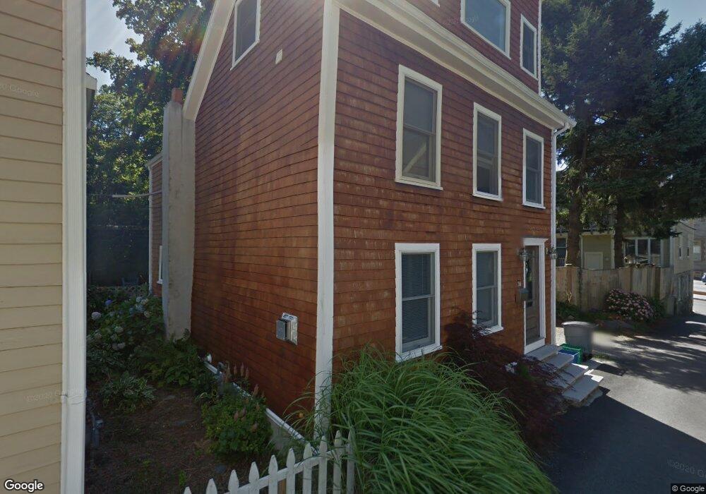
30 West St Newport, RI 02840
Historic Hill NeighborhoodEstimated Value: $1,103,000 - $1,586,000
3
Beds
3
Baths
2,134
Sq Ft
$613/Sq Ft
Est. Value
About This Home
This home is located at 30 West St, Newport, RI 02840 and is currently estimated at $1,307,572, approximately $612 per square foot. 30 West St is a home located in Newport County with nearby schools including Rogers High School, St Michael's Country Day School, and St George's School.
Ownership History
Date
Name
Owned For
Owner Type
Purchase Details
Closed on
Jul 1, 2022
Sold by
Coll Marie and Coll Douglas
Bought by
Coll Douglas and Tokutake Aki
Current Estimated Value
Home Financials for this Owner
Home Financials are based on the most recent Mortgage that was taken out on this home.
Original Mortgage
$552,500
Outstanding Balance
$523,825
Interest Rate
5.09%
Mortgage Type
Stand Alone Refi Refinance Of Original Loan
Estimated Equity
$783,747
Purchase Details
Closed on
Jun 5, 2007
Sold by
Surber Patrick and Surber Judith
Bought by
Coll Marie and Coll Douglas
Home Financials for this Owner
Home Financials are based on the most recent Mortgage that was taken out on this home.
Original Mortgage
$192,000
Interest Rate
6.24%
Mortgage Type
Purchase Money Mortgage
Purchase Details
Closed on
Jul 29, 1992
Sold by
Ahearn Margaret M and Sullivan Eileen
Bought by
Surber Patrick and Surber Judith
Create a Home Valuation Report for This Property
The Home Valuation Report is an in-depth analysis detailing your home's value as well as a comparison with similar homes in the area
Home Values in the Area
Average Home Value in this Area
Purchase History
| Date | Buyer | Sale Price | Title Company |
|---|---|---|---|
| Coll Douglas | -- | None Available | |
| Coll Douglas | -- | None Available | |
| Coll Marie | $240,000 | -- | |
| Coll Marie | $240,000 | -- | |
| Surber Patrick | $88,000 | -- |
Source: Public Records
Mortgage History
| Date | Status | Borrower | Loan Amount |
|---|---|---|---|
| Open | Coll Douglas | $552,500 | |
| Closed | Coll Douglas | $552,500 | |
| Previous Owner | Surber Patrick | $320,000 | |
| Previous Owner | Surber Patrick | $192,000 | |
| Previous Owner | Surber Patrick | $36,000 |
Source: Public Records
Tax History Compared to Growth
Tax History
| Year | Tax Paid | Tax Assessment Tax Assessment Total Assessment is a certain percentage of the fair market value that is determined by local assessors to be the total taxable value of land and additions on the property. | Land | Improvement |
|---|---|---|---|---|
| 2025 | $7,635 | $1,063,400 | $353,100 | $710,300 |
| 2024 | $8,741 | $1,063,400 | $353,100 | $710,300 |
| 2023 | $6,844 | $689,900 | $230,800 | $459,100 |
| 2022 | $6,630 | $689,900 | $230,800 | $459,100 |
| 2021 | $6,437 | $689,900 | $230,800 | $459,100 |
| 2020 | $5,750 | $559,300 | $218,100 | $341,200 |
| 2019 | $5,750 | $559,300 | $218,100 | $341,200 |
| 2018 | $5,587 | $559,300 | $218,100 | $341,200 |
| 2017 | $5,059 | $451,300 | $156,000 | $295,300 |
| 2016 | $4,933 | $451,300 | $156,000 | $295,300 |
| 2015 | $4,815 | $451,300 | $156,000 | $295,300 |
| 2014 | $5,150 | $427,000 | $132,600 | $294,400 |
Source: Public Records
Map
Nearby Homes
- 30 S Baptist St
- 28 Young St
- 13 Dean Ave
- 30 Brewer St Unit 3
- 24 Brown and Howard Wharf Unit 301
- 364 Bellevue Ave Unit A1
- 364 Bellevue Ave Unit D7
- 26 Freebody St
- 20 Berkeley Ave Unit 2
- 6 Sharon Ct
- 604 Thames & 4 Dixon St
- 8 Sylvan St
- 26 Franklin St
- 19 Slocum St
- 50 E Bowery St
- 75 Pelham St Unit B
- 21 Slocum St
- 5 Lowndes St
- 66 Webster St Unit 9
- 50 School St Unit 7
- 26 W Narra Unit 11
- 26 West St
- 24 W Narra
- 24 West St
- 24 West St
- 35 West St
- 31 West St
- 5 Grant Ct
- 18 Perry St
- 18 Perry St Unit A
- 20 Perry St
- 20 Perry St Unit C
- 20 Perry St Unit 1
- 20 Perry St Unit A
- 20 Perry St Unit B
- 14 Perry St
- 22 Perry St Unit 24
- 22 Perry St Unit 24
- 22 Perry St Unit 24
- 22 Perry St Unit B