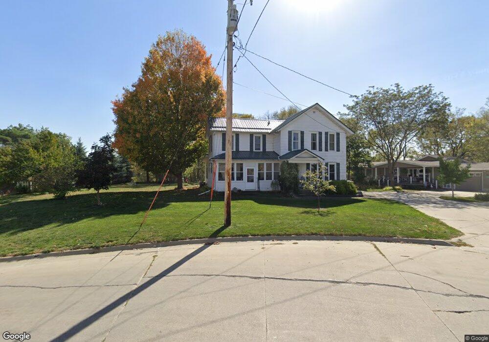
300 High St SE Elkader, IA 52043
Estimated Value: $129,000 - $178,000
4
Beds
2
Baths
2,456
Sq Ft
$63/Sq Ft
Est. Value
About This Home
This home is located at 300 High St SE, Elkader, IA 52043 and is currently estimated at $154,413, approximately $62 per square foot. 300 High St SE is a home located in Clayton County with nearby schools including Central Elementary School and Central Middle School/High School.
Ownership History
Date
Name
Owned For
Owner Type
Purchase Details
Closed on
Mar 22, 2010
Sold by
Federal National Mortgage Association
Bought by
Grover Steven J and Grover Marilyn A
Current Estimated Value
Purchase Details
Closed on
Jun 7, 2007
Sold by
Reinert Margie E
Bought by
Wright Robert L
Home Financials for this Owner
Home Financials are based on the most recent Mortgage that was taken out on this home.
Original Mortgage
$72,000
Interest Rate
6.2%
Mortgage Type
New Conventional
Create a Home Valuation Report for This Property
The Home Valuation Report is an in-depth analysis detailing your home's value as well as a comparison with similar homes in the area
Home Values in the Area
Average Home Value in this Area
Purchase History
| Date | Buyer | Sale Price | Title Company |
|---|---|---|---|
| Grover Steven J | -- | None Available | |
| Wright Robert L | $72,000 | None Available |
Source: Public Records
Mortgage History
| Date | Status | Borrower | Loan Amount |
|---|---|---|---|
| Previous Owner | Wright Robert L | $72,000 |
Source: Public Records
Tax History Compared to Growth
Tax History
| Year | Tax Paid | Tax Assessment Tax Assessment Total Assessment is a certain percentage of the fair market value that is determined by local assessors to be the total taxable value of land and additions on the property. | Land | Improvement |
|---|---|---|---|---|
| 2025 | $2,736 | $130,684 | $15,877 | $114,807 |
| 2024 | $2,488 | $109,479 | $13,807 | $95,672 |
| 2023 | $2,260 | $109,479 | $13,807 | $95,672 |
| 2022 | $2,092 | $86,560 | $12,551 | $74,009 |
| 2021 | $1,898 | $86,560 | $12,551 | $74,009 |
| 2020 | $1,898 | $82,046 | $12,551 | $69,495 |
| 2019 | $1,730 | $82,046 | $12,551 | $69,495 |
| 2018 | $1,730 | $76,487 | $12,551 | $63,936 |
| 2017 | $1,704 | $76,487 | $12,551 | $63,936 |
| 2015 | $1,294 | $56,437 | $22,788 | $33,649 |
| 2014 | $1,218 | $56,437 | $22,788 | $33,649 |
Source: Public Records
Map
Nearby Homes
- 117 S Main St
- 209 2nd St SW
- 0 E Bridge St
- 302 N 3rd St
- 301 N 1st St
- 702 N Main St
- 707 N Main St
- 710 Woodland Dr NW
- 26642 Iowa 13
- 247 Franzen Ridge Rd
- 249 Franzen Ridge Rd
- 27766 Highway 13
- 0 13 Hwy Unit NBR20255145
- 27455 Harbor Rd
- 0 Grandview Rd
- 14149 Iowa 56
- TBD Country Rd
- 305 S Russell St
- TBD Birch Rd
- 100 Volga St
- 208 High St SE
- 204 High St SE
- 204 High St SE
- 202 Chestnut St SE
- 204 Chestnut St SE
- 200 High St SE
- 206 Chestnut St SE
- 300 Chestnut St SE
- 104 High St SE
- 106 2nd St SE
- 302 Chestnut St SE
- 107 High St SE
- 201 Chestnut St SE
- 104 2nd St SE
- 304 Chestnut St SE
- 301 Chestnut St
- 205 S Main St
- 306 Chestnut St SE
- 100 N High St
- 208 E Bridge St